Dom na Gospincu - Kalška gora (via Zvoh)
Starting point: Dom na Gospincu (1491 m)
| Lat/Lon: | 46,2957°N 14,5214°E |
| |
Name of path: via Zvoh
Time of walking: 4 h 45 min
Difficulty: difficult marked way
Altitude difference: 556 m
Altitude difference po putu: 950 m
Map: Kamniške in Savinjske Alpe 1:50.000
Recommended equipment (summer): helmet
Recommended equipment (winter): helmet, ice axe, crampons
Views: 6.747
 | 2 people like this post |
Access to the starting point:
a) From the motorway Ljubljana - Jesenice take the exit Vodice, then continue to the first semaphore crossing in Vodice, where you turn left towards Cerkelj na Gorenjskem and Brnik. When you reach the main roundabout at Spodnji Brnik, continue driving in the direction of Cerkeliai and the ski resort Krvavec. At the end of Cerklje na Gorenjskem, leave the main road, which continues towards Velesovo and Visoke, and turn slightly right onto the road towards the ski resort Krvavec. Park in the large parking lot at the lower station of the round-cabin cable car to Krvavec, buy a ticket and take the cable car to the upper station, which is located next to the Mountain House at Gospinec.
b) From the motorway Jesenice - Ljubljana, take the exit Kranj - East, then continue to Brnik, Komenda and Mengeš. When you reach the main roundabout at Spodnji Brnik, continue driving towards Cerkeliai and the ski resort Krvavec. At the end of Cerklje na Gorenjskem, leave the main road, which continues towards Velesovo and Visoke, and turn slightly right onto the road towards the ski resort Krvavec. Park in the large parking lot at the lower station of the round-cabin cable car to Krvavec, buy a ticket and take the cable car to the upper station, which is located next to the Mountain House at Gospinec.
c) From the motorway Ljubljana - Jesenice, take the exit Vodice, then continue driving to the first semaphorised crossroads in Vodice, where you turn left in the direction of Cerkelj na Gorenjskem and Brnik. When you reach the main roundabout at Spodnji Brnik, continue driving in the direction of Cerkeliai and the ski resort Krvavec. At the end of Cerklje na Gorenjskem, leave the main road, which continues towards Velesovo and Visoke, and turn slightly right onto the road towards the ski resort Krvavec. Continue to the village of Grad, where the signs for Ambrož pod Krvavcem direct you to the right on a steep asphalt road (straight ahead to the lower station of the round-cabin cable car to Krvavec and Štefanja Gora). When the steepness of the steep road eases slightly, you will come to a junction, where you will continue to the left in the direction of Ambrož pod Krvavcem (straight ahead to the settlements of Ravne, Apno and Šenturška Gora). A little further on, the road descends a little and then climbs over slopes that are sometimes quite scenic. Higher up, you reach Ambrož pod Krvavcem, where you pass the church of St Ambrose and the tourist farm Pr Ambružarju on the left. From the tourist farm the road passes into the forest and climbs through it to mountain pasture Jezerec, where there is a large parking lot. The road here is laid and turns left, and about 500 m further on it leads to a crossroads, where you continue slightly left (to the right Kriška mountain pasture). You then drive along a dirt road for some time or to the upper station of the round-cabin cable car. The road from mountain pasture Jezerec to Dom na Gospincu is now closed to public traffic, which will extend the journey by about 30 minutes.
d) From the motorway Jesenice - Ljubljana take the exit Kranj - East, then continue to Brnik, Komenda and Mengeš. Once you reach the main roundabout at Spodnji Brnik, continue driving towards Cerkeliai and the ski resort Krvavec. At the end of Cerklje na Gorenjskem, leave the main road, which continues towards Velesovo and Visoke, and turn slightly right onto the road towards the ski resort Krvavec. Continue to the village of Grad, where the signs for Ambrož pod Krvavcem direct you to the right on a steep asphalt road (straight ahead to the lower station of the circular cable car to Krvavec and Štefanja Gora). When the steepness of the steep road eases slightly, you will come to a crossroads, where you will continue to the left in the direction of Ambrož pod Krvavcem (straight ahead to the settlements of Ravne, Apno and Šenturška Gora). A little further on, the road descends a little and then climbs over slopes that are sometimes quite scenic. Higher up, you reach Ambrož pod Krvavcem, where you pass the church of St Ambrose and the tourist farm Pr Ambružarju on the left. From the tourist farm the road passes into the forest and climbs through it to mountain pasture Jezerec, where there is a large parking lot. The road here is laid and turns left, and about 500 m further on it leads to a crossroads, where you continue slightly left (to the right Kriška mountain pasture). You then drive along a dirt road for some time or to the upper station of the round-cabin cable car.
The road from mountain pasture Jezerec to Dom na Gospincu is now closed to public traffic, which extends the journey by about 30 minutes.
Path description:
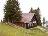
At the top station of the circular cable car to Krvavec you will see a number of mountain signs. We head in the direction of the Krvavec home and Marija Snežna on a poorly visible path that climbs up the grassy slope almost straight up. The faintly visible path leads us higher up over a pasture fence, beyond which it becomes slightly more traceable. A relatively steep path then leads to the Krvavec home, which is visible from the upper cable car station (you can also get here by a less good dirt road).
From home, continue in the direction of Zvoh along the road which leads us past the chapel and transmitters on Krvavec to the Razor saddle (the saddle between the top of Krvavec and Velika Zvoh), where there is a crossroads. Continue straight along the ridge (right Krvavec peak 5 minutes) and follow the increasingly steep transport-rescue road, which is occasionally paved, along the edge of the ski slope to the reservoir lake at Velika Zvoh. From the lake, climb to the nearby summit, then walk over the wire fence to the registration box, located a few steps below the summit.
From Veliki Zvoh we continue along the marked path along the ridge called Jež-a. The relatively easy ridge trail, however, starts to descend after a few minutes of walking and leads us to a technically challenging place. With the help of a rope ladder, we climb up a steep and crumbly gully, which is exposed to falling rocks. The gully is short, but still long enough to cause a lot of problems for inexperienced mountaineers. The difficulties then disappear and the pleasant path, which mostly follows the ridge, is followed to two successive switchbacks. At the first one, the trail branches off to the right down to Mokrica and mountain pasture Koren, and at the second one, the trail branches off to the right up to Vrh Korena (1 minute). Then descend for about 15 minutes on a slope partly covered with dwarf pines. At the end of the descent, the path leads to a crossroads at Škrbini.
Here we continue straight in the direction of Kalški greben and Cojzova huts along the path which, after a few further steps, leads us to the next crossroads. Continue slightly to the right in the direction of "Kalce" (Kalški greben on the left) along the path which, after a few minutes of further walking, begins to descend more visibly. After a few minutes of descent, the path turns slightly to the left and crosses the scree under the Kalška ridge. Here, on the right hand side, at the foot of the scree, you can see a small lake called Krvava lokev, and we continue along the marked path, which gradually turns into the area of high-lying plateau. There are a few short ascents and descents along the path, which leads us past a number of small potholes, and then we come out on the scree again. In the middle of the scree, at a kind of back, the abandoned climbing route to Kalški greben branches off to the left, and we continue on the marked path, which is joined only slightly further on the right by a barely visible path from Žagana peči. We continue in the direction of Cojzova hut, and the path gradually leads us to steeper and steeper and partly grassy slopes. The path is slightly further on with the help of a jeklenice climbs over a steep slope, then lays down and in a few minutes of further walking leads us to a marked crossroadsFrom the crossroads, located on a small saddle, continue to the right in the direction Kalška gora (sharp left Kalški greben on a very difficult path, straight down Kokrsko sedlo). The path continues on steep and especially in the wet dangerous for slipping grassy slopes. Follow this relatively folded path all the way to Kalška gora, only to reach it after a good 5 minutes of further walking.
Dom na Gospincu - Veliki Zvoh 1:25, Veliki Zvoh - Vrh Korena 1:15, Vrh Korena - Kalška gora 2:05.

Pictures:
 1
1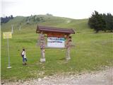 2
2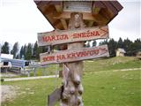 3
3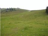 4
4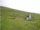 5
5 6
6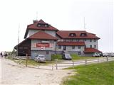 7
7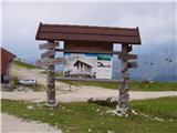 8
8 9
9 10
10 11
11 12
12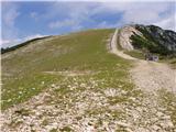 13
13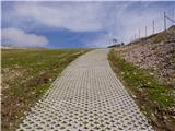 14
14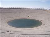 15
15 16
16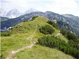 17
17 18
18 19
19 20
20 21
21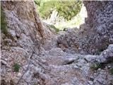 22
22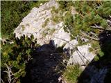 23
23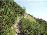 24
24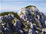 25
25 26
26 27
27 28
28 29
29 30
30 31
31 32
32 33
33 34
34 35
35 36
36 37
37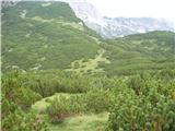 38
38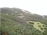 39
39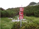 40
40 41
41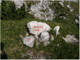 42
42 43
43 44
44 45
45 46
46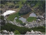 47
47 48
48 49
49 50
50 51
51 52
52 53
53 54
54 55
55 56
56 57
57 58
58 59
59 60
60 61
61 62
62 63
63 64
64 65
65 66
66 67
67 68
68 69
69 70
70 71
71 72
72 73
73 74
74 75
75
Discussion about the trail Dom na Gospincu - Kalška gora (via Zvoh)