Sovodenj - Štor (razgledna pot)
Starting point: Sovodenj (592 m)
| Lat/Lon: | 46,085°N 14,0386°E |
| |
Name of path: razgledna pot
Time of walking: 1 h 45 min
Difficulty: easy marked way
Altitude difference: 413 m
Altitude difference po putu: 440 m
Map: Škofjeloško in Cerkljansko hribovje 1:50.000
Recommended equipment (summer):
Recommended equipment (winter):
Views: 1.876
 | 1 person likes this post |
Access to the starting point:
a) From Ljubljana or Kranj, drive to Škofja Loka, from where you continue to Gorenjska vas. In Gorenjska vas, turn right towards Cerkno and Žiri. The road then leads you past the village of Trebija, after which you turn right towards Cerkno (on the left Žiri). Follow this road to the village of Sovodenj, where you park in the parking lot between the Mercator shop and the firemen's home.
b) From Tolmin, drive to Cerkno, and from there continue over the pass Kladje (787 m) towards Škofja Loka. When you get to the village Sovodenj, park in the parking lot between the shop and the fire station.
c) From the motorway Ljubljana - Koper take the exit Logatec and then continue to Logatec. From the roundabout, where you reach the old road Vrhnika - Postojna, turn right (direction Vrhnika) and continue driving along the old road towards Vrhnika, we drive along it for only a few 100 m, then turn left onto the road in the direction of Rovt and Žirov. From Žiri, we continue our drive towards Škofja Loka and Gorenjska vas, then at one of the crossroads we take a sharp left in the direction of Cerkno and Sovodnja. When you arrive in Sovodenj, park in the parking lot between the Mercator shop and the firemen's home.
Path description:
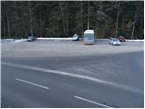
From the parking lot, continue along the asphalted road towards Ermanovec and Cerkno. After a few minutes of climbing along the main road, you will come to a marked crossroads where the road to Ermanovec branches off to the right. Take this road, which runs alongside a picturesque stream, and after a few minutes of further walking, you will reach the next crossroads.
Continue straight on (right on Ermanovec) along the road which continues along the aforementioned stream. The road then crosses the stream via a small bridge and leads us past a small hamlet to a marked crossroads.
Continue sharp left in the direction of Ermanovec along the scenic route (straight Ermanovec through the Miklavže ravine). Continue along the cart track, which soon passes out of the forest onto the grassy slopes. A little higher up, the path leads to a small hamlet, at which you also step onto a road, which you then follow uphill. The road then leads us past a small cross to a crossroads, where we continue to the right in the direction of Ermanovec. The road, which continues to climb slightly, quickly leads us to the next crossroads, where we continue straight in the direction of Ermanovec.
From the deteriorating road, just a little further on, a marked cart track branches off to the right, crossing a shorter lane of forest. The cart track, which only crosses the slopes, then passes into a slightly larger clearing, after which it leads into a dense wood. Cart track then starts to climb, passes higher up out of the forest and then leads to a tarmac road, which is then followed uphill.
Here, the path through Miklavževo grapo soon joins us from the right. The road then leads us past a small hamlet to a crossroads near the Ermanovec Cottage. Here we continue to the left (right top of Ermanovec) and after a few further steps we reach the aforementioned mountain hut.
At the hut you will see a mountain direction sign for Štor, which directs you to a footpath that climbs steeply through the forest. The path quickly lays down and leads us out of the forest to a meadow where the markings end. Here, continue right into the dense forest and ascend along a gently sloping, unmarked path, which, within 2 minutes of further walking, leads to an undistinguished and wooded summit.

Pictures:
 1
1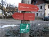 2
2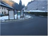 3
3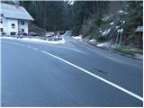 4
4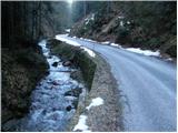 5
5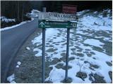 6
6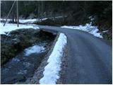 7
7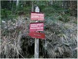 8
8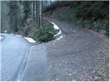 9
9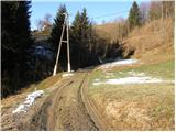 10
10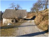 11
11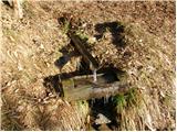 12
12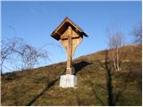 13
13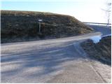 14
14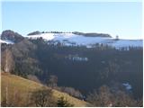 15
15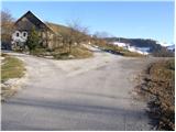 16
16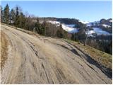 17
17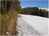 18
18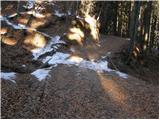 19
19 20
20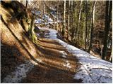 21
21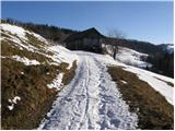 22
22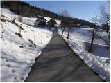 23
23 24
24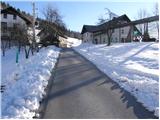 25
25 26
26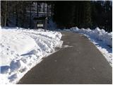 27
27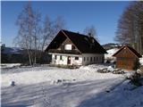 28
28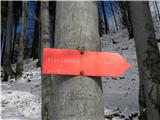 29
29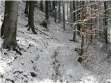 30
30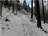 31
31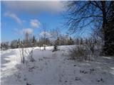 32
32 33
33 34
34 35
35 36
36
Discussion about the trail Sovodenj - Štor (razgledna pot)