Tinčkova koča - Tomčeva koča na Poljški planini
Starting point: Tinčkova koča (1015 m)
| Lat/Lon: | 46,4214°N 14,1988°E |
| |
Time of walking: 1 h
Difficulty: partly demanding marked way
Altitude difference: 165 m
Altitude difference po putu: 200 m
Map: Karavanke - osrednji del 1:50.000
Recommended equipment (summer):
Recommended equipment (winter): ice axe, crampons
Views: 5.365
 | 1 person likes this post |
Access to the starting point:
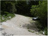
From the Ljubljana - Jesenice motorway, take the Lesce exit and follow the road towards Žirovnica and Jesenice. After a few kilometres of driving, you will come to a crossroads where the road to Žirovnica and Moste turns right (from Jesenice to the left). Just a few metres further on, at the next crossroads, turn left into Moste (to the right Žirovnica). Continue past the memorial to the fallen fighters, where the road starts to climb uphill under the railway line. At the top of the hill, turn right (at the Vila Karin sign) and we continue towards Završniškem jezero and Valvasor's home. The road then bends and leads to a crossroads where the road to Valvasor's home branches off to the left and we continue straight ahead. The road continues past a nicely landscaped parking lot, and the asphalt road soon becomes a dirt road. The dirt road, which is asphalted in a few steep sections, leads us higher up to a small crossroads, where we continue straight in the direction of Zelenica and Roblek (the right-hand road leads towards the Kališča pass). The road then crosses a grazing fence and leads us just a little further to a hut (Pri žagi). We continue driving along the steeper road again, but soon we see the markings for Poljško mountain pasture and Roblek, which direct us to the sharp right. As there is no suitable parking place next to the mountain signs, we drive a good 50 metres higher and then park in a suitable place along the road.
Path description:
From the starting point, return along the macadam road to the nearby direction signs for Poljško mountain pasture and Roblek, and from there continue along the initially parallel mountain path. The trail descends to a small stream, crosses it, and then passes to the western slopes of Begunjščica, where it first crosses moderately steep slopes. The crossing continues to the right, where it quickly reaches very steep slopes, over which it ascends crosswise. The continuation of the route is not very pleasant, as the poorly maintained path leads over a very steep slope which is dangerous for slipping (especially in wet conditions). Above the exposed part, the path and the slope are laid down and we continue crossing. The path continues through the forest and gradually switches back to steeper slopes. There are a few more minutes of scrambling before we move to the south-western slopes, where the slope visibly flattens out. After a short climb up a less steep slope, we arrive at a small crossroads where a path branches off to the right downhill towards the NOB monument, and we continue straight ahead on a path that climbs moderately through the forest. Higher up, we join the cart track, which we follow to the right, and we descend it in a few minutes to Tomč's hut at Poljška mountain pasture.

Pictures:
 1
1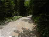 2
2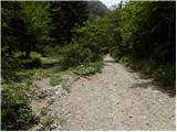 3
3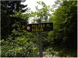 4
4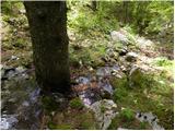 5
5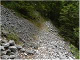 6
6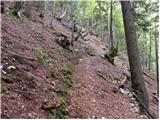 7
7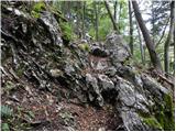 8
8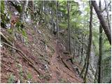 9
9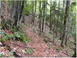 10
10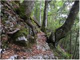 11
11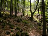 12
12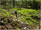 13
13 14
14 15
15 16
16 17
17 18
18 19
19 20
20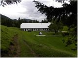 21
21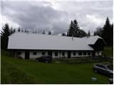 22
22
Discussion about the trail Tinčkova koča - Tomčeva koča na Poljški planini
|
| darh4. 05. 2013 |
Po tu opisani poti smo danes sestopili s Poljške planine. Pot je bila z izjemo kratkega neproblematičnega prečenja pomrznjenega snega v spodnejm delu skoraj povsem suha, a zato prav na območju prečenja pobočja izdatno posuta z listjem, ki je na že tako ozki stezi zahtevalo dodatno previdnost. Pa tudi "potoček" na dnu poti v trenutnih razmerah ni tako nedolžen, čeprav je varno prečkanje suhih nog še vedno povsem izvedljivo. Več o naši celotni današnji poti pa tule.
|
|
|