Žlebe - Sveti Jakob (via Jeterbenk)
Starting point: Žlebe (410 m)
| Lat/Lon: | 46,1121°N 14,3954°E |
| |
Name of path: via Jeterbenk
Time of walking: 2 h 15 min
Difficulty: easy marked way
Altitude difference: 396 m
Altitude difference po putu: 485 m
Map: Škofjeloško in Cerkljansko hribovje 1:50.000
Recommended equipment (summer):
Recommended equipment (winter): crampons
Views: 5.003
 | 1 person likes this post |
Access to the starting point:
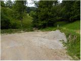
a) First, drive into Ljubljana, then continue along the Celovška Road towards Medvode. When you arrive in Medvode, turn left at the first traffic light over the railway line towards Gole Brdo, Žleb and Preska. After the railway line, turn left (right towards Preska) in the direction of Medno, Golo Brdo and Žleb, and then a little further right (right towards Medno). Only about 500 m further on, you will reach the next crossroads, where at the beginning of Seničica, turn right (right towards Golo Brdo) in the direction of Žlebe. When the residential houses of Seničica are finished, we arrive in the forest, where we continue left at the crossroads towards Žlebe (also slightly to the right there are signs for Žlebe - it is a circular road). Continue along the slightly ascending road, which we follow until we reach a small pass. At the pass, turn left onto the dirt road, which quickly leads to the next crossroads, where you continue along the lower left road. From the crossroads, where there are also mountain direction signs, drive for about 100 m, or until you reach a left turn, at which there is a marked parking area.
b) From Škofja Loka, Kranj or Vodice, drive to Medvode and from there continue towards Ljubljana. At the last traffic light in Medvode, which is located about 100 m further from the Hofer store, turn right across the railway line in the direction of Golego Brdo, Žleb and Preska. After the railway line, turn left (right Preska) in the direction of Medno, Golo Brdo and Žleb, and then a little further right (straight Medno). Only about 500 m further on, you will reach the next crossroads, where at the beginning of Seničica, turn right (straight Golo Brdo) in the direction of Žlebe. When the residential houses of Seničica are finished, we arrive in the forest, where at the crossroads we continue left towards Žlebe (also slightly to the right there are signs for Žlebe - it is a circular road). Further on, we follow a slightly ascending road, which we follow to a small pass. At the pass, continue left on the dirt road, which quickly leads to the next crossroads, where you continue on the lower left road. From the crossroads, where there are also mountain direction signs, drive for about 100 m, or until you reach a left turn, at which there is a marked parking area.
Path description:
From the parking lot continue along cart track in the direction of Katarina, Jeterbenk and St. Marjeta (Petelinc on the left), which continues along the left side of the brook. After a few 10 steps leave the cart track and continue right into the woods, first descending to and crossing the stream. On the other side, continue climbing gently for a short distance, then the path turns right and climbs steeply. A little higher you reach a marked crossroads, where you continue left (right St Margaret's Church for 3 minutes) and then left again at the next one. A little further on, the path splits into two parts, and we continue on the lower left (right Jeterbenk over Turnice), which is not marked for some time, but is marked at most of the crossroads.
From the unmarked crossroads we first descend gently to a small gully, then climb steeply to cart track, which we follow to the left, and we walk along it to the point where the "Petelinc" markers direct us right onto a steeper path, which in a few minutes takes us to a hayfield (there is a bench at the edge of the hayfield), which we climb steeply over. The way forward returns to the forest and leads us past the ruins to a marked crossroads, where we join the marked path from Slavkov's home at Golem Brdo.
Here we continue to the right and start climbing along the ridge Jeterbenk, which occasionally opens up some views to the south. Higher up, we reach a sort of headland, from which we descend to a small pass where we join the path from Katarina. Continue straight ahead and in a few steps reach the summit, in the middle of which stands a large cross.
From the crossroads, a few steps below the summit, continue in the direction of Katarina, first descending steeply through the forest and then reaching a cottage, where the path is laid and leads to the road. Continue along the road, which quickly leads to the crossroads at the chapel.
From this crossroads, which is located at the edge of the forest, continue straight ahead (sharp left Jeterbenk, left Slavkov dom na Golem Brdu) along the scenic road, which quickly leads to the next crossroads, from where you continue straight ahead on the footpath, which continues between two roads (the left road leads to Katarina, the right road leads to the Kozomer farm). The path continues quickly up to a bench and a table, and then continues for a short distance along the edge of the forest, where a beautiful view opens up. Higher up, the path descends into the forest and leads to a hill, from which it descends past a byte to cart track. Climb cart track for a short distance, then, at the point where cart track turns slightly to the right, continue straight up a well-trodden track which begins to climb steeply over hay meadow. Higher up, the path enters the woods, where it climbs even steeper. When you get a little higher out of the forest, you are at the top of the Róg by a large wooden cross. From the top, continue along the pleasant ridge path, which leads along a scenic ridge, and then the path crosses the lane of the forest, after which you arrive at a crossroads. At the crossroads, a path branches off to the left to the church of St. We continue slightly to the right along a slightly less distinct, but still well-traced path, which continues for some time through hay fields, then turns into the forest and descends to a narrow macadam road leading from Topole towards the hamlet of Brezovica. Follow the road to the right for a short distance and then arrive at a well-marked crossroads located at the edge of a small hamlet.
The marked trail passes the hamlet on the right and then continues along the wide cart track, which offers a beautiful view of our destination and, in good weather, of the Kamnik and Savinja Alps and the Posavje hills. On the other side of the meadow, the path approaches the forest, where we join the path from Sora and Preska. Here, too, we continue to the left, and we walk along the cart track for only a few more 10 steps, as the signs then lead us to the right on a relatively steep path that continues along the edge of the forest (even if we continue along the cart track we will reach the top). During the ascent we have a nice view towards Polhograjska Grmada, and from the summit, which we reach after a few minutes, towards the other peaks of the Polhograjsko hills.

Pictures:
 1
1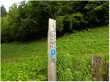 2
2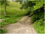 3
3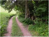 4
4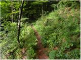 5
5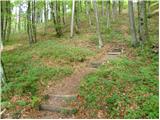 6
6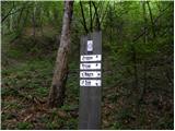 7
7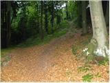 8
8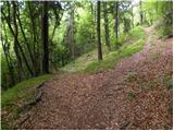 9
9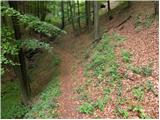 10
10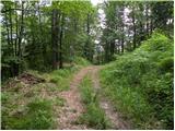 11
11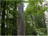 12
12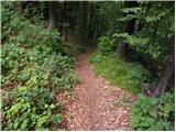 13
13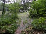 14
14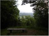 15
15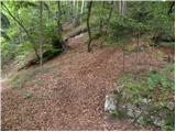 16
16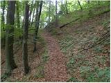 17
17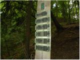 18
18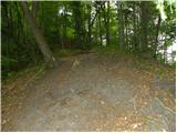 19
19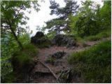 20
20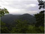 21
21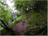 22
22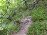 23
23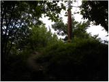 24
24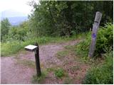 25
25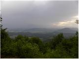 26
26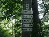 27
27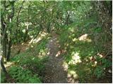 28
28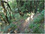 29
29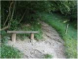 30
30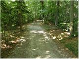 31
31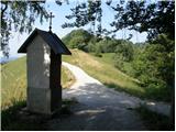 32
32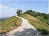 33
33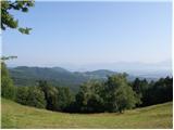 34
34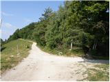 35
35 36
36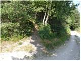 37
37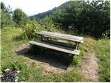 38
38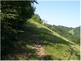 39
39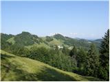 40
40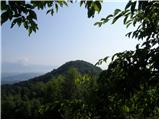 41
41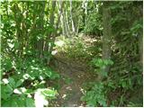 42
42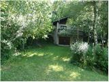 43
43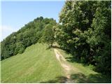 44
44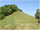 45
45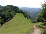 46
46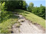 47
47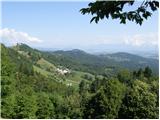 48
48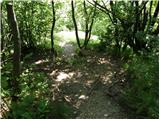 49
49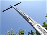 50
50 51
51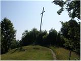 52
52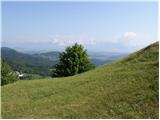 53
53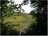 54
54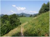 55
55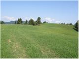 56
56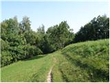 57
57 58
58 59
59 60
60 61
61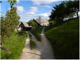 62
62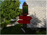 63
63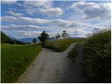 64
64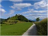 65
65 66
66 67
67 68
68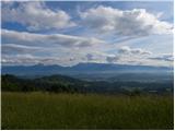 69
69 70
70 71
71 72
72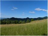 73
73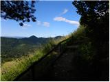 74
74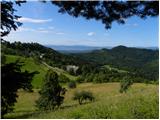 75
75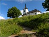 76
76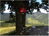 77
77 78
78
Discussion about the trail Žlebe - Sveti Jakob (via Jeterbenk)
|
| xjl1919. 10. 2020 |
Pozdravljeni, danes smo želeli prehoditi to pot, kar pa nam ni uspelo. Namreč, že po 5 minutah smo prišli do točke, kjer smo se morali zaradi nejasnih/dvoumnih/pomanjkljivih/napačnih(?) navodil obrniti in preložiti načrt na (upam, bližnjo) prihodnost.
Navodila so na začetku jasna: "Po nekaj 10 korakih zapustimo omenjeni kolovoz in nadaljujemo desno v gozd, kjer se najprej spustimo do potočka in ga tudi prečimo. Na drugi strani se kratek čas še zložno vzpenjamo, nato pa pot zavije desno in se strmeje vzpne." Do tu brez težav. Nato pa se nadaljujejo: "Nekoliko višje prispemo na označeno razpotje, kjer nadaljujemo levo (desno cerkev sv. Marjete 3 minute)". Tako razpotje je lahko samo znak učne poti s tremi fotografijami in smerokazom za sv. Marjeto, ki smo ga zlahka našli. Od njega se nadaljuje samo ena pot - v desno (ki nas v par minutah pripelje do cerkve sv. Marjete). V levo ni poti, niti ozke stezice. Razen, če je popolnoma opuščena in zaraščena...
Vljudno prosim za pomoč. Hvala in srečno!
|
|
|
|
| ben19. 10. 2020 |
Tale opis je očitno že precej zastarel. Namreč ta pot, ki ste jo iskali v levo je žal tisti znani žledolom popolnoma zasul in je precej težko prehodna. Se pa da...s precej telovadbe  Če želite preko Petelinca na Jeterbenk in potem naprej po opisu na Sveti Jakob potem je najbolje, da po nekaj 10 korakih ne greste desno v gozd ampak kar nadaljujete naravnost po kolovozu. Je pa ta del poti do Petelinca neoznačen in ima mogoče lahko kakšno past, da se lažje zaide. V kolikor ste pa prvič v teh krajih pa vam priporočam, da greste kar lepo do Sv. Marjete in tam levo po kolovozu in markirani poti do kapelice na sl. 32 in od tam na vrh Jeterbenka. Od tam nazaj do kapelice in naprej po zgornjem opisu. Upam, da nisem preveč zakompliciral 
|
|
|