Alba di Canazei - Cima Ombretta (Via Ferrata Ombretta)
Starting point: Alba di Canazei (1486 m)
| Lat/Lon: | 46,45751°N 11,78814°E |
| |
Name of path: Via Ferrata Ombretta
Time of walking: 5 h 15 min
Difficulty: very difficult marked way
Altitude difference: 1525 m
Altitude difference po putu: 1550 m
Map: Tabacco 06 1:25.000
Recommended equipment (summer): helmet, self belay set
Recommended equipment (winter): helmet, self belay set, ice axe, crampons
Views: 3.960
 | 2 people like this post |
Access to the starting point:
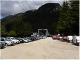
a) From Kranjska Gora via the Koren saddle to Austria, where at the first major junction continue left towards Podkloštro / Arnoldstein and Trbiz / Tarvisio. At the end of Podklošter, the signs for Šmohor / Hermagor direct you to the right on the regional road, which takes you past this town to the end of the Ziljska valley, or more precisely to Kötschach-Mauthen, where you turn right towards Oberdrauburg. The road continues over the Gailbergsattel Alpine pass (982 m), after which you descend into the above-mentioned town. After crossing a bridge over the River Drava, turn left towards Lienz. At the main roundabout in Lienz, turn left towards Sillian and Itali. Next, cross the national border between Austria and Itali and follow the main road to Dobbiaco/Toblach, where you turn left towards Cortina d'Ampezzo. Once in Cortina d'Ampezzo, follow the signs for the Passo Falzarego Alpine pass. At the Falzarego Pass (2105 m) there is a crossroads where you continue straight down towards Marmolada and the Passo Fedaia Pass. At the following junctions, follow the road towards Marmolada and the aforementioned pass. After the Fedaia Pass (2057 m), which is located by the artificial lake Lagho di Fedaia, the road starts to descend again and we follow it to the beginning of Alba, where we will see the Ciampac cable car (swing) on the left. Park in the large parking lot at the bottom station of the cable car. From Kranjska Gora to the starting point is about 280 km.
b) From Kranjska Gora via Border crossing Rateče to Trbiz / Tarvisio and then on the motorway to Udine. Leave the motorway at Tolmezzo, from where we continue driving towards Ampezzo and on to the Alpine pass Passo della Mauria (1298 m). The road then starts to descend and leads into the Cadore valley, where we continue to the right towards Auronzo di Cadore. At the next crossroads follow the signs for Cortina d'Ampezzo. When you arrive in Cortina d'Ampezzo, follow the signs for the Passo Falzarego Alpine pass. At the Falzarego Pass (2105 m) there is a crossroads where you continue straight down towards Marmolada and the Passo Fedaia Pass. At the following junctions, follow the road towards Marmolada and the aforementioned pass. After the Fedaia Pass (2057 m), which is located by the artificial lake Lagho di Fedaia, the road starts to descend again and we follow it to the beginning of Alba, where we will see the Ciampac cable car (swing) on the left. Park in the large parking lot at the bottom station of the cable car. From Kranjska Gora to the starting point is approximately 270 km.
c) From Nova Gorica, drive into Itali and continue on the motorway to Portogruaro, where you will take the motorway fork towards Belluno. Follow the motorway to the Belluno exit, and after Belluno follow the road towards Agordo and then Marmolada and the Passo Fedaia Alpine pass. After the Fedaia Pass (2057 m), which is situated by the artificial lake Lagho di Fedaia, the road starts to descend and we follow it until we reach the beginning of Alba, where we will see the Ciampac cable car (swing) on the left hand side. Park in the large parking lot at the bottom station of the cable car. From the Slovenian border to the starting point is about 245 km.
Path description:
At the end of the parking lot, turn slightly left after the "Locia de Contrin" signs onto a forest road closed to public traffic. The road is mostly through the forest, with only occasional views of the nearby peaks. The road then soon crosses a bridge and leads to a marked crossroads where the footpath from Penia joins from the left. Further on, the road climbs mostly in switchbacks and, higher up, a few cart tracks branch off the road. We continue straight ahead on a well-maintained road. Later the road turns left and soon a footpath branches off to the right towards the ski resort of Ciampac. We continue along the road and after a short climb we reach the Locia de Contrin hut.
From the hut we continue along a gravel road which soon crosses a forest. The road continues to lead us through the valley along the Ruf de Contrin stream and leads us to a crossroads by the pastureland.
A path branches off to the right up towards the Forcia Neigra saddle and the Colac summit, and we continue along the road, which then begins to descend gently. Soon we come to a crossroads again, where a path branches off to the right towards the Rifugio Passo San Nicolò hut.
We continue along the road, which turns left here and crosses a bridge. The scenic road starts to climb again and leads to hut Baita Cianci.
From hut Baita Cianci we continue along the road, which soon leads us into the forest and starts to climb a little steeper. The path then alternates between strips of forest and meadows, from which we have increasingly beautiful views of the surrounding peaks. This path then leads us to hut Rifugio Contrin
From the hut, continue along the macadam road, which quickly leads to a crossroads where, on the left, the path No 606 branches off towards Marmolada and the Passo Ombretta saddle. We continue along the road, which leads us along the pasture and then gently descends. The road then becomes a track which leads to the foot of the slopes of the summit of the Ombretta Ogcidentale. Here the path turns slightly to the right and climbs through a sparse larch forest. The path then crosses a fence and soon reaches a crossroads.
Continue left along path 607, following the Cima Ombretta signs, and the path to the right leads to the Passo Pasche saddle. The trail then ascends mainly on grassy slopes with sparse larch trees and follows the valley below the slopes of the Ombretta. The higher grassy slopes slowly give way to scree, which is then climbed for some time. The path continues along the valley below the peaks of the Ombretta towards the south-east and later leads to a marked crossroads.
We head left after the Cima Ombretta markers, and to the right the path leads to the Passo Cirelle saddle. From the crossroads, the path begins to climb on scree towards the buttresses of Sasso Vernale. When you reach the foot of the wall, you are at the crossroads again. To the right the path leads to the saddle of Passo di Ombretola, and we continue to the left where the Via Ferrata Ombretta climbing route starts.
At the start, the climbing route climbs steeply up along a small rope and passes slightly to the left of a steep ravine. There is a short traverse to the right, and then the route climbs steeply with the aid of scrambles. The climbing route continues for a short time along the steel and then ends in a relatively short climbing route that leads to the scree below the walls of Sasso Vernale Peak.
The route then follows the broad and relatively flat valley between the peaks of Ombretta Ogcidentale and Sasso Vernale. Higher up, the path begins to climb a little steeper on the scree and leads to a small saddle below the Cima Ombretta peak.
At the saddle, where we have a wonderful view of the Marmolada, we continue to the right and then climb up the ridge to the summit.

Pictures:
 1
1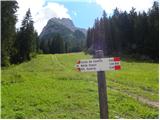 2
2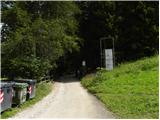 3
3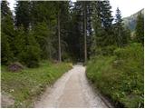 4
4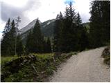 5
5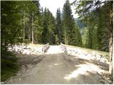 6
6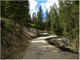 7
7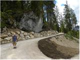 8
8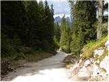 9
9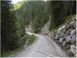 10
10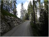 11
11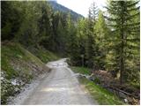 12
12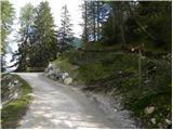 13
13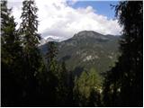 14
14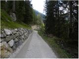 15
15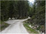 16
16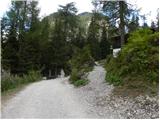 17
17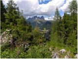 18
18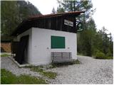 19
19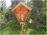 20
20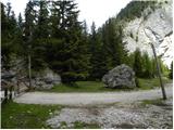 21
21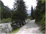 22
22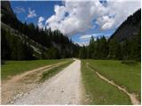 23
23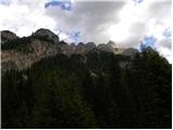 24
24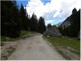 25
25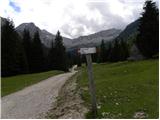 26
26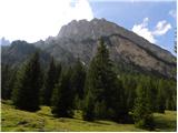 27
27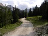 28
28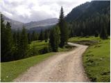 29
29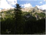 30
30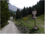 31
31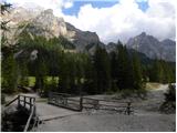 32
32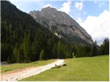 33
33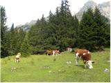 34
34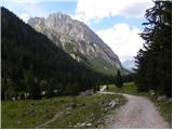 35
35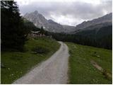 36
36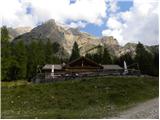 37
37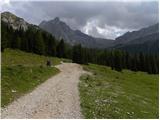 38
38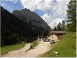 39
39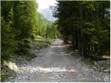 40
40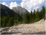 41
41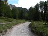 42
42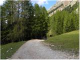 43
43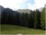 44
44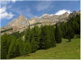 45
45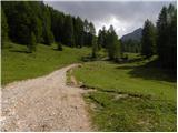 46
46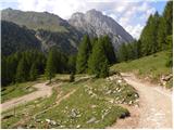 47
47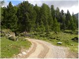 48
48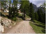 49
49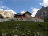 50
50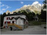 51
51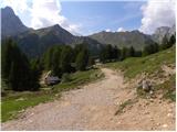 52
52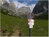 53
53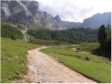 54
54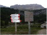 55
55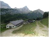 56
56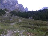 57
57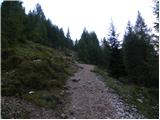 58
58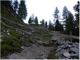 59
59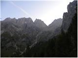 60
60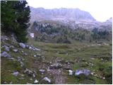 61
61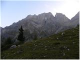 62
62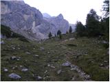 63
63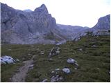 64
64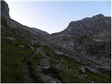 65
65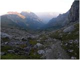 66
66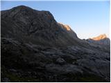 67
67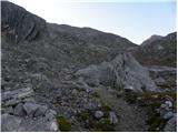 68
68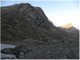 69
69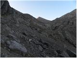 70
70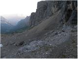 71
71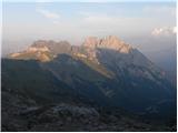 72
72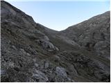 73
73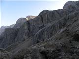 74
74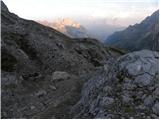 75
75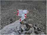 76
76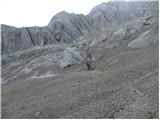 77
77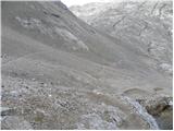 78
78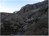 79
79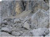 80
80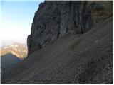 81
81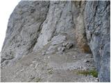 82
82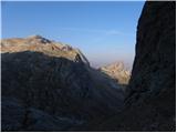 83
83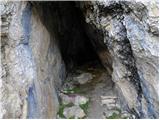 84
84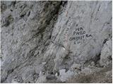 85
85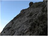 86
86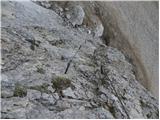 87
87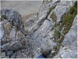 88
88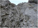 89
89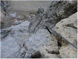 90
90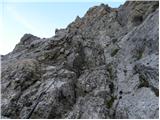 91
91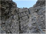 92
92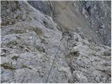 93
93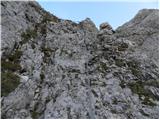 94
94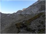 95
95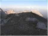 96
96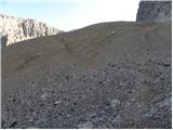 97
97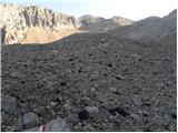 98
98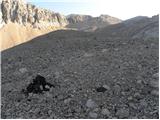 99
99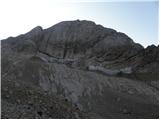 100
100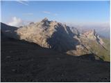 101
101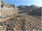 102
102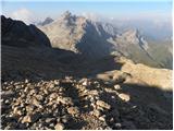 103
103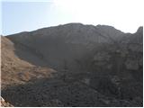 104
104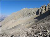 105
105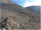 106
106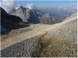 107
107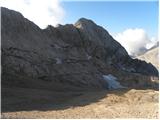 108
108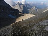 109
109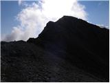 110
110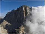 111
111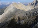 112
112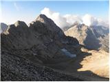 113
113 114
114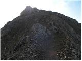 115
115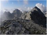 116
116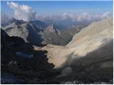 117
117 118
118
Discussion about the trail Alba di Canazei - Cima Ombretta (Via Ferrata Ombretta)