Belopeška jezera - Srednja Ponca / Ponza di Mezze
Starting point: Belopeška jezera (929 m)
| Lat/Lon: | 46,4733°N 13,6713°E |
| |
Time of walking: 3 h 45 min
Difficulty: very difficult marked way
Altitude difference: 1299 m
Altitude difference po putu: 1299 m
Map: Julijske Alpe - zahodni del 1:50.000
Recommended equipment (summer): helmet, self belay set
Recommended equipment (winter): helmet, self belay set, ice axe, crampons
Views: 14.076
 | 2 people like this post |
Access to the starting point:
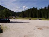
From Kranjska Gora, drive to Trbiž / Tarvisio via the Rateče border crossing. Shortly after the border crossing, the road to the left turns off in the direction of the Belopeški jezera / Laghi di Fusine, which is then followed in a moderate ascent to the large parking lot at the Upper Mangart (Belopeci) Lake.
Path description:
From the parking lot, continue along the left-hand side of the guest house towards the Zacchi hut. The path initially follows a forest road, which you leave after a few minutes, as the signs direct you to the left on a wide cart track. The cart track we are walking on turns into an ascending footpath a little higher up. A relatively wide and well-marked path then leads us on a moderate ascent through the forest to the Zacchi mountain hut (which can also be reached by forest road) within a good hour's walk from the starting point.
At the hut, follow the signs "Ponza di Mezzo, Ponza Grande". The path then climbs for some time from the hut through dwarf pines under the steep slopes of the Ponzi slightly to the right, and soon leads to the first steel cables on the path. Here the path turns slightly to the left and then climbs quite steeply alongside the steel cable a few times. As we approach the cliffs below Visoka Ponca, the path turns right and crosses a wide gully. There is a short climb slightly to the right of the ravine, which leads to a crossroads. To the left, a direct, very difficult climbing route (ferrata) branches off to Visoka Ponca, and we take the route to the right, which leads to Srednja Ponca and to Visoka Ponca by a slightly easier route. From the crossroads, the path first crosses the slopes to the right in a slight ascent, then turns left and climbs up a steep grassy slope. The grassy slope is soon replaced by rocks and after a short climb we are back at the crossroads. The path to the left leads to Visoka Ponca, and we turn right to follow the Tamar markers. From the crossroads, it's just a short climb up the rocky slope to the top of Srednja Ponca, where we get spectacular views in all directions.

Pictures:
 1
1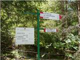 2
2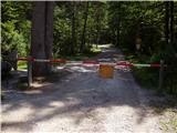 3
3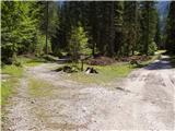 4
4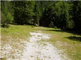 5
5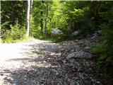 6
6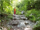 7
7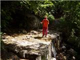 8
8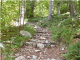 9
9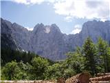 10
10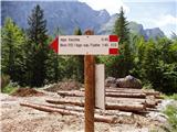 11
11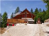 12
12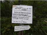 13
13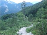 14
14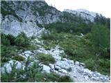 15
15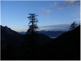 16
16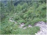 17
17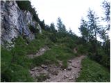 18
18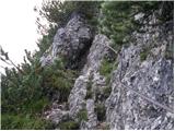 19
19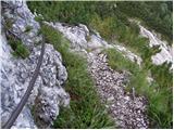 20
20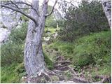 21
21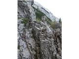 22
22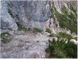 23
23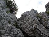 24
24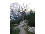 25
25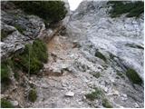 26
26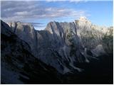 27
27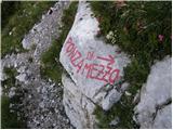 28
28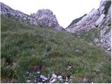 29
29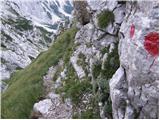 30
30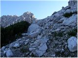 31
31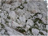 32
32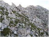 33
33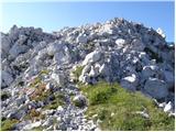 34
34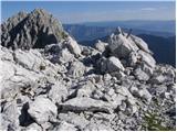 35
35
Discussion about the trail Belopeška jezera - Srednja Ponca / Ponza di Mezze
|
| malimiha2. 12. 2016 |
Zdravo zanimajo me razmere na poti je kopna? Hvala in lp miha
|
|
|
|
| matic411. 06. 2017 |
Pot je kopna, varovala so brezhibna, markacije obnovljene.
|
|
|
|
| bogdan@bzq.si1. 10. 2023 14:27:44 |
bil danes, sicer na koči Zacci piše , da je pot zaprta, pa gre brez problemov ! Le slabe markacije, sploh ko prideš izven rušovja, me je zaneslo ob steno, pa je treba iti desno !
Razglkedi pa božanski !
|
|
|
|
| 2061alessio2. 10. 2023 18:43:44 |
v kratkem bo potekala prenovitev cele ferate na Visoko Ponco 
|
|
|
|
| Stoick11. 10. 2023 14:02:09 |
Table ni več, bil včeraj (na Ponza Grande  . Ferata je bila pravkar obnovljena, se še vidi prah od vrtanja! Je pa uradno zaprta pot na Malo Ponco, tabla je tako spodaj pri cesti kot pri koči Zacchi.
|
|
|