Borovnica - Mali Trebelnik
Starting point: Borovnica (350 m)
| Lat/Lon: | 45,9092°N 14,3668°E |
| |
Time of walking: 1 h 30 min
Difficulty: easy marked way
Altitude difference: 457 m
Altitude difference po putu: 470 m
Map: Ljubljana - okolica 1:50.000
Recommended equipment (summer):
Recommended equipment (winter):
Views: 10.606
 | 1 person likes this post |
Access to the starting point:
From the motorway Ljubljana - Koper take the exit Vrhnika and follow the road towards Bistra and Borovnice. At the crossroads in Borovnica, turn right in the direction of Pekel (Podpeč on the left) and follow the road for another 100 m, then turn right on the ascending road in the direction of Pokojišča. Above the village Borovnica, the road loses its asphalt surface and we follow it a little further, then park in one of the roadside car parks.
Path description:
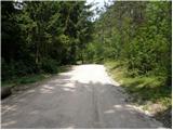
From the starting point we continue along the road along which we parked, which after about an hour's walk, mostly through the forest, leads us to the village Pokojišče. At the crossroads on Pokojišče, continue straight on in the direction of Vrhnika (left Cerknica) along the road which leads past the hunting lodge Pokojišče to the next crossroads, where you continue sharp right to the village of Zavrh. The road then leads past a children's playground and splits into two parts just a little further on.
Continue along the road to the right, which is also where the signs direct you. Higher up (at the last house), the road changes to cart track, which leads us in a moderate ascent over a grassy slope with a view. Cart track soon lays down, turns left and after a short descent leads us to the upper part of the village, where at the crossroads we continue to the sharp right. There is a short climb, and then signs direct you left to cart track, which starts in the courtyard of the houses. Take the above-mentioned cart track, which leads across a courtyard (careful, dogs!) to an expansive grassy slope. Continue up the less visible but, due to the grazing fences, orientationally easy cart track, which, after a few minutes' further ascent, leads us to the unmarked summit of Malý Trebelnik.
From the top, you can continue a little further (approx. 50 to 100 m) to the paragliders' take-off point, which offers a beautiful view of the Ljubljana Marshes.

Pictures:
 1
1 2
2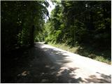 3
3 4
4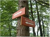 5
5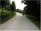 6
6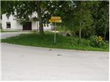 7
7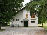 8
8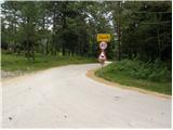 9
9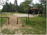 10
10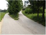 11
11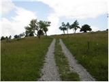 12
12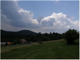 13
13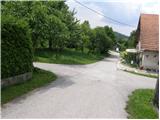 14
14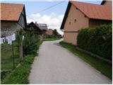 15
15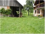 16
16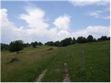 17
17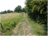 18
18 19
19 20
20
Discussion about the trail Borovnica - Mali Trebelnik
|
| grega_p8. 02. 2010 |
Pes omenjen v opisu samo laja in ne grize, razen če nimate v nahrbtniku kakšnih dobrot:-). Najboljse ga je ignorirati - preverjeno.
Lepa turca tudi pozimi, v tem casu je sneg lepo spihan in pomrznjen ter ponekod skorja drzi tezo.
|
|
|