Črnivec - Peračica waterfall (on footpath)
Starting point: Črnivec (500 m)
| Lat/Lon: | 46,3388°N 14,2191°E |
| |
Name of path: on footpath
Time of walking: 10 min
Difficulty: easy unmarked way
Altitude difference: -70 m
Altitude difference po putu: 1 m
Map: Karavanke - osrednji del 1:50.000
Recommended equipment (summer):
Recommended equipment (winter):
Views: 3.270
 | 3 people like this post |
Access to the starting point:
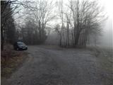
a) From the motorway Ljubljana - Jesenice, take the exit Brezje and then continue driving towards the settlement of Brezje and Podvin Castle. From the nearby roundabout at Črnivec, continue "straight ahead" (second exit), then after a few 100 metres of further driving, leave the main road by turning slightly right in the direction of Črnivec. After the crossroads, continue along the road on the left, and at the next stop sign, go slightly right (left Črnivec and Kranj, straight Radovljica). Continue parallel to the main road, and then at the next crossroads, go right, just a little further on, and at the former landfill, turn right onto the dirt road. After about 100 metres of further driving, park at a suitable place on the side of the road at the edge of the forest.
b) From the motorway Jesenice - Ljubljana, take the exit Radovljica, then follow the signs for Podvin Castle. From the semaphore crossroads at Podvin Castle, continue straight ahead, then at the top of the hill turn slightly right towards Črnivec. In Črnivac, turn left towards Radovljica, go through the underpass, and on the other side continue slightly left, so that you do not enter the main road, but go parallel to it. Continue parallel to the main road, then turn right at the next junction, just a little further on, and at the former landfill site turn right onto the dirt road. After about 100 metres of further driving, park at a suitable place on the side of the road at the edge of the forest.
Path description:
From the starting point, continue along the road as it continues through the forest and starts to descend. After a short descent, you reach a small crossroads where you leave the wider road and continue straight on to a worse macadam road. Even on the worse road, you continue to descend easily, but when the road turns right, you continue straight ahead, on a beaten track. The path turns slightly to the right at first, then starts to descend steeply and turns left. After a short cross-country descent, you will reach an information board and a registration box at the Peračica waterfall, and there are still some 10 steps of easy walking to the base of the waterfall.
Description and pictures refer to the situation in 2018 (January).
Pictures:
 1
1 2
2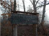 3
3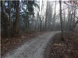 4
4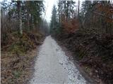 5
5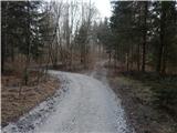 6
6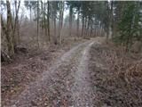 7
7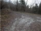 8
8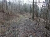 9
9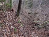 10
10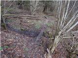 11
11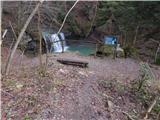 12
12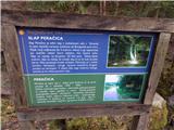 13
13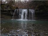 14
14
Discussion about the trail Črnivec - Peračica waterfall (on footpath)