Starting point: Dol (850 m)
| Lat/Lon: | 46,3826°N 14,4445°E |
| |
Time of walking: 1 h 40 min
Difficulty: easy unmarked way
Altitude difference: 656 m
Altitude difference po putu: 656 m
Map: Karavanke - osrednji del 1:50.000
Recommended equipment (summer):
Recommended equipment (winter): ice axe, crampons
Views: 5.600
 | 4 people like this post |
Access to the starting point:
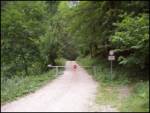
From the motorway Ljubljana - Jesenice take the exit Kranj - East and follow the road in the direction of Jezersko, but only as far as the Kanonir Inn, where you turn left. Continue on the asphalted road, but only until the crossroads about 2km away, where the road to Stegovnik branches off to the right. Take this road and follow it for a few 100m to a roadblock, where you park in a small parking lot.
Path description:
From the barrier, follow the forest road, which after about 20 minutes leads to a crossroads. Turn right and follow the road to a large grassy clearing where the house stands. Here, go straight on to the footpath marked Stegovnik (left Stegovnik out of the window, unmarked path). The path climbs slightly and leads to cart track. Here, look carefully at the markings and make sure that cart track does not mislead you. The path then crosses cart track a few more times and leads to Močnikovo sedlo together with the track.
Here, leave the marked path at Stegovnik and head right along the ridge of Bukovec. You will notice a very badly worn and, in the initial part, difficult to see path. If you do not find the track, stick to the ridge. The path leads us higher through the forest to a ridge which we follow along a wire towards the top. In the upper part there are a lot of fallen trees so we will have to climb a bit or dodge them in the redundant bends. Just below the top, the ridge narrows and the forest becomes more sparse. The last metres below the summit are on very tall grass. When you reach the top, you have a beautiful view.
The walk along the trackless path takes just over 30 minutes.
Orientation is not difficult, despite the poor track, as most of the way is along the ridge.

Pictures:
 1
1 2
2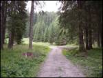 3
3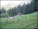 4
4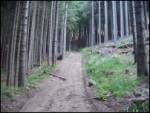 5
5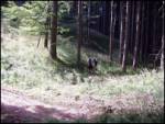 6
6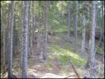 7
7 8
8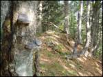 9
9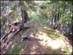 10
10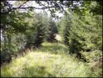 11
11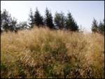 12
12
Discussion about the trail Dol - Bukovec
|
| Guest30. 08. 2006 |
Ta gugalnica je stara ograja ,ki je preprečevala divjadi prehod na Jezersko stran .Prvi jo je postavljal baron Born iz Jelendola oz.takratnega Putrhofa.Pozneje go lovci,gozdni delavci in drudi to obnavkjali,danes pa se vidi v kaksnem stanju je.
|
|
|