End of road on Pokljuka - Viševnik (via Gola Ravan)
Starting point: End of road on Pokljuka (1340 m)
| Lat/Lon: | 46,3386°N 13,9045°E |
| |
Name of path: via Gola Ravan
Time of walking: 2 h 15 min
Difficulty: easy unmarked way
Altitude difference: 710 m
Altitude difference po putu: 725 m
Map: TNP 1:50.000
Recommended equipment (summer):
Recommended equipment (winter): ice axe, crampons
Views: 7.021
 | 3 people like this post |
Access to the starting point:
a) Leave the Gorenjska motorway at the exit for Lesce, then follow the signs for Bled and Pokljuka. Continue through Gorje and past the Zatrnik ski resort to Rudni Polje on Pokljuka, where there is a large pay parking lot, and a military barracks and shooting range nearby. From here, continue straight along the macadam road, which leads us a little further to a crossroads, where we continue to the right (Uskovnica on the left). Follow this road to the former parking lot Za Ribnico, which is at the end of the road (there are mountain signs for mountain pasture Konjščico).
After the new parking at the end of the road is forbidden, so we park already at Rudne polje, which lengthens the route by about 40 minutes, but it is more convenient to choose the marked trail, which starts already at Rudne polje.
b) From Železniki or Podbrdo, take the road to Bohinjska Bistrica and then continue in the direction of Bled. Shortly after the Petrol station, which is located just after Bohinjska Bistrica, turn left in the direction of Pokljuka and Jereka. The road climbs steeply at first, then gradually flattens out behind Koriti, leading to a junction by the bus station, where you continue right in the direction of Pokljuka, Koprivnik and Jereka (straight ahead Srednja vas). Just after the crossroads we arrive at Jereka, and from the crossroads in front of the church we continue straight on towards Pokljuka (left Podjelje). After Jereka the road starts to climb steeply again, and higher up it levels off and continues along the Mrzle potok. When you join the road from Bled, go left and drive to Rudno Polje, where there is a large pay parking lot, and also a military barracks and shooting range nearby. From here, continue straight along the macadam road, which leads us a little further to a crossroads, where we continue to the right (Uskovnica on the left). Follow this road to the former parking lot Za Ribnico, which is at the end of the road (there are mountain signs for mountain pasture Konjščico).
After the new parking at the end of the road is forbidden, so we park already at Rudne polje, which lengthens the route by about 40 minutes, but it is more convenient to choose the marked trail, which starts already at Rudne polje.
Path description:
From the former parking lot at the end of the road, follow the wide and initially ascending cart track towards mountain pasture of Konjščice. The cart track, which goes immediately into the dense forest, is quickly laid and after a few minutes of easy walking turns into a footpath which continues along the left bank of the Ribnica stream. When the path is quite close to the stream, it turns slightly to the right and climbs steeply. Higher up, the path lays down and leads out of the forest to the lower edge of the vast Konjščice River. Here the path turns slightly to the left, crosses a small stream and after a few further steps leads us to a place where a marked path crosses the next small stream. Just before crossing the stream, an unmarked path branches off to the right, leading towards the marked Rudno polje Triglav trail. Here continue to the right (left cheese cottage at mountain pasture Konjščica, Vodnikov dom, Triglav. . . ), where you first climb a few steps by stepping out of the stream bed, then the path becomes transiently lost and laid. Cross the grazing area and continue eastwards or slightly further to the right, until the point where the track becomes more distinct. After crossing a torrential gully, the track becomes more distinct and, with fine views of the mountains surrounding mountain pasture Konjščica, begins to climb more steeply. Higher up, the path passes into forest, and then quickly leads to the marked Rudno polje - Triglav path, which is reached just at a sort of back.
Follow the marked path down to the left, and we walk along it only until we cross the first torrent. At the torrent we leave the marked path and continue our ascent along the torrent, initially straight up. Soon we can see the footprints of our predecessors, and a few steps higher we see a well-traced path (you can also get here by following the path that branches off into the woods from the aforementioned back (the start of the path is not visible)). Here the path crosses a small stream to the right, and then turns slowly in a semicircle to the left, where it leads us across a meadow, where the path is not visible. As we approach the stream again we see the track again, but it crosses the stream and starts to climb crossways on the other side. The path then climbs into a small valley, where it disappears again. When the valley flattens out, continue right, where after a few metres you see the track again, this time more distinct. From the point where we left the valley we walk for only a minute or two, then we see a small cairn along the path, at which the path splits into two parts. The left path leads to the saddle between Viševnik and Plesišče, while the path that continues straight ahead joins the marked Rudno polje - Viševnik path at Zlaté vode. From this crossroads, continue along the left-hand path, which begins to climb crosswise to the left. For some time, the trail is still easy to follow and occasionally opens up some views of the Lower Bohinj Mountains and the surrounding mountain pasture Konjščica area, but then the trail slowly starts to disappear. We know we are on the right track because we see something burnt dwarf pines along the way. After crossing the grass-covered torrent, the path loses further, and just at this point the "path" turns in a long arc in a semicircle to the right, where the path becomes more visible again. A few minutes of traversing or a slight ascent to the right follows and the increasingly traceable path soon leads to the saddle between Plesišče on the right and Viševnik on the left.
At this saddle we reach the marked path Rudno polje - Viševnik, and we follow it to the left. The way ahead climbs first moderately and then steeply through lane of dwarf pines. Higher up, dwarf pines ends and the path leads to a mini-valley from where a fine view opens up. Further on, we climb up a steeper and more scenic grassy slope, and the path then turns slightly to the right and leads us in a cross-climb to the ridge Viševnik, where we get another nice view towards Rjavina and the surrounding mountains. The trail continues along and along the ridge and climbs only moderately for some time. After a short crossing, we arrive at the bottom of Viševnik, where the trail becomes quite steep (this part is often icy in winter) and leads us to a scenic summit in a few minutes.
Starting point - mountain pasture Konjščica 30 minutes, mountain pasture Konjščica - Viševnik 1:45.
The description refers to the situation in July 2014, since then also the pictures from mountain pasture Konjščice to Viševnik.

Pictures:
 1
1 2
2 3
3 4
4 5
5 6
6 7
7 8
8 9
9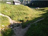 10
10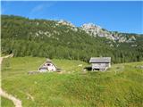 11
11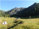 12
12 13
13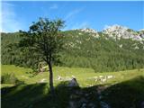 14
14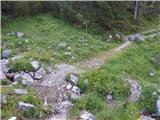 15
15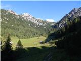 16
16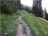 17
17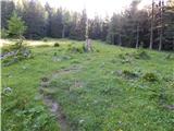 18
18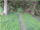 19
19 20
20 21
21 22
22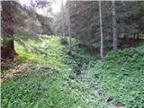 23
23 24
24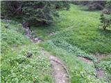 25
25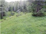 26
26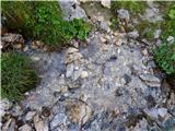 27
27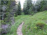 28
28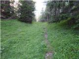 29
29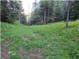 30
30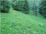 31
31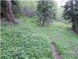 32
32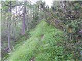 33
33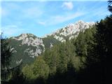 34
34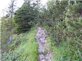 35
35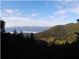 36
36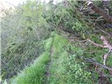 37
37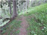 38
38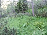 39
39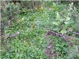 40
40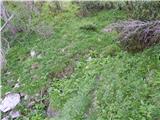 41
41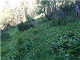 42
42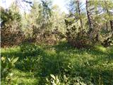 43
43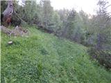 44
44 45
45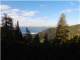 46
46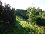 47
47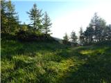 48
48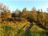 49
49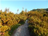 50
50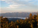 51
51 52
52 53
53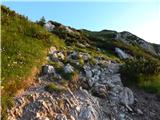 54
54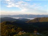 55
55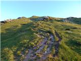 56
56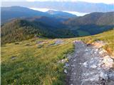 57
57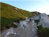 58
58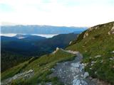 59
59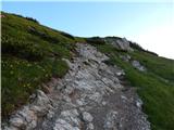 60
60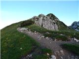 61
61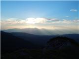 62
62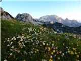 63
63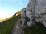 64
64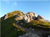 65
65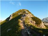 66
66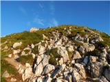 67
67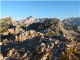 68
68 69
69
Discussion about the trail End of road on Pokljuka - Viševnik (via Gola Ravan)
|
| Ajgor200127. 02. 2019 |
Oj, a je bil kdo v kratkem na visevniku. Zanima me kako je za hoditi sneg led itd. Hvala.
|
|
|