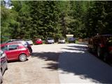
Starting point: Etrachsee (1368 m)
| Lat/Lon: | 47,2226°N 13,977°E |
| |
Time of walking: 3 h 15 min
Difficulty: easy marked way
Altitude difference: 1056 m
Altitude difference po putu: 1056 m
Map:
Recommended equipment (summer):
Recommended equipment (winter): ice axe, crampons
Views: 3.510
 | 1 person likes this post |
Access to the starting point:
From the motorway Beljak / Villach - Salzburg take the St. Michael exit and follow the road until Tamsweg, where you turn left towards Sauerfeld. Follow this road to the village of Seebach (you can also reach it from Murau), where signs for Krakaudorf direct you to the left. Continue following the signs towards Lake Etrachsee, in front of which you park in the parking lot. The road is closed in winter.
Path description:
From the parking lot at Etrachsee, continue along the road towards the Bauleiteck summit and the Rudolf Schober Hütte. The way forward takes you past the lake mentioned above, behind which you reach a couple of private huts. Continue along the road, which after a few minutes' walk leads to a marked crossroads. Continue right up the cart track, which begins to climb steeply. After a short climb, the path leads back to the road, which you follow to the next crossroads. Here you have two options for continuing: you can climb up to the hut either by road (straight ahead) or by a pleasant footpath that turns left. If you choose the 5 minute shorter walk, continue left and then after a few steps right along the stream uphill. A beautiful path leads through pastures and, higher up, crosses the stream via a number of small bridges. The path, which has since turned into a forest, climbs steeply and leads us within a few minutes to the mountain home.
From home, we continue in the direction of Bauleiteck along the path, which climbs slightly and quickly leads us to the next crossroads on the path. Here, continue slightly to the left and follow the increasingly steep path, which climbs through increasingly sparse, mostly coniferous forest, to the next crossroads, where you continue to the right (to the left of the Wildenkarsee).
The path ahead finally leaves the forest and the lower Wildenkarsee lake is seen on the left below. Here the steepness eases briefly and the path turns right under steep slopes. The path to Bauleiteck climbs straight up the slope. After 15 minutes, the slope drops and the path leads to a grassy slope where it turns slightly left. After a further few minutes of walking the path passes to a scenic and not to steep ridge which is then climbed. The summit, now clearly visible on the left, is reached after about 30 minutes of moderate cross-climbing along and along the top ridge of the mountain.

Pictures:
 1
1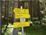 2
2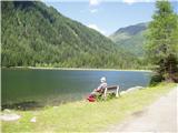 3
3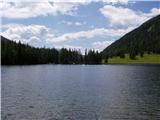 4
4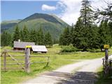 5
5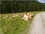 6
6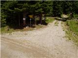 7
7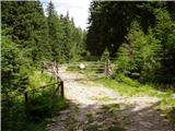 8
8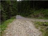 9
9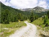 10
10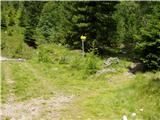 11
11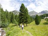 12
12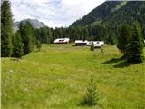 13
13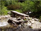 14
14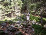 15
15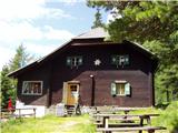 16
16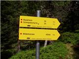 17
17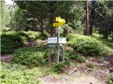 18
18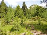 19
19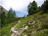 20
20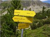 21
21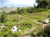 22
22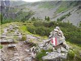 23
23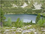 24
24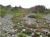 25
25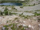 26
26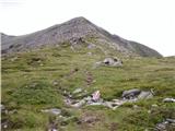 27
27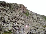 28
28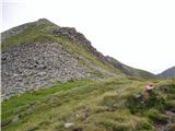 29
29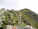 30
30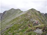 31
31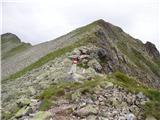 32
32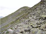 33
33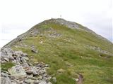 34
34 35
35
Discussion about the trail Etrachsee - Bauleiteck