Gozd Martuljek - Bivak pod Špikom (direct way)
Starting point: Gozd Martuljek (750 m)
| Lat/Lon: | 46,4821°N 13,8378°E |
| |
Name of path: direct way
Time of walking: 2 h
Difficulty: easy marked way
Altitude difference: 674 m
Altitude difference po putu: 674 m
Map: Kranjska Gora 1:30.000
Recommended equipment (summer):
Recommended equipment (winter): ice axe, crampons
Views: 31.641
 | 1 person likes this post |
Access to the starting point:
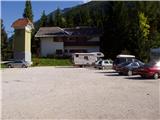
From Mojstrana drive to Kranjska Gora or vice versa, but only as far as the village of Gozd-Martuljek, where you park in the parking lot near the bridge over the Sava Dolinka river (the parking lot is located behind the bridge, or in front if you are coming from Kranjska Gora).
Path description:
From the parking lot, continue along the main road towards Kranjska Gora, but only to the point where the cycle path branches off to the left (there are also mountain signs at the start of the cycle path, which also direct you to the road). Follow the cycle path to the first crossroads, where you continue straight onto the dirt road (the cycle path turns right), which quickly leads you to the next crossroads.
Continue to the right and follow the road closed to traffic until you reach the TNP signpost. Further on, the path splits into two parts. Continue straight up the steep cart track, which climbs up the right-hand side of the Martuljška gorge. The cart track, which climbs mostly through the forest, leads us after 15 minutes to a beautiful viewpoint where a view of the valley opens up. The path then goes back into the forest and continues to climb. A little further on, the path from the waterfall joins us from the left, and a little further on, the path to the bivouac under Špikom branches off to the right.
Take this path, which initially climbs steeply along cart track. The wide path we are climbing then leads us past a rock with the inscription "pod Špik".
As the path approaches the torrent we come across an orientation lop. The path to the left leads to the torrent and then gets lost, we continue straight on past a small boulder on which there is a marker. After this, our path also approaches the torrent but does not cross it yet. It continues up the right-hand side and crosses it a little later. The crossing is not difficult, but the climb out of the torrent back to the path is a bit more difficult. This part is only three metres long, so it does not cause us any problems. The path continues gently climbing through the forest to the next torrent at which there is a boulder with a large marker. The way forward begins to climb steeply up a woded slope. In the middle of this climb we come across a small spring and a pleasant bench a little further on. Further on, the forest becomes more and more sparse and the path leads us to the unpaved slopes below Špik, where we encounter torrential layers of rocks. The path turns slightly right here and goes into the forest again. After a few minutes of walking up a moderate incline away from the torrential deposits, we reach the bivouac below Špik.

Pictures:
 1
1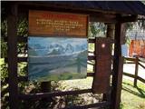 2
2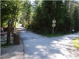 3
3 4
4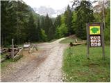 5
5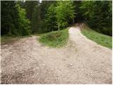 6
6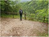 7
7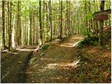 8
8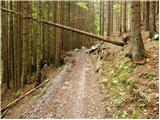 9
9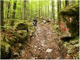 10
10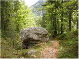 11
11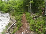 12
12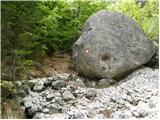 13
13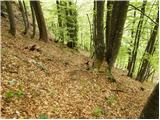 14
14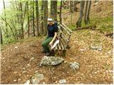 15
15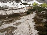 16
16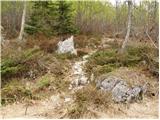 17
17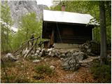 18
18
Discussion about the trail Gozd Martuljek - Bivak pod Špikom (direct way)
|
| JusAvgustin13. 10. 2010 |
danes za lep poldnevni izlet izbereva s kolegom krnico pod srcem, se vmes ustaviva na bivaku pod špikom, narediva krog pod stenami špika, frdamanih polic in rušice, se povzpneva do skalne zapore in se vrneva po poti skozi sotesko na izhodišče. prekrasne barve in razgledi, bolj kot sva se dvigala bolj se je "delala šajba"
Lpp
|
|
|
|
| JusAvgustin5. 11. 2011 |
danes na tak turoben dan odpeljem nežnejši del PN v "moj Martul`k"  To je res oaza miru in sprostitve, pa čeprav bi ošpičene prekle padale dol. Naredimo krog od stare poti na KV in skoraj do bivaka pod srcem, ustavimo se pr` Ingotu. Srečali nismo nikogar samo dežni pršec nam je hladil obraz.
|
|
|
|
| aaja5. 11. 2011 |
OJ Mene pa zanima če bi bla ta pot primerna zame,a je kje kaj za poplezat?  ? lp Aja
|
|
|
|
| JusAvgustin5. 11. 2011 |
primerna je tudi za mamice z vozički  , seveda je primerna. Predvsem je pa lepota krnice Pod Srcem above all
|
|
|
|
| aaja5. 11. 2011 |
Hvala
|
|
|
|
| J.P.2. 01. 2020 |
Zimska oprema potrebna pri vrhu oziroma zadnjih 50-100m visinskih zaradi pomrznjenega snega. Okrog bivaka pa sama belina in krasen amfiteater s Špikom na čelu :-) Varen korak. Lp
|
|
|
|
| Majdag13. 07. 2023 08:23:30 |
10.7. ...Pot z leti postaja vedno bolj strma, toda biti tako blizu Špika in ostalim vrhovom je lepo. Nadaljevali sva do izvira Mrzle vode- Mahovja, ki ga kmalu ne bo več. Povsod podrto drevje. Zgornji M. slap je bil tisti dan zaprt, obiskovalcev pa veliko. Spodnji M. slap je normalno prehoden in potepanja je bilo konec. Lepo! https://jelenkamenmajdag.blogspot.com/2023/07/pod-spik-krnica-pod-srcem.html
|
|
|
|
| natasacraine3. 09. 2023 17:47:46 |
Pot do nadaljnega zaprta. Vse podrto.
|
|
|