Gozdec - Visoki Kanin (via Dom Petra skalarja na Kaninu)
Starting point: Gozdec (1075 m)
| Lat/Lon: | 46,3385°N 13,4939°E |
| |
Name of path: via Dom Petra skalarja na Kaninu
Time of walking: 6 h 50 min
Difficulty: very difficult marked way
Altitude difference: 1512 m
Altitude difference po putu: 1850 m
Map: Julijske Alpe - zahodni del 1:50.000
Recommended equipment (summer): helmet
Recommended equipment (winter): helmet, ice axe, crampons
Views: 3.286
 | 1 person likes this post |
Access to the starting point:
Drive into the centre of Bovec, where from the crossroads by the main square continue along the ascending road, which starts to climb past the post office towards the nearby church. Go around the church on the left and then arrive in Kaninsko vas. Bovec then ends, and the road continues westwards for some time. At a small fork, leave the main asphalt road leading to the village Plužna and continue along the road slightly to the right (after the crossroads marked for the Gozdec road). After the nearby homestead, the road splits again, and this time we take the road slightly to the left (slightly to the right Zavrzelno and the starting point of the route to Rombon). We continue to climb on the macadam road, which leads us higher up to the B station of the cable car to Kanin. At the B station, the road turns sharp left, and then, after about 1 km of further driving, a cross-country climb brings us to the next crossroads. From this junction, continue to the left or straight on (sharp right mountain pasture Cirque), and follow the road from the junction for a short distance. We soon see signs for Kanin along the road, and we park about 20 metres further on, in a small parking lot by the road.
From the Square of the Pigeon Victims, it is about 9 km to the starting point.
Path description:
From the starting point, go back a few steps and then follow the marked path towards Visoki Kanin and Vrha Laška planje. The trail immediately begins to climb steeply, and mostly leads us through a dense forest, only occasionally opening up some views of the surrounding area. During the ascent, the path leads us under the cliffs of Turno v Skednju (1555 m). When the cliffs end we arrive at an unmarked crossroads where we continue slightly right along the marked path (slightly left unmarked path leading to Veliki Babanski Skedenj 2121 m), which soon climbs steeply over a short steep slope, where there is a greater risk of slipping, especially in the wet. The steepness soon eases and you reach the abandoned mountain pasture Gozdec, which you pass on the right.
We continue to climb through increasingly sparse forest, so that the path opens up some views towards the Bovška basin and the Krn mountains. A fairly steady climb follows, and we, while looking at the walls of the Great Barn, arrive at a small spring located to the right of the path. The trail is also covered with grass, which can be quite wet in the mornings and after the rain. After a while the path turns more to the west and gradually becomes less steep. After a few minutes of scenic ascent, you reach the ruins of the old hut of Peter Skalar, which burnt down in 1972.
Go around the hut on the left and then climb gently to moderately for some time on a more grassy terrain. The path then turns more to the south, so that you get the feeling that you are going in the wrong direction. There is a steeper climb, and the path turns slowly to the right, so that we are walking mainly westwards. A few minutes of easy walking follows and you arrive at a marked crossroads, where you continue downhill to the right in the direction of Dom Petra Skalarja na Kaninu (straight ahead Visoki Kanin and Vrh Laška planje).
After a short descent, the trail lays down and then crosses the area of high-lying plateau. The ascent follows through the high mountain landscape of the Kaninsko Podovi, where there is no trail for the most part, but the markings are quite frequent, so there are no problems with orientation in good weather, but it is of course quite different in fog. The path ahead leads through scree and between potholes, caves and crevasses, so caution is not superfluous, and in wet weather the smooth slabs can be quite slippery. We continue for some time cross-climbing the slopes of Velika Gnila glava (2114 m), and the trail leads us to the next marked crossroads at this point.
Continue slightly to the right (to the left to return to the path towards the top of Laška Planje) and continue to follow the worse path and markings. Follow this trail, which offers a really nice view of the Kanin massif, all the way to Dom Petra Skalarja na Kaninu, from where a nice view to the east opens up.
Go around the lodge on the right, and at the crossroads take the left path towards Visoki Kanin (slightly to the right, D station of the cable car to Kanin). Quickly climb up to the nearby bivouac, which you go around on the left, and then continue in a north-westerly direction, following the signs to the north-west. The path, which also descends a little here and there, leads us mostly along an undistinguished ridge, and we soon reach the Vrh Osojnic (2348 m). Here the ridge narrows a little, and we continue to follow the marked path. When we reach the next, slightly more distinct peak with a mogic, we are at Vrh Osojnic (2371 m).
From the viewpoint we continue northwards, slowly descending the ridge. Continue along the ridge for a few minutes and then reach the slopes of Hudé Vršič, where you join the trail from Station D.
Continue left in the direction Visoki Kanin (right Prestreljeniško okno and D station), where the trail leads you along the scree of Hudega Vršič, and later on along the scree of Peči and Srednji Vršič, where it starts to climb more steeply. A fairly steep climb up the rocky terrain follows, and then we reach the scenic border ridge, from where we have a beautiful view of Jôf di Montasio, Viš and the neighbouring peaks. The route continues along the occasionally exposed ridge, where the path leads westwards, with some fixed safety gear to help us in the more difficult places.
A short descent follows, where with the help of fixed safety gear we reach Kaninska škrbina, from which we climb back to the ridge. A little further on, the ferrata Julija joins us from the right, and we follow the increasingly scenic ridge path to Visoki Kanin, a few minutes away, which offers a fine view to the west.
Starting point - mountain pasture Gozdec 0:50, mountain pasture Gozdec - Stara koča 1:20, Stara koča - Dom Petra Skalarja 2:05, Dom Petra Skalarja - Vrh Osojnic 0:25, Vrh Osojnic - Visoki Kanin 2:10.

We can extend the trip to the following destinations: Mali Kanin
Pictures:
 1
1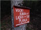 2
2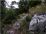 3
3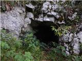 4
4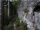 5
5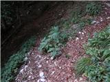 6
6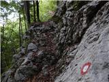 7
7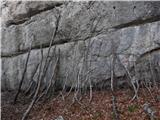 8
8 9
9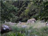 10
10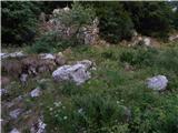 11
11 12
12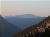 13
13 14
14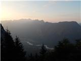 15
15 16
16 17
17 18
18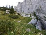 19
19 20
20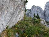 21
21 22
22 23
23 24
24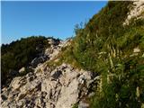 25
25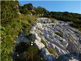 26
26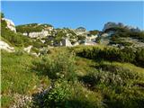 27
27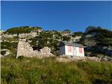 28
28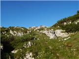 29
29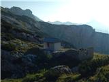 30
30 31
31 32
32 33
33 34
34 35
35 36
36 37
37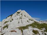 38
38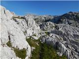 39
39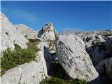 40
40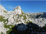 41
41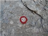 42
42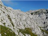 43
43 44
44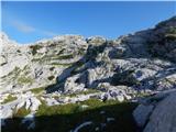 45
45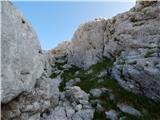 46
46 47
47 48
48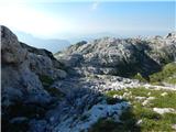 49
49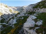 50
50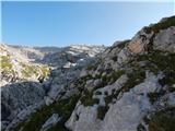 51
51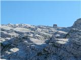 52
52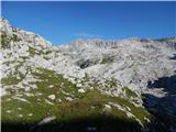 53
53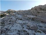 54
54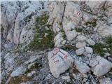 55
55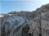 56
56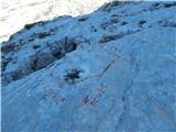 57
57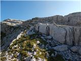 58
58 59
59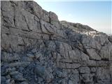 60
60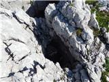 61
61 62
62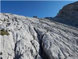 63
63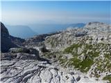 64
64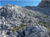 65
65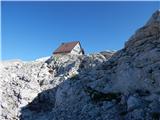 66
66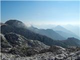 67
67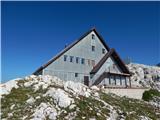 68
68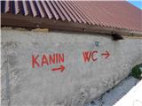 69
69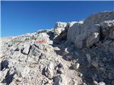 70
70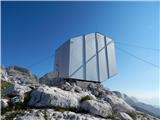 71
71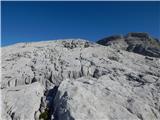 72
72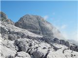 73
73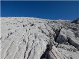 74
74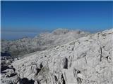 75
75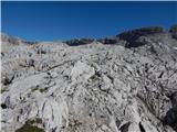 76
76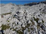 77
77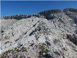 78
78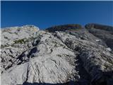 79
79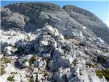 80
80 81
81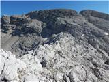 82
82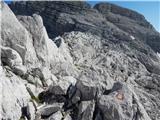 83
83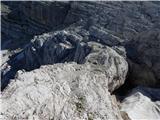 84
84 85
85 86
86 87
87 88
88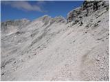 89
89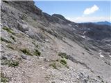 90
90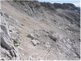 91
91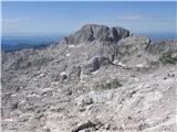 92
92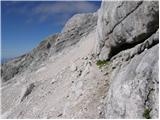 93
93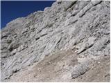 94
94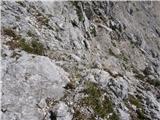 95
95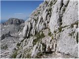 96
96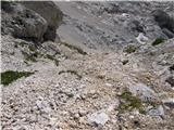 97
97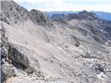 98
98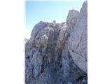 99
99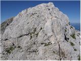 100
100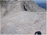 101
101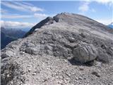 102
102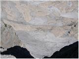 103
103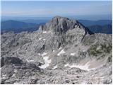 104
104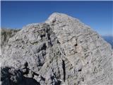 105
105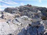 106
106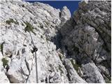 107
107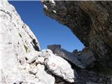 108
108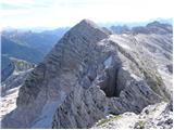 109
109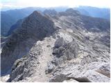 110
110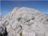 111
111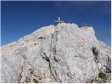 112
112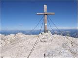 113
113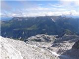 114
114
Discussion about the trail Gozdec - Visoki Kanin (via Dom Petra skalarja na Kaninu)