Izlake - Črni vrh (Čemšeniška planina) (via Razbor pri Čemšeniku)
Starting point: Izlake (307 m)
| Lat/Lon: | 46,1582°N 14,9242°E |
| |
Name of path: via Razbor pri Čemšeniku
Time of walking: 3 h 10 min
Difficulty: easy marked way, easy unmarked way
Altitude difference: 897 m
Altitude difference po putu: 900 m
Map: Posavsko hribovje - zahodni del 1:50.000
Recommended equipment (summer):
Recommended equipment (winter): ice axe, crampons
Views: 776
 | 1 person likes this post |
Access to the starting point:
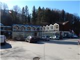
a) Exit the Styria motorway at exit Trojane, then follow the signs for Izlake and Zagorje. There is a downhill and then you arrive in the valley of the Orehovica stream. Continue along the valley and when you reach Izlake, just a few metres after the road sign marking the beginning of the village, turn right and park in the parking lot next to the former Medijske toplice, today only the Bar And Lounge Carpe Diem is open.
b) Take Moravče and then follow the road to Izlake. When you reach the main road Zagorje ob Savi - Izlake, turn left towards Izlake, and before the end of Izlake, turn left into the parking lot in front of the former Media Spa.
c) From the road Litija - Hrastnik, take the road Zagorje ob Savi, then follow the signs for Izlake. When you arrive in Izlake, drive through the village on the main road, and before the end of the village, turn left and park in the parking lot next to the former Medija Spa.
Path description:
From the parking lot at the former Medijske toplice, continue towards the Izlake centre, then cross the main road at the pedestrian crossing and continue along the road that branches off the main road at the Tuš market Ajda.
Continue in the direction of Čemšeniška mountain pasture and continue along the asphalt road, which ascends gently, first passing houses and then several meadows and individual houses. The gently sloping road that leads us along the Lesje brook leads us after a while to a crossroads where the road branches off to the left towards a part of the hamlet of Brde, and we continue straight on and continue to walk along the valley of the Lesje brook. A little further on, the marked footpath to Čemšeniška mountain pasture branches off to the left, and we continue straight ahead and continue walking along the road, along which there are no more markings. A slightly steeper climb follows, and the road leads us out of the forest in a few serpentines and a little further on to a marked crossroads.
From the crossroads, continue to the right in the direction of Zagorje (Čemšenik on the left), then climb crosswise to the crossroads by the chapel, where you join the marked path from Zagorje and Kisovec.
Continue left in the direction of Čemšeniška mountain pasture and continue walking along the narrow macadam road, which leads past a few houses to an asphalt road, which you follow up to the left.
Continue past the bottom station of the cargo cableway leading to Dom na Čemšeniška mountain pasture (there is also a parking lot next to the cargo cableway, if you park here you will shorten your journey by about an hour and a half), and after the bottom station the road turns slightly to the left, and before the beginning of the Razbor pri Čemšeniku settlement we leave it and continue slightly to the right to cart track. From cart track go right again, climbing up a grassy slope with a view to the "last" house.
Go around the last house on the right and then start climbing steeply through the forest. The steep path leads us to the edge of the cliffs, which offer a beautiful view of the surrounding area and the nearby hills, and when the path becomes a bit steeper, we arrive at a marked crossroads.
From the crossroads go left (right St. Primož and Felicijan Church 5-10 minutes) and then, after a few minutes of cross-country climbing, ascend to the macadam road, which you follow to the left, and walk along it only until it climbs, then go slightly right to cart track. Also from cart track go right shortly, then join the path from Izlake through Čemšenik, where go right again.
Continue in the direction of Čemšeniška mountain pasture and climb quite steeply across. The cross-climb ends when the ridge of Čemšeniška mountain pasture is reached, and at the above-mentioned point the path from Trojane or Prvin joins.
Continue to the right and continue the ascent along the folded macadam road, which you leave a little higher up and continue slightly to the right on the marked footpath, which leads us along the beautiful views of Zasavje and Posavsko hribovje with the highest Kum, and in the distance you can also see Snežnik. A little further on, we cross the lane of the forest, and the path then lays down and crosses a steep grassy slope where, when it is icy, there is a high risk of slipping, but otherwise the path is wide and technically easy. Shortly before the mountain lodge, cross the route of the cargo cableway and then walk to the mountain lodge, enjoying the beautiful views.
From the mountain lodge, continue eastwards or along the path towards Krvavice. After the viewpoint, the path enters the forest and continues along the gently sloping ridge of Čemšeniška mountain pasture, and after a few minutes it splits. Take the path slightly right in the direction of Zajčeva koča (slightly left Vransko and Tabor) and continue to climb gently to moderately. At first you pass a hunting observation post, and then in a few minutes you climb up to a small pass where there is a registration box.
Shortly before the registration box, go left and within a minute of further walking climb to Črni vrh, which is the highest peak of Čemšeniška mountain pasture.
Izlake - Razbor pri Čemšeniku 1:30, Razbor pri Čemšeniku - Dom na Čemšeniška mountain pasture 1:25, Dom na Čemšeniška mountain pasture - Črni vrh 0:15.
Description and figures refer to the situation in 2019 (February).

Pictures:
 1
1 2
2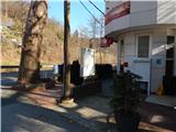 3
3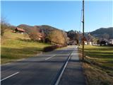 4
4 5
5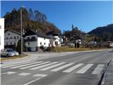 6
6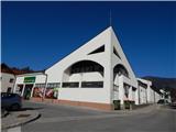 7
7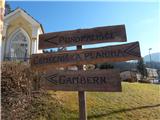 8
8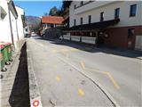 9
9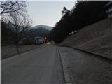 10
10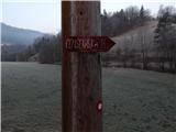 11
11 12
12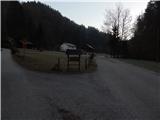 13
13 14
14 15
15 16
16 17
17 18
18 19
19 20
20 21
21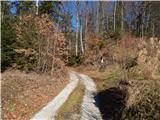 22
22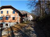 23
23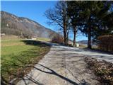 24
24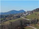 25
25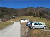 26
26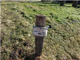 27
27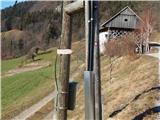 28
28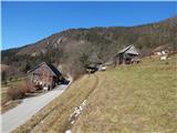 29
29 30
30 31
31 32
32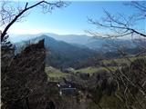 33
33 34
34 35
35 36
36 37
37 38
38 39
39 40
40 41
41 42
42 43
43 44
44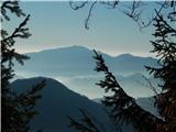 45
45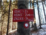 46
46 47
47 48
48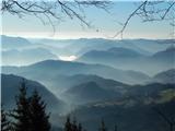 49
49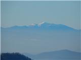 50
50 51
51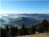 52
52 53
53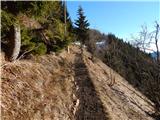 54
54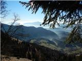 55
55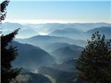 56
56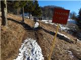 57
57 58
58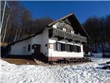 59
59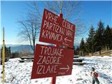 60
60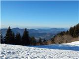 61
61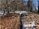 62
62 63
63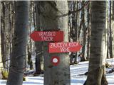 64
64 65
65 66
66 67
67 68
68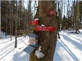 69
69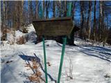 70
70 71
71
Discussion about the trail Izlake - Črni vrh (Čemšeniška planina) (via Razbor pri Čemšeniku)