Jereka - Vodnikov razglednik
Starting point: Jereka (619 m)
| Lat/Lon: | 46,2967°N 13,9618°E |
| |
Time of walking: 1 h 15 min
Difficulty: easy marked way
Altitude difference: 398 m
Altitude difference po putu: 400 m
Map: TNP 1:50.000
Recommended equipment (summer):
Recommended equipment (winter): crampons
Views: 9.220
 | 2 people like this post |
Access to the starting point:
a) From the motorway Ljubljana - Jesenica, take the exit Lesce and then continue to Bled and then Bohinj. After Bitnje, which the main road passes on the left, take a sharp right in the direction of Jereka and Pokljuka. The road then climbs steeply at first, and then gradually flattens out after Koriti, leading to a crossroads by the bus station, where you turn right in the direction of Pokljuka, Koprivnik and Jereka (straight ahead to Srednja vas). Just after the crossroads we arrive at Jereka, and from the crossroads in front of the church we continue straight towards Pokljuka (left Podjelje). We pass through the village, passing a few more houses, and then we arrive at the bridge over the Jerečice River, where the footpath described above begins. There are no parking spaces at the starting point.
b) From Železniki or Podbrdo, take the road to Bohinjska Bistrica and then continue in the direction of Bled. Shortly after the Petrol station, which is located just after Bohinjska Bistrica, turn left in the direction of Pokljuka and Jereka. The road climbs steeply at first, then gradually flattens out after Koriti, leading to a junction by the bus station, where you continue right in the direction of Pokljuka, Koprivnik and Jereka (straight ahead Srednja vas). Just after the crossroads we arrive at Jereka, and from the crossroads in front of the church we continue straight towards Pokljuka (left Podjelje). We pass through the village, passing a few more houses, and then we arrive at the bridge over the Jerecica River, where the footpath described above begins. There are no parking spaces at the starting point.
Path description:
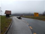
After the bridge over the Jerečice we see the first signs for Vodnikov razglednik, which direct us to the left, on a path that quickly climbs to the next houses, where we cross two consecutive asphalt roads. The path continues along an old cobbled path dating from the 18th century and initially follows a small stream. The path through the woods soon turns slightly to the right and then crosses the tarmac road a few more times. Higher up, when the asphalt road is reached again, walk along the road towards Vogar and Krnišké Lom for a short distance, and the signs for Vodnikov razglednik quickly direct you to the right onto the old cobbled path, which you follow in the direction of the signs at the crossroads. When the path is laid and leads us to the edge of the forest, we join the path with Koprivnik on our left, and we continue to the right, back into the forest. A few minutes of slightly steeper trail follows and the path, aided by a wooden fence, quickly leads us to a scenic peak with a slightly larger cross.
Description and pictures refer to 2016 (January).

Pictures:
 1
1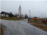 2
2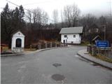 3
3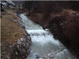 4
4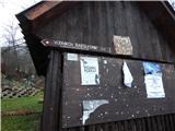 5
5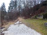 6
6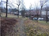 7
7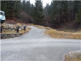 8
8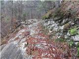 9
9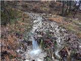 10
10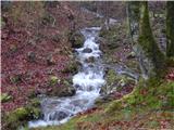 11
11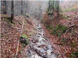 12
12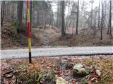 13
13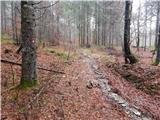 14
14 15
15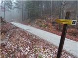 16
16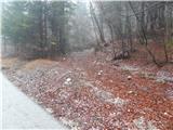 17
17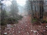 18
18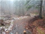 19
19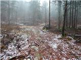 20
20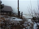 21
21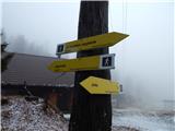 22
22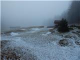 23
23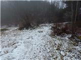 24
24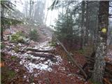 25
25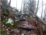 26
26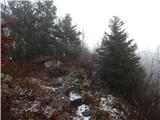 27
27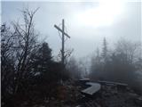 28
28 29
29
Discussion about the trail Jereka - Vodnikov razglednik
|
| J.P.14. 07. 2020 |
Začetek pešpoti je trenutno poraščen ter se ga nekoliko težje "napikira". Parkirate pa lahko na prvem ostrem ovinku za mostom. Prostor je za cca dva avta. Drugače lep krajši izlet z razgledom na ledeniško dolino. Lp
|
|
|
|
| exwannabe25. 04. 2021 17:16:59 |
Pot je zelo lepo urejena in dobro markirana, saj po poti poteka tudi pot Julijana. Začetka poti sploh ni težko najti, saj gre pot takoj za mostom levo navzgor (gledano v smeri Pokljuke). Je pa res, da na izhodišču ni parkirnega prostora, tako da ne vem kam z avtom v takem primeru sam sem bil na srečo na dveh kolesih. Za tako prevozno sredstvo pa je za mostom dovolj "parkirišč". 
|
|
|