Jermanca - Turska gora (via Kamniško sedlo)
Starting point: Jermanca (900 m)
| Lat/Lon: | 46,3349°N 14,5848°E |
| |
Name of path: via Kamniško sedlo
Time of walking: 4 h 45 min
Difficulty: very difficult marked way
Altitude difference: 1351 m
Altitude difference po putu: 1450 m
Map: Kamniške in Savinjske Alpe 1:50.000
Recommended equipment (summer): helmet, self belay set
Recommended equipment (winter): helmet, self belay set, ice axe, crampons
Views: 52.106
 | 3 people like this post |
Access to the starting point:
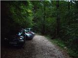
Drive into Kamnik and follow the road towards the Kamnik Bistrica valley. From your home in Kamniška Bistrica, continue along the forest road, which leads you higher up to a crossroads where you turn right towards Jermanca (the straight starting point for Kokrsko sedlo). Follow this occasionally slightly steeper road to the parking lot, which is located just before the end of the road.
After the new road sign, driving is forbidden from the Kamniški Bistrica hut to Jermanca, which extends the journey by a good hour.
Path description:
From the parking lot, continue along the road along which you parked. The road runs out after a few minutes, and we continue along the footpath without any major ascents or descents. The path, which crosses a large number of ravines, then joins the path from Kamniška Bistrica (lower starting point). Here we should be careful when descending to follow the path we came on. The well-marked and relatively steep path, which climbs through the forest for some time, leads us higher up to a pleasant little spring (which dries up in dry periods). From the little spring there is a short climb and the path leads us to the well-known resting place Pri Pastirjih, where there is an emergency bivouac.
Continue straight along the marked path, which then quickly passes out of the forest onto a vast meadow. Beyond the meadow, the path goes into lane of dwarf pines, where it starts to climb steeply again. The path, which continues along the increasingly scenic steep slope, leads us after a good hour's walk from Pastirjev to the mountain hut at Kamnišek sedlo.
From the hut at Kamnik saddle, continue left in the direction of Brana along the path which leads us across the meadows to a crossroads, where we continue slightly left (right down Okrešelj). The path which continues to climb up the increasingly rocky slope quickly leads us to a scree slope, which is dangerous in the snow for slipping. The scree is crossed in a slight cross-climb, and then the path leads to the next crossroads.
The path to Brana leads up to the left, and we continue slightly to the right, continuing our ascent and crossing the slopes to the west. From the scree slope, the path briefly leads to a grassy slope, and then the path becomes more difficult. Here we descend left down a well-protected unmarked gully, which leads us into a slightly thickened ravine. This is followed by a traverse of steep slopes to the west, which leads to the Kotliči notch (1949m).
From the notch, descend to the south side of the ridge using the rope ladders. This is followed by a shorter, slightly steeper descent and then the path begins to climb again on the slightly crumbly slope above Kotliškim grabno. With the help of some fixed safety gear, you then reach the ridge again where you continue to the left. The path continues along the ridge for a short distance, then turns right and crosses an exposed slope protected by wedges past a memorial plaque. The path then becomes a shade less steep and climbs up the slope from which a beautiful view opens up towards Mrzla Gora. Later the path turns left again and crosses a very steep slope. The path then turns to the right and is followed by a climb along a slightly crumbly gully, which leads us under a depression called the Bottomless Barrel.
A slightly more difficult climb through the tunnel follows, where you climb almost vertically for a few metres using ropes. Above the bulge, you then walk for a while on a relatively wide and scenic ridge, and then start to descend a bit steeper with the help of some fixed safety gear. There is a very short vertical descent on scrambles which leads to a narrow notch. From the notch, continue down to the left, then the path turns to the right and climbs up a gully with the help of a few wedges, which brings us above the narrow notch already mentioned. Above the stubble, continue to the left and the path leads us further along a slightly less difficult slope, which is partly covered with grass. The slope becomes rocky again and the climb up to the top of Turska gora follows the scenic eastern slope of the mountain. When you reach the top, a beautiful view opens up to the west where you can see Grintovec, Skuta and Rinke.
Jermanca - Pri Pastirjih 1:15, Pri Pastirjih - Kamniška koča 1:15, Kamniška koča - Turska gora 2:15.

We can extend the trip to the following destinations: Brana
Pictures:
 1
1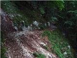 2
2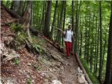 3
3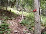 4
4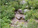 5
5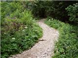 6
6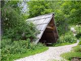 7
7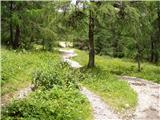 8
8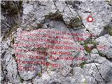 9
9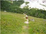 10
10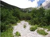 11
11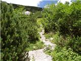 12
12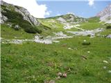 13
13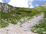 14
14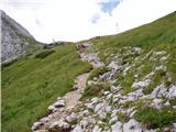 15
15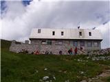 16
16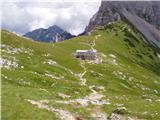 17
17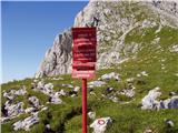 18
18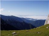 19
19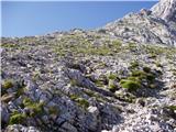 20
20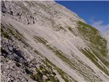 21
21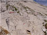 22
22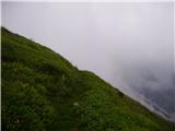 23
23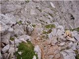 24
24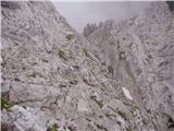 25
25 26
26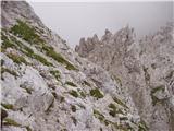 27
27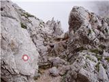 28
28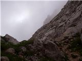 29
29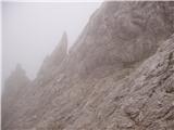 30
30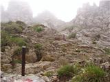 31
31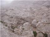 32
32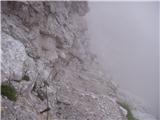 33
33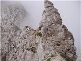 34
34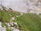 35
35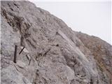 36
36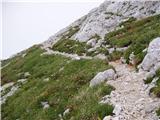 37
37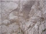 38
38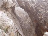 39
39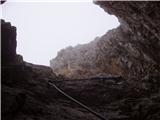 40
40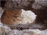 41
41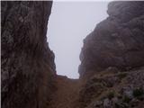 42
42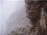 43
43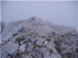 44
44
Discussion about the trail Jermanca - Turska gora (via Kamniško sedlo)
|
| Guest25. 06. 2007 |
Brane V. Zahtevna tura,za ljubitelje jeklenic.Pozor, res zelo krušjivo.Žal je pihal neprijeten veter.
|
|
|
|
| SuperNejc20. 08. 2007 |
Kakšnen pa je vzpon na Tursko goro z Logarske strani? Torej mimo Okrešlja in skozi Turski žleb? Se priporočam za odgovor in lepo pozdravljam.
|
|
|
|
| Guest7. 10. 2007 |
Skozi Turski žleb je kar lušna pot
|
|
|
|
| Guest5. 02. 2008 |
Osebno sem za pot iz K. Sedla. Skozi Turski žleb je neprijeten sestop - visiš na razrahljanih jeklenicah. Zelo priporočljivo samovarovanje.
lp. Franci
|
|
|
|
| jlogar17. 06. 2010 |
Zanima me kakšne so razmere na poti na Tursko goro čez Kamniško sedlo. Je še veliko snega.
|
|
|
|
| rajerfss18. 06. 2010 |
v soboto sem šel na tursko goro, pa sem se moral obrniti ker je bilo v grapi imenovani kotliči še veliko snežišče, ki ga nisem mogel prečiti brez derez in brez cepina,tako da sem šel samo na brano kjer pa si nisem mogel pritisniti štampiljke ker je blazinica čisto suha. morda se je stanje v teh dneh že izboljšalo,presodi sam. lp.
|
|
|
|
| starakapa18. 06. 2010 |
Jaz pa VEDNO nosim s seboj blazinico pa še lahka je.
|
|
|
|
| jlogar18. 06. 2010 |
Hvala za konkreten odgovor! Bom počakal še malo ali pa vzel zimsko opremo. Vsem srečno planinarenje 2010.....
|
|
|
|
| jlogar6. 07. 2010 |
No malo sem počakal, Konec tedna bi šel na Tursko goro. Koliko je še snega se da priti gor brez zimske opreme
|
|
|
|
| Marky29. 07. 2011 |
Kakšne so kaj razmere za na Tursko goro? Razmišljam, da bi šel jutri malo gor pogledat.. aja, pa slišal sem, da so bila zajle potrgane. So že nameščene nove ali kako je s tem? Hvala..
|
|
|
|
| mala planina17. 10. 2011 |
Razmere so dobre pot ja lepo označena ter zavarovana. tudi zajle so uredu! ZELO LEPA TURA 
|
|
|
|
| pohodnik381. 08. 2012 |
Tole pot sva s prijateljco prehodila v soboto 28.7. zelo zahtevno ampak lepo,pot je v dobrem stanju,lepi razgledi,ljudi veliko vreme pa je tudi fajn služilo  pa še nekaj SLIK
|
|
|
|
| stropci27. 08. 2012 |
Oj mene pa zanima če se da na tursko goro pridit tudi brez samovarovalnega kompleta ? kak nasvet ? al je nujno? hvala 
|
|
|
|
| dprapr27. 08. 2012 |
Turska gora je bila precej obiskana poleti in pozimi, ko še ni bilo "duha ne sluha" o SVK!
Se da!
|
|
|
|
| pohodnik3827. 08. 2012 |
@stropci če boš šel iz Kam.Bistrice gor čez Žmavcarje ga 100% ne boš potreboval
|
|
|
|
| smatjaz17. 08. 2013 |
Sem šel včeraj čez Kotliče dol (veliko težje kot gor), zelo krušljivo, v primeru večjega obiska velika možnost padajočega kamenja (čelada obvezna), varovalni komplet pa zelo priporočljiv, še posebej pri sestopu (sem generacija srednjih let). 
|
|
|
|
| klavdipo7. 08. 2014 |
Ali je čez Kotliče še kakšno snežišče?
|
|
|
|
| BananaBronson1. 10. 2018 |
Pot čez Kamniško sedlo in Kotliče je brez posebnosti. Še najbolj problematična je cesta, ki je komaj še prevozna. Tule pa je kratko poročilo.
|
|
|
|
| trdi10. 10. 2018 |
Super pot, lepo varovana, gor in dol se mi zdi podobno težavna, saj se v vsakem primeru spuščaš po zajlah do Kotličev. Smatjaz me je prestrašil, pa sem vzel SVK, vendar ni bilo nobene potrebe po uporabi. Ni pretirano izpostavljeno, še najbolj kritičnih je par klinov pred sodom brez dna. Priporočam. Zame ena lepših poti v KSA.
|
|
|
|
| Turbolazec24. 05. 2020 |
Je po tej poti se kaj snega? Hvala
|
|
|
|
| arko easy19. 06. 2020 |
je na poti še kaj snega? zajle so kopne?
|
|
|
|
| green23. 06. 2021 18:26:48 |
Kakšne so razmere na tej poti(sneg, varovala)?
|
|
|