Kaisigen - Dachsteinblick
Starting point: Kaisigen (630 m)
Time of walking: 2 h 45 min
Difficulty: partly demanding marked way
Altitude difference: 929 m
Altitude difference po putu: 929 m
Map:
Recommended equipment (summer):
Recommended equipment (winter): ice axe, crampons
Views: 665
 | 1 person likes this post |
Access to the starting point:
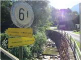
Drive through the Karavanke Tunnel into Austria and continue along the Turkish Autobahn past Salzburg. Leave the motorway at the exit for Mondsee, which is bypassed along the east coast. Continue towards Attersee, where you immediately turn right and follow the road along the southern and then the eastern shore of the lake to the point of Steinbach. Turn right towards Kaisigen/Traunsee and then follow the mountain signs for Hochleckenhaus (route number 822). Park in the parking lot.
Path description:
From the parking lot, continue on the dirt road (right up). Soon the signs for the Aubodenhütte hut direct you to the right onto a path that runs first gently and then quite steeply along the edge of the forest. The path then leads into the woods and soon reaches a dirt road, the Valerieweg, which is followed to the left to the next signpost, where you follow the signs for Aubodenhütte and the mountain pasture Geißalm. Shortly after the hut, take the mountain path 822 - Stieg. As you approach the steep slope on the dirt track, it turns into a track, which is adequately protected in exposed places. When you reach the plateau, follow the signs for Dachsteinblick (mountain path 820). Follow the path, which then runs more gently through the pine trees, until you reach the next signpost, where you continue in the direction of Weißenbach. Soon you will see a cross at the top of the Dachsteinblick. The path follows a ridge with increasingly beautiful views on all sides.
You can continue along the ridge to Mahdlgupf (1261 m) and Schoberstein (1037 m).
The whole route is very well marked.

Pictures:
 1
1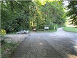 2
2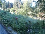 3
3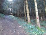 4
4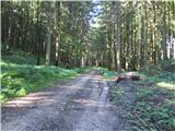 5
5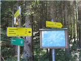 6
6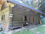 7
7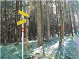 8
8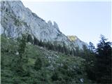 9
9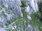 10
10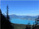 11
11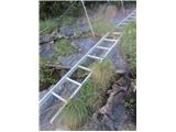 12
12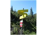 13
13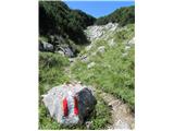 14
14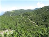 15
15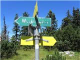 16
16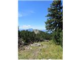 17
17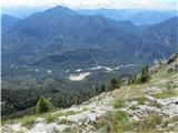 18
18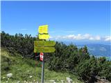 19
19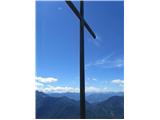 20
20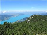 21
21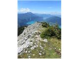 22
22 23
23
Discussion about the trail Kaisigen - Dachsteinblick