Klemenčevo - Kamniški vrh (by Korošaki waterfalls)
Starting point: Klemenčevo (600 m)
| Lat/Lon: | 46,2739°N 14,5709°E |
| |
Name of path: by Korošaki waterfalls
Time of walking: 2 h 15 min
Difficulty: easy unmarked way
Altitude difference: 659 m
Altitude difference po putu: 700 m
Map: Kamniške in Savinjske Alpe 1:50.000
Recommended equipment (summer):
Recommended equipment (winter): ice axe, crampons
Views: 45.044
 | 2 people like this post |
Access to the starting point:
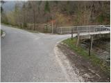
From Kamnik we drive towards Stahovica. Just after the village Godič, turn left onto the road towards Županjih njiv. At the next crossroads, turn left towards Bistričica and follow the road to the village of Klemenčevo, where you turn right over a small bridge and then park in a small parking lot. In front of the bridge there are signs for Kamniški vrh and mountain pasture Osredek.
Path description:
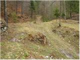
From the parking lot, continue along the main road, which climbs steeply up the left side of the stream (right bank). After a few minutes' walking, the path leads us to a bus turnaround point, behind which we see the mountain signs for Ambrož pod Krvavcem. Just a little further on, the road leads us to a small crossroads, where we continue to the right across the bridge. After the bridge, we reach the houses, at which we leave the marked path towards Krvavec. Continue to the right along the cart track, which climbs over a meadow. Cart track, which is getting worse, takes us higher up between two trestles and then leads us to a small confluence at the ruins of an old house. The way forward leads us along the right-hand side of the ruins and then over a wire fence to a stream by which we then climb. The path continues along the stream, crossing it several times. At the point where the path leaves the gorge to the right, we see the 1st waterfall, which is only a minute's walk downstream. Given the low water level, it does not deserve to be called the 1st waterfall.
The path which follows the gorge to the right, after a short climb, leads to the next waterfall, which dries up completely in dry periods. The path which climbs steeper, however, quickly leads us to a small pass, where we reach the next crossroads. To the left, first slightly downwards and then upwards, a path branches off to the next waterfall. After a five-minute walk, you reach the bottom one in the main chain of waterfalls. If you want to get to the top of the biggest one, you have to climb up the left side of the waterfall steeply (not suitable for the less experienced).
From the waterfalls, return to the crossroads and continue along the path, which climbs steeply up the less and less vegetated slope. The steep path ahead crosses some slightly exposed slopes which are dangerous to slip on when wet. The increasingly scenic path then leads us to a cross, at which we step onto a marked path. Continue left along the gently sloping path, which leads us in 5 minutes of further walking to mountain pasture Osredek.
From mountain pasture continue right in the route Kamniški vrh along the path which leads us in a moderate ascent through the forest to the next crossroads, where we turn right (left Krvavec). Continue along the northern slopes through the forest. After 30 minutes from mountain pasture the path leads to the saddle between Planjava and Kamniškim vrh. Here we have a view to the south. Continue left along the ridge path and reach the summit in a few minutes.

Pictures:
 1
1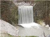 2
2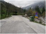 3
3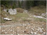 4
4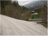 5
5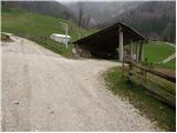 6
6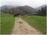 7
78
 9
9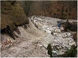 10
10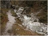 11
11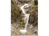 12
12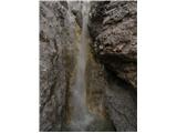 13
13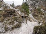 14
14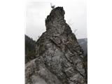 15
15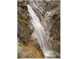 16
16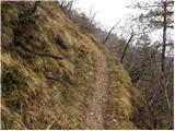 17
17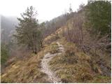 18
18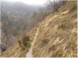 19
19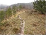 20
20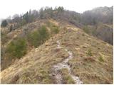 21
21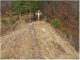 22
22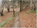 23
23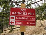 24
24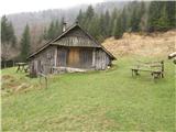 25
25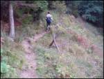 26
26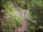 27
27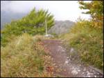 28
28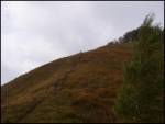 29
29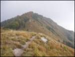 30
30 31
31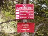 32
32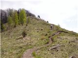 33
33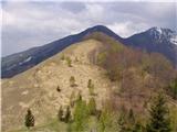 34
34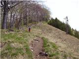 35
35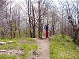 36
36 37
37
Discussion about the trail Klemenčevo - Kamniški vrh (by Korošaki waterfalls)
|
| Kokta26. 05. 2012 |
Ja, spodnji del je neoznačen, tako da sem ven prišel nekje na poti čez Slevo. Slapove sem našel šele nazaj grede ko sem pred Slevom zavil desno dol po neoznačeni poti in se potem zopet povzpel po melišču. Se splača mal raziskovat po teh poteh brez markacij. Lepa tura, pa še vreme je zdržalo 
|
|
|
|
| LidijaJesih21. 09. 2014 |
Ko pasejo (vsaj takrat) je začetek malo drugačen. Pri avtu, ki se ga vidi na sliki 3 se zavije desno na kolovoz, nato dvakrat čez potok in po kolovozu navzgor. Ko se v levo odcepi prva pot, ki je tudi malo širša, s kolovoza, pot se po nekaj minutah spusti do vode, ki jo spet prečite. In ste malo za ograjo s slike 9. Ali pa po zgornjem opisu, vendar je treba čez električnega pastirja in mimo krav (bikov?), ne vem pa, če so stanovalci nad tem navdušeni. Poti ni videti.
|
|
|
|
| navdušena6. 05. 2018 |
bolj priporočam začetek, ki ga opisuje LidijaJesih. Za avtom se zapeljete mimo obračališča za avtobuse, od tam je pri tabli v gozd kolovoz... kot opisano v komentarju. Bolje, kakor hoditi po travniku, zlasti, če je že visoka trava - kmet nas ne bo vesel. Priporočam povratek - spust s sedla direktno navzdol, ko dosežemo ravnino, se držimo desno, pri smernih tablah (pred Slevom) zavijemo desno na potko, nekajkrat prečimo ograjo - so vrata oz. urejeni prehodi - in pridemo na pot, ki je opisana za začetek.
|
|
|
|
| darkom25. 04. 2021 21:20:52 |
Dne 24/04/21 sem prehodil omenjeno pot (na začetku pri tabli zavil desno na kolovoz).
Pot je brez posebnosti in normalno prehodna.
|
|
|