Kriška planina - Vrh Korena (via Planina Koren)
Starting point: Kriška planina (1480 m)
| Lat/Lon: | 46,2929°N 14,5369°E |
| |
Name of path: via Planina Koren
Time of walking: 2 h 15 min
Difficulty: easy marked way
Altitude difference: 519 m
Altitude difference po putu: 650 m
Map: Kamniške in Savinjske Alpe 1:50.000
Recommended equipment (summer):
Recommended equipment (winter): ice axe, crampons
Views: 54.859
 | 6 people like this post |
Access to the starting point:
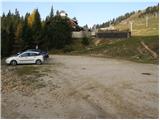
a) From the motorway Ljubljana - Jesenice take the exit Vodice, then continue to the first semaphore crossing in Vodice, where you turn left towards Cerkelj na Gorenjskem and Brnik. When you reach the main roundabout at Spodnji Brnik, continue driving in the direction of Cerkeliai and the ski resort Krvavec. At the end of Cerklje na Gorenjskem, leave the main road, which continues towards Velesovo and Visoke, and turn slightly right onto the road towards the ski resort Krvavec. Continue to the village of Grad, where signs for Ambrož pod Krvavcem direct you to the right on a steep asphalt road (straight ahead to the lower station of the round-cabin cable car to Krvavec and Štefanja Gora). When the steepness of the steep road eases slightly, you will come to a junction, where you will continue to the left in the direction of Ambrož pod Krvavcem (straight ahead to the settlements of Ravne, Apno and Šenturška Gora). A little further on, the road descends a little, then climbs over slopes that are sometimes quite scenic. Higher up, you reach Ambrož pod Krvavcem, where you pass the church of St Ambrose and the tourist farm Pr Ambružarju on the left. From the tourist farm the road passes into the forest and climbs through it to mountain pasture Jezerec, where there is a large parking lot. The road is laid here and turns left, about 500 m further on it leads to a crossroads, where you continue right in the direction of Kriška planina (straight ahead the upper station of the round-cabin cableway and the Mountain Home at Gospinac). There is only a short steep climb and you arrive at a parking lot at the edge of Kriška planina.
The road from mountain pasture Jezerec to Kriška planina is now closed to public traffic, which extends the journey by about 15 minutes.
b) From the motorway Jesenice - Ljubljana take the exit Kranj - East, then continue to Brnik, Komenda and Mengeš. Once you reach the main roundabout at Spodnji Brnik, continue driving towards Cerkeliai and the ski resort Krvavec. At the end of Cerklje na Gorenjskem, leave the main road, which continues towards Velesovo and Visoke, and turn slightly right onto the road towards the ski resort Krvavec. Continue to the village of Grad, where signs for the village of Ambrož pod Krvavcem direct you to the right on a steep asphalt road (straight ahead to the lower station of the circular cable car to Krvavec and Štefanja Gora). When the steepness of the steep road eases slightly, you will come to a junction, where you will continue to the left in the direction of the village of Ambrož pod Krvavcem (straight ahead to the villages of Ravne, Apno and Šenturška Gora). A little further on, the road descends a little and then climbs over slopes that are sometimes quite scenic. Higher up, you reach Ambrož pod Krvavcem, where you pass the church of St Ambrose and the tourist farm Pr Ambružarju on the left. From the tourist farm the road passes into the forest and climbs through it to mountain pasture Jezerec, where there is a large parking lot. The road is laid here and turns left, about 500 m further on it leads to a crossroads, where you continue right in the direction of Kriška planina (straight ahead the upper station of the round-cabin cableway and the Mountain Home at Gospinac). There is only a short steep climb and you arrive at a parking area at the edge of Kriška planina. The road from mountain pasture Jezerec to Kriška planina is now closed to public traffic, which extends the journey by about 15 minutes.
Path description:
From the parking lot, turn onto the road in the route mountain pasture Koren. The road then leads through an underpass to a quarry, where you leave. Continue the ascent along a pleasant but poorly visible mountain path, which runs along the edge of the pasture fence. The path, which becomes more visible, then leaves the Kriška planina grazing areas and enters a world covered with dwarf pines. After a short climb, the path leads to a beautiful lookout point, from which we have a beautiful view of the Korošica valley. Next, the path starts to descend more steeply and after a few minutes we are already 60m lower. The path then flattens out and we are joined on the right by the path from the valley mentioned above. Next we cross the lane of a forest, and then the path starts to climb again. During the ascent, an unmarked path branches off to the left, leading to the Razor saddle, and we continue on the marked path, which after a few minutes leads us to the southern part of the mountain pasture Koren. The path then descends past the animal watering point to the shepherd's hut at mountain pasture.
Here our route continues slightly left (slightly right mountain pasture Košutna) through the meadows on the valley flor (the path is initially not very visible). The path then becomes steeper and steeper and after less than 30 minutes of walking leads us to a small puddle where there is a less well marked crossroads. Continue straight on (right Košutna) and follow the gently sloping path to the next crossroads, where you continue left in the direction of Vrh Korena (straight Kompotel). The way ahead starts to climb steeper and quickly leads us through the karst world to the place where we join the path from Veliki Zvoh to Vrh Korena (the ridge of Jez). Continue to the right and the path leads us in a few steps to a place where the path to Vrh Korena branches off to the right, which is reached after a minute's further walking.
Kriška planina - mountain pasture Koren 1:15, mountain pasture Koren - Vrh Korena 1:00.

Pictures:
 1
1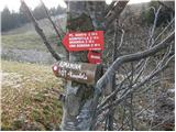 2
2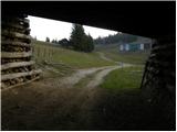 3
3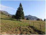 4
4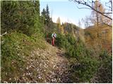 5
5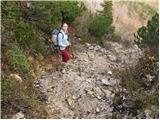 6
6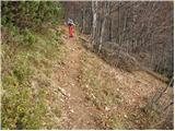 7
7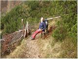 8
8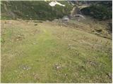 9
9 10
10 11
11 12
12 13
13 14
14 15
15 16
16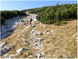 17
17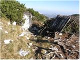 18
18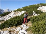 19
19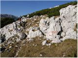 20
20 21
21 22
22 23
23 24
24
Discussion about the trail Kriška planina - Vrh Korena (via Planina Koren)
|
| ROBERT23. 08. 2006 |
ena najlepših izletov. primerno za občudovalce narave. ampak naj vas opozorim-nekaj posebnega-nekaj kar je v slovenskih gorah zelo redko-NI ŽIGA!!!
|
|
|
|
| Guest26. 08. 2006 |
robert :nabiralec žigov,zgrešil vrh .Skrinjica,knjiga ,svinčnik ,žig.Vse ,blazinice pa nekateri nosijo sabo,da se poštemplajo.
|
|
|
|
| Nickster22. 07. 2008 |
Zelo lepo!  Ampak sam neki me mot!!! Sam en metr do 2000!  Zbiralci (med njimi tud jest)2000-akov bi imeli en vrh več. 
|
|
|
|
| hajdiga13. 09. 2009 |
Odličen izlet, zelo lepa narava in razgibana pot.
|
|
|
|
| vespuci10. 10. 2010 |
Markacisti so včeraj na novo pobarvali markacije,hvala v imenu vseh.
|
|
|
|
| Keki4. 12. 2017 |
Je bil kdo v zadnjih dneh na Kompoteli in Vrh Korena...je gaz narejena?
|
|
|
|
| Bandzo4. 12. 2017 |
Včeraj (03.12.2017) sva s kolegom šla v smeri Kompotele. Do planine Koren je bilo zgaženo in je sled popolnoma uhojena. Od planine Koren naprej pa sva uspela priti malo naprej od sedla, kjer sva na trenutke gazila do "jošk". Od sedla dalje je ogromno napihanega snega in se je z vsakim korakom udrlo do pasu. Za nama je šel par, ki je pred sedlom že obrnil, ko sva se pa vračala sta pa za nama šla še en turni smučar in njegov prijatelj s krpljami, rekla sta da sta namenjena na Košutno. Glede na njune krplje in pa smuči, kamorkoli sta že šla dalje, je potrebno še gaziti. Od mesta, kjer sva midva obrnila, je najverjetneje še za nekje 45min gaženja do Mokrice. LP, Ben
|
|
|
|
| Keki6. 12. 2017 |
Ker sem siten, sem vseeno šel preverit stanje. Ker sta bila vmes dva dokaj lepa dneva sem upal, da bo gaz že konkretno uhojena... No pa ni...že do pl. Koren je mestoma zapihana, od pl. Koren dalje pa vse zapihano in skorjast sneg do kolen in čez, zato sem malo pod markacijo na skali na koncu travnika obrnil..... Slikce na FB.
|
|
|
|
| TinaHefe23. 03. 2019 |
Zdravo! Ali ima kdo podatek, je pot uhojena oz. je se veliko snega? Hvala!
|
|
|
|
| umetnik0077. 06. 2019 |
"Sam en metr do 2000!" Če te kaj tolaži - ko si na vrhu, je tvoja glava nad 2000
|
|
|
|
| David197724. 10. 2019 |
Danes sem bil na V. Korena in užival v razgledu na alpe. Opazil sem tudi, da je vpisna knjiga v razdejanju, dejansko je en kup listov najverjetneje uničenih od dežja.
|
|
|
|
| tjasaam17. 12. 2020 |
Živjo! Je bil kdo mogoče v kratkem na vrhu? Je pot uhojena? 
|
|
|
|
| Bandzo21. 12. 2020 |
Brez težav se pride. Višje je pahko bolj pomrznjenih, nižje gnilo že zjutraj
|
|
|