Ledinsko Razpotje - Gradišče (above Spodnja Idrija) (steep path)
Starting point: Ledinsko Razpotje (702 m)
| Lat/Lon: | 46,0281°N 14,0477°E |
| |
Name of path: steep path
Time of walking: 1 h
Difficulty: easy unmarked way
Altitude difference: 296 m
Altitude difference po putu: 315 m
Map: Škofjeloško in cerkljansko hribovje 1:50.00
Recommended equipment (summer):
Recommended equipment (winter): ice axe, crampons
Views: 1.070
 | 1 person likes this post |
Access to the starting point:
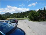
a) From Železniki, Kranj or Medvode, drive to Škofja Loka, and from there continue in the direction of Gorenje vasi in the Poljanska valley and Žire. In Žire, or at the end of Žire (Stare Žiri), leave the main road towards Rovty and Logatec and turn right towards Idrija. After about 6 km of driving from the crossroads in Žire, you will arrive at the Ledine crossroads, where there is a small crossroads with mountain direction signs. Park about 50 m further in the direction of Idrija, in a slightly larger parking lot at the next crossroads. The parking lot is located in the immediate vicinity of several mountain direction signs and the pension Kmečki hram Fortuna.
b) From Horjul or Polhov Gradec, drive to Šentjošt nad Horjul, and from there continue to Smreč. When you reach the main road Podlipa - Žiri, follow it to the right, and we drive along it to Žiri. When you reach the main road Škofja Loka - Logatec in Žire, follow it to the left, and you will pass the parish church and the Lenger Inn and Pizzeria. After the inn we reach a crossroads, where we leave the main road towards Logatec and continue in the direction of Idrija. After about 6 km of driving from the crossroads in Žire, we arrive at the Ledine crossroads, where there is a small crossroads and mountain direction signs. Park about 50 m further in the direction of Idrija, in a slightly larger parking lot at the next crossroads. The parking lot is located in the immediate vicinity of several mountain direction signs and the pension Kmečki hram Fortuna.
c) From the motorway Ljubljana - Koper take the exit Vrhnika, then when you reach the old road Ljubljana - Logatec, continue in the direction of Logatec, but only for a short time, because already at the next junction continue right in the direction of Horjul. The road continues for a short distance through Vrhnika, later through the outskirts of Stara Vrhnika, and then soon we leave the road towards Horjul and continue slightly left in the direction of Smrečje. After Smrečje the road starts to descend towards Račeva and Žire. Once in Žire, we reach the main road Škofja Loka - Logatec, follow it to the left, and we drive along it past the parish church and the Lenger Inn and Pizzeria. After the inn we reach a crossroads, where we leave the main road towards Logatec and continue in the direction of Idrija. After about 6 km of driving from the crossroads in Žire, we arrive at the Ledine crossroads, where there is a small crossroads and mountain direction signs. Park about 50 m further in the direction of Idrija, in a slightly larger parking lot at the next crossroads. The parking lot is located in the immediate vicinity of several mountain direction signs and the pension Kmečki hram Fortuna. d) From the motorway Koper - Ljubljana take the exit Logatec, and when you reach the old road Logatec - Vrhnika follow it to the right (first exit from the roundabout), and follow it for a short time, as the signs for Rovte and Žiri then direct you to the left. After Rovte, the road starts to descend towards Žire, and when you reach the above-mentioned place, you will soon turn left towards Idrija. After about 6 km of driving from the crossroads in Žire, you arrive at the Ledine crossroads, where there is a small crossroads with mountain direction signs. Park about 50 m further in the direction of Idrija, in a slightly larger parking lot at the next crossroads. The parking lot is located in the immediate vicinity of several mountain direction signs and the pension Kmečki hram Fortuna.
e) From the road Idrija - Spodnja Idrija, just after the end of Idrija, turn right (if coming from Spodnja Idrija, turn left before Idrija) over the bridge over the Idrijca river towards the Eurospin shop. On the other side of the bridge you will reach the village of Mokraška vas, and we stick to the main road leading to Ledinsko Razpotje and Žire. Higher up, the road leads us through some serpentines, and then we arrive at the Ledine Razpotje settlement, where we turn right at the first crossroads and park in a slightly larger parking lot. The parking lot is located in the immediate vicinity of several mountain direction signs and the pension Kmečki hram Fortuna.
Path description:
From the starting point, continue along the main road towards Žire, and walk along it for 50 m, or until the crossroads where the road to Lediny branches off to the left. From this junction, turn left and then immediately right towards the marked path towards Sivka. After the nearby house, the road temporarily loses its asphalt coating, and then, in a moderate ascent, joins a slightly wider road, which we only cross and continue straight in the direction of Pečnik or ICPP (left down Ledine crossroads, right Sivka and Ledine). The way forward leads us along a narrower asphalt road, which leads us past individual houses and initially along beautiful views of the surrounding hills. Further on, the road leads us to a part of the village where the houses are more together, and in the last part of the hamlet we continue to the left past the yard of a nearby house. A little further on, you reach another road, which you follow in a straight direction, and walk along it to a place where a macadam road branches off slightly to the right, along which you can see markings. The dirt road is also soon abandoned as the signs direct you to the right to cart track, which passes onto the slope of Gradišče. Cart track soon turns slightly to the right from an unmarked ridge and crosses the slopes of the above-mentioned summit, while we continue on an unmarked path (the worse cart track), which continues along and along an unmarked ridge. Shortly before the cart track ends, we see on the left a continuation of the beaten track leading to the top of Gradišče. Higher up, another cart track is reached, which is followed to the right before joining the wider cart track, which is followed to continue the ascent. The cart track, which leads to the summit, is soon followed again to the left on a beaten but steeper path, which climbs to the summit, where the conversion tower is located.
Description and pictures refer to the situation in 2016 (August).

Pictures:
 1
1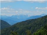 2
2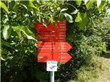 3
3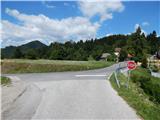 4
4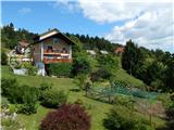 5
5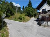 6
6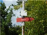 7
7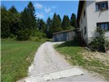 8
8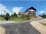 9
9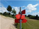 10
10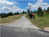 11
11 12
12 13
13 14
14 15
15 16
16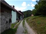 17
17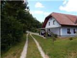 18
18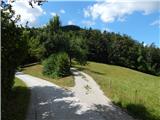 19
19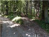 20
20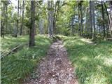 21
21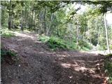 22
22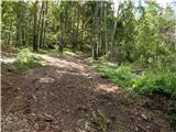 23
23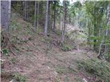 24
24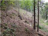 25
25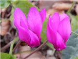 26
26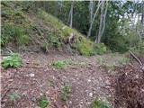 27
27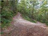 28
28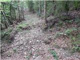 29
29 30
30 31
31
Discussion about the trail Ledinsko Razpotje - Gradišče (above Spodnja Idrija) (steep path)