Starting point: Leška gmajna (1220 m)
| Lat/Lon: | 46,2985°N 14,7197°E |
| |
Time of walking: 1 h 15 min
Difficulty: easy marked way
Altitude difference: 205 m
Altitude difference po putu: 325 m
Map: Kamniške in Savinjske Alpe 1:50.000
Recommended equipment (summer):
Recommended equipment (winter): ice axe, crampons
Views: 19.474
 | 1 person likes this post |
Access to the starting point:
From Gornji Grad or Stahovica drive to the Črnivec pass, then continue driving to the right (or left if you have come from Stahovica) along the macadam (forest) road, which starts to climb after a big cut (weather storm 13. 7. 2008). Follow the climbing and sometimes slightly worse road to the left at the first junction, and straight ahead at the second junction. After a few km of climbing, the road leads to a small pass, where the next junction is. Here we continue to the right along a narrower and partly overgrown road along which we see mountain direction signs for Rogatec (and a little further on for Lepenatko. Follow this road, which descends slightly, to its end, where you park.
The starting point can also be reached from the Volovljek Pass (Kranjski and Štajerski Rak).
Path description:
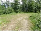
From the end of the road, follow the marked footpath into the forest, which begins to descend gently. After a few minutes of descent, take the cart track, which leads you in a few further steps to the Kunšperk saddle, where there are a few crossroads.
Continue straight on the marked cart track, which after a few steps leads to a marked crossroads, where you continue to the right in the direction of Lepenatka. The path continues to climb through a short lane of fallen trees and then begins to turn increasingly to the right. The path then crosses the steep and, in the wet, slippery slopes of Kunšperski vrh in a gentle ascent. After this, the path climbs steeply and after a few minutes of further walking leads us to the western ridge of Lepenatka. Next, we follow a rather overgrown path, which leads us through increasingly sparse forest to the top grassy slope of the mountain. The path from which we open up to increasingly beautiful views (the most beautiful is the view of nearby Rogatec), but within a few minutes of climbing the top slope leads us to a grassy peak.

Pictures:
 1
1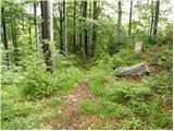 2
2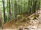 3
3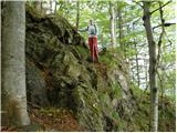 4
4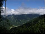 5
5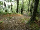 6
6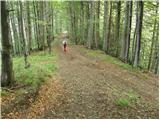 7
7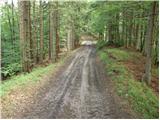 8
8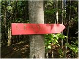 9
9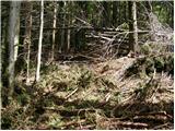 10
10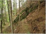 11
11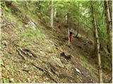 12
12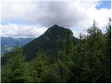 13
13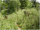 14
14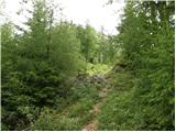 15
15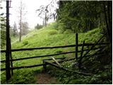 16
16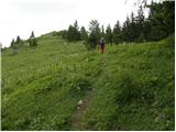 17
17 18
18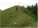 19
19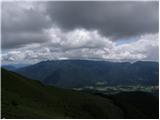 20
20 21
21
Discussion about the trail Leška gmajna - Lepenatka
|
| ločanka25. 10. 2015 |
Danes po tej poti in sicer s Črnivca najprej na Kranjsko reber, nato pa spust mimo koče na Kašini planini do križišča poti (tu tabla s pripisom Lepenatka 1.45 ure, naprej pa po opisu te poti. Zanimivo je povezati izlet na oba vrhova, po tablah sodeč, je časovna razdalja dveh ur. Razgledi z obeh vrhov pa prekrasni!
|
|
|