Starting point: Liboje (350 m)
Time of walking: 2 h
Difficulty: easy marked way
Altitude difference: 586 m
Altitude difference po putu: 675 m
Map: Posavsko hribovje - zahodni del 1:50.000
Recommended equipment (summer):
Recommended equipment (winter):
Views: 8.904
 | 1 person likes this post |
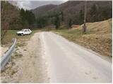
Access to the starting point:
From the Ljubljana - Maribor motorway, take the Žalec exit and continue towards Arji vas. At the crossroads at the end of the village, continue straight on towards Liboj. Shortly after the sign, at the end of the village of Liboje, you will see a mountain sign for Liboje. Continue for another 100m to a small parking area by the road, where the footpath to Šmohor and Malič begins. The start of the footpath is not marked (if we have driven to the Ramšak water source, we are already to far).
Path description:
From the parking lot, turn left onto the footpath, which climbs gently across the meadow. After a few minutes of ascent, the path crosses a macadam road, where you first see the mountain sign for Šmohor. The path then climbs to the top of the meadow, after which the path goes into the forest and after a further few minutes of walking leads us to a forest road where we continue straight up towards Šmohor. The path continues through the forest and becomes steeper and steeper. After a good half an hour's walk, the steepness eases and the path leads us to cart track. From cart track the signs for Šmohor soon direct us left on the path which, after another short climb, leads us to a forest road where we continue right towards Šmohor. After a few metres of gentle downhill, the marked footpath to Malič (right, home on Šmohorju 5 min) branches off to the left. The path then goes into the forest and climbs parallel to the road. With a few ups and downs, the path leads to a paragliding airstrip. Next, the path climbs steeply and, following the forested western ridge of Malič, quickly leads to the summit.

Pictures:
 1
1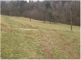 2
2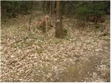 3
3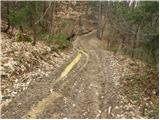 4
4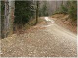 5
5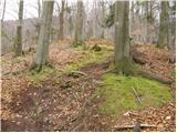 6
6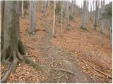 7
7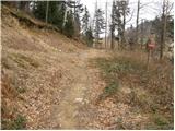 8
8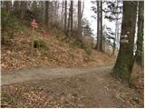 9
9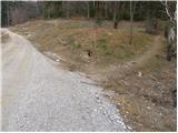 10
10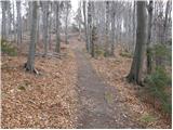 11
11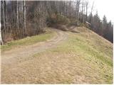 12
12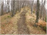 13
13 14
14
Discussion about the trail Liboje - Malič
|
| seinfeld23. 04. 2018 |
Smo včeraj opravili ta izlet. Lepa, ne najlažja tura, dobra za priprave na višje hribe. Strmina je kar lepa in zlepa je ne zmanjka. Skupaj se premaga 700 višinskih metrov, gor in dol smo hodili dve uri in tričetrt.
|
|
|
|
| garmont21. 11. 2020 |
Izhodišče poti je cca 100 metrov naprej, kjer se v levo odcepi makadamska cesta. Po njej še 50 metrov do urejenega parkirišča na desni strani. Tako se izognemo hoji po sredini travnika. 
|
|
|
|
| Lisica18. 05. 2021 18:39:55 |
Na tem parkiriscu je mene danes nekdo prijazno posvaril da boljse da tu ne parkiram ker so bile Opazene neke pizd@rije na avtih. Baje je lastnik malo psiho.  Na stebru zraven pise zasebno zemljisce. Parkirala sem visje ob tej cesti. Par metrov naprej od tu je pa levo oznaka za Malic in Smohor.
|
|
|
|
| Mtb4718. 05. 2021 20:00:53 |
Ta tabla "zasebno zemljišče" je novost pred tem travnikom...Še pred kratkim je ni bilo. 
|
|
|
|
| Lisica19. 05. 2021 07:30:07 |
Bolj slabo se vidi....a je to parking ob cesti ki gre mimo kamnoloma, za izhodiscem za Kotecnik? Tam so me posvarili. Tole zgoraj zgleda zelo podobno. Dopuscam moznost da sem se zmotila. Ti opisi v tem delu mi vedno delajo probleme najdit izhodisce na sreco je toliko izhodisc da tudi ce opisanega na hribi.net falim se ne zgubim.
|
|
|