Ljubelj - Hochstuhl/Stol (lower path)
Starting point: Ljubelj (1058 m)
| Lat/Lon: | 46,4324°N 14,2602°E |
| |
Name of path: lower path
Time of walking: 4 h 50 min
Difficulty: easy marked way
Altitude difference: 1178 m
Altitude difference po putu: 1400 m
Map: Karavanke - osrednji del 1:50.000
Recommended equipment (summer):
Recommended equipment (winter): ice axe, crampons
Views: 36.416
 | 3 people like this post |
Access to the starting point:
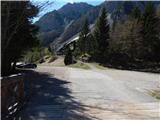
From the motorway Ljubljana - Jesenice, at the Podtabor fork, continue in the direction of Ljubelj and Tržič. Continue along the first expressway and then the regional road, which you follow all the way to the Ljubelj border crossing. Just before the border crossing, turn left (direction Zelenica) and then park in a large parking lot after driving for a few 10 metres.
Path description:
From the parking lot, follow the pedestrian route towards Zelenica, Vertatscha and Hochstuhla. The dirt track, which runs along the left-hand side of the ski slope, leads us after about 15 minutes of moderate ascent through the forest to the aforementioned slope along which we then climb. The path, which offers beautiful views of the extensive scree Begunjščica on the left and the ridge Ljubeljščica on the right, then leads us in a gentle ascent to the hut at Vrtača. From the hut, continue straight along the marked path, which slowly turns slightly to the left and, after a short cross-climb, leads us to lane of dwarf pines. The path then climbs more steeply for a short time and then leads to cart track (the transport-rescue road), which is then followed in a moderate ascent to the mountain home at Zelenica.
From the hut on Zelenica, continue right in the direction of Hochstuhla and Vertatscha (Begunjščica on the left) along the path which turns left immediately after the home and climbs by the children's ski lift. Somewhere halfway along the cableway, you will come to a less obvious crossroads where the path to Vertatscha branches off to the right. Continue straight ahead on the path, which quickly leads to the top of the children's ski lift. Continue along a wide path which begins to descend gently, first along the edge of the second lift and then through the forest. After about 20 minutes' walk from the house on Zelenica, the path leads to the hut at the source of the Završnice River.
Here we continue to the right in the direction of Vertatscha and Hochstuhla along a path which quickly changes from Smokuška planina into a small, at first undefined valley between Srednji vrh on the left and Vertatscha on the right. After a moderately steep trail, a good half-hour walk from Smokuška planina leads us to the Šija saddle, where the next crossroads are located.
Continue straight on (Srednji vrh on the left, Vertatscha on the right and Hochstuhl upper path) along the path, which descends gently at first and then gradually begins to climb. Here, the unmarked path over Zagon joins us almost imperceptibly from the left, and we continue straight on along the path surrounded by lush bushes. The relatively gently sloping path soon leads us into the high mountain cirque, where the (upper) path from the house at Zelenica joins us from the right.
We continue westwards, this time along a path that leads us through a beautiful high mountain valley, surrounded on the left by the lesser-known Srednja peč (1920 m), and on the right by the Svačiča and the Belščice ridge, blocking our view towards Austria. Just a little further on, a path branches off to the right to Bielschitza and to Klagenfurter Hutte, and we continue straight on along the increasingly high mountain path, which leads us in a gentle ascent to a large scree slope below Celovška špica (2105 m). The path then climbs over a relatively steep scree slope, and after this leads us to an unmarked saddle between the Small and Large Hochstuhl. Here we continue to the right (left Prešernova koča 5 minutes) in the direction of Hochstuhla, the top of which we reach after 10 minutes of further walking. Ljubelj - Zelenica 1:20, Zelenica - Hochstuhl 3:30.

Pictures:
 1
1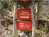 2
2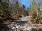 3
3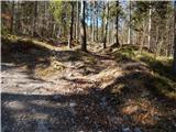 4
4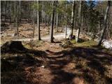 5
5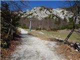 6
6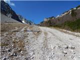 7
7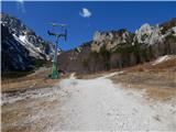 8
8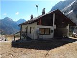 9
9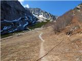 10
10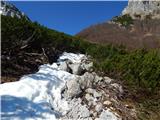 11
11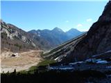 12
12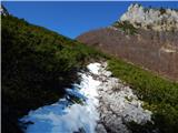 13
13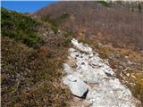 14
14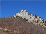 15
15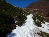 16
16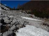 17
17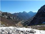 18
18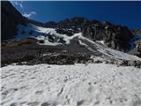 19
19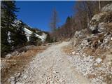 20
20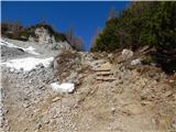 21
21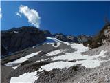 22
22 23
23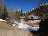 24
24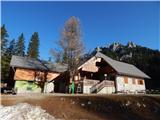 25
25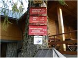 26
26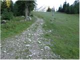 27
27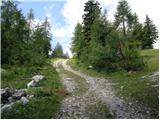 28
28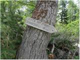 29
29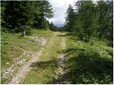 30
30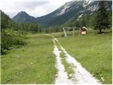 31
31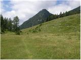 32
32 33
33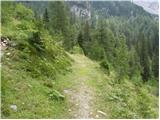 34
34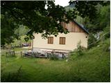 35
35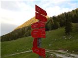 36
36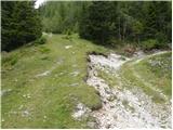 37
37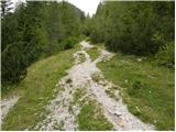 38
38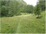 39
39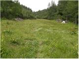 40
40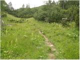 41
41 42
42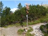 43
43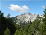 44
44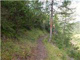 45
45 46
46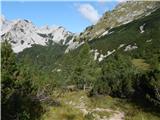 47
47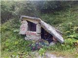 48
48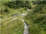 49
49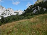 50
50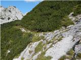 51
51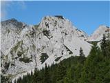 52
52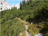 53
53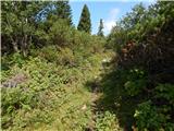 54
54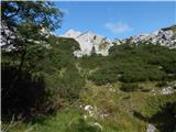 55
55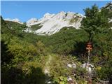 56
56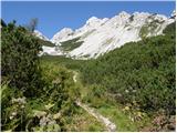 57
57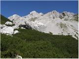 58
58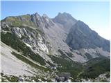 59
59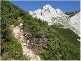 60
60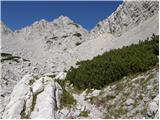 61
61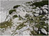 62
62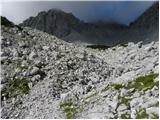 63
63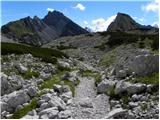 64
64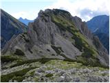 65
65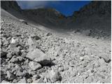 66
66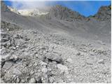 67
67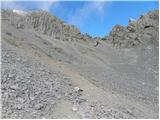 68
68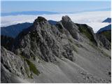 69
69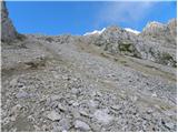 70
70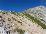 71
71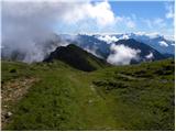 72
72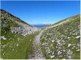 73
73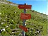 74
74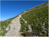 75
75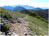 76
76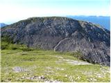 77
77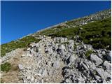 78
78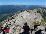 79
79 80
80
Discussion about the trail Ljubelj - Hochstuhl/Stol (lower path)
|
| ceko9. 01. 2012 |
Kakšna je letos pot v snegu?
|
|
|
|
| as778019. 08. 2012 |
Ali mogoče kdo ve kako je z sedežnico Zelenica v poletnem času? Ali ta vozi ob vikendih in do kdaj (tudi v septembru)?
|
|
|
|
| matttt1. 09. 2013 |
31.8. sem opravil opisano pot. Sama pokrajina je zelo lepa, vendar pa je katastrofalno slabo markirana in zelo zaraščena, tako da sem imel kar nekaj orientacijskih težav. Lahko bi jo opisal kot lahko brezpotje. Kasneje, ko se ji pridruži zgornja pot pa je spet vse v najlepšem redu. Pot je bolj slabo obiskana, tako da jo priporočam tistim, ki imajo radi mir in malo prometa na poti.
|
|
|
|
| velkavrh2. 09. 2013 |
Če grem na Stol od Ljubelja jo vedno uporabim za nazaj. Tudi letos sem jo. Je pa vse res kot je napisal mattt.Ne bi rekel, da je slabo markirana, ker se dejansko markacij sploh ne opazi, bolj bi rekel, da se po njej bolj malo hodi.Na sedlu pa zmerom zavijem takoj dol k domu Pri izviru Završnice. Ta je veliko prijetnejša kot tista po melišču.
|
|
|
|
| cebelca20. 07. 2014 |
Danes prehodila to pot. Pot normalno sledljiva in lepo uhojena. Ob poti res precej vegetacije, ampak ne moti, ker se pot lepo vidi in se ne zgublja. Meni je bilo celo všeč, ker je vse zeleno in pisano od rožc  Glede na veliko količino odrezanega ruševja ob poti, zna biti, da so jo tudi malce uredili. Markacij se mi je zdelo dovolj.
|
|
|
|
| mikkeni27. 06. 2021 11:46:51 |
Kaksne so razmere? Kopna pot z Ljubelja?
|
|
|
|
| Lazo27. 06. 2022 21:44:07 |
Pozdravljeni Evo, prilagam vam posnetek celotne poti do Vrtače in Stola iz Ljubelja. Na izhodišče pa se se vrnil po označeni SPODNJI POTI. Varen korak! https://youtu.be/5sPJbXHRxBA
|
|
|