Ljubelj - Vrh Ljubeljščice (Triangel)
Starting point: Ljubelj (1058 m)
| Lat/Lon: | 46,4324°N 14,2602°E |
| |
Time of walking: 1 h 50 min
Difficulty: easy unmarked way
Altitude difference: 646 m
Altitude difference po putu: 646 m
Map: Karavanke - osrednji del 1:50.000
Recommended equipment (summer):
Recommended equipment (winter): ice axe, crampons
Views: 30.936
 | 3 people like this post |
Access to the starting point:
From the Ljubljana - Jesenice motorway, take the Ljubelj exit and follow the road to the border crossing. Just a few metres before the border crossing, the signs for Zelenica direct us to the left and after a few 10 metres of further driving, the road leads to a parking lot under the Zelenica ski centre.
Path description:
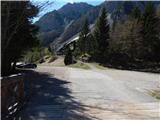
At the beginning of the parking lot, the mountain signs for Hochstuhl, Vertatscha and Dom na Zelenici direct us to the wide cart track, which begins to climb along the torrent. When the cart track turns left a little higher up, we continue straight on along the mountain path, which continues through the forest and soon returns to cart track. Cart track turns right a little higher up and leads us out of the forest onto the ski slope of the former Zelenica ski resort. There is a short, steeper climb up the ski slope, and then the trail flattens out and leads us along the fothills of the scree below Begunjščica.
The marked path soon branches off to the right along a service road, and we continue along the "road" to the nearby Vrtača Hut.
At the hut, the road turns right and we continue straight on towards the mountain path to Zelenica. For a short time we continue under the former single-seater Zelenica II, and then the path begins to climb steeply up the slope, which is partly overgrown by dwarf pines. After a few switchbacks, we return to the service road, which we continue along, overloking the Šentanski avalanche.
The path ahead takes you along the slopes of the Lower Plot (the summit of which was covered by a sport climbing route a few years ago), then off the road turn right onto a footpath that cuts around a long bend. Once back on the road, we are at the top station of the former Zelenica II single-seater, and it is only a few steps downhill to the Zelenica Home.
In front of the mountain lodge, the marked path to Begunjščica branches off to the left, and behind the lodge, also to the left, there is a path to Hochstuhl, Vertatscha and Završnica, and behind the lodge we continue straight on to a less visible unmarked path that climbs up an unmarked valley. A little higher, continue right (straight ahead to the saddle Čez Pod and the top of the former Triangel ski lift), cross a small spring and start climbing steeply up a grassy slope. Higher up, we reach the ridge connecting Vrh Ljubeljščice and Spodnji Plot, and we continue to the left towards Peak Ljubeljščica (Spodnji Plot on the right), a peak also known as Triangel.
The way forward is to retreat slightly left along the ridge, and then, with beautiful views that stretch across the Stol all the way to Triglav, we reach the scenic summit.
Ljubelj - Koča Vrtača 0:40, Koča Vrtača - Dom na Zelenici 0:40, Dom na Zelenici - Vrh Ljubeljščice 0:30.

Pictures:
 1
1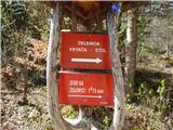 2
2 3
3 4
4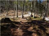 5
5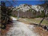 6
6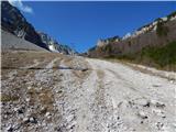 7
7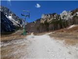 8
8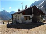 9
9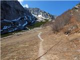 10
10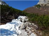 11
11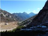 12
12 13
13 14
14 15
15 16
16 17
17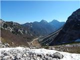 18
18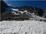 19
19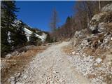 20
20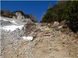 21
21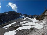 22
22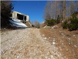 23
23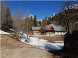 24
24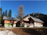 25
25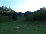 26
26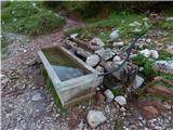 27
27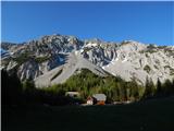 28
28 29
29 30
30 31
31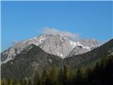 32
32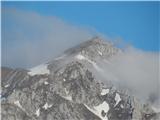 33
33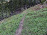 34
34 35
35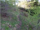 36
36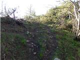 37
37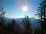 38
38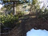 39
39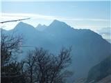 40
40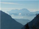 41
41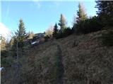 42
42 43
43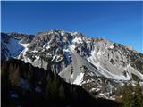 44
44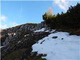 45
45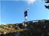 46
46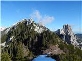 47
47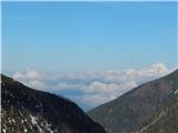 48
48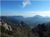 49
49
Discussion about the trail Ljubelj - Vrh Ljubeljščice (Triangel)
|
| robter7. 02. 2011 |
Danes sem bil na tem vrhu nad Zelenico. Doma sem potem pogledal na stran Geopedia.si, kjer je ta vrh imenovan Čez pod (1704 m). Ali mi lahko nekdo pove, kako je s tem Čez pod ali Zgornji plot ?
No ko rečemo Triangel, je itak vsem jasno, pa kljub temu.
Drugače pa luštno spomladansko vreme.
|
|
|
|
| robter7. 02. 2011 |
Dobil sem podatek, da so vsa tri imena pravilna.
|
|
|
|
| neyo31. 07. 2014 |
V soboto 19. 7. sva z ženo šla po grebenu Ljubeljščice na Zelenico. Od tam pa na Vrtačo. Pot po grebenu je izredno slikovita in lepa. Ne vem pa kako bi jo ocenil. Ni ne težka in ne lahka. Fizično ni zahtevna,potrebna pa je velika mera pazljivosti. Predvsem zato ker nikjer ni zelo velikih prepadov, pa se zato človek hitro opusti in ni več pozoren. Pot je na kar nekaj mestih nevarna za zdrs. Kaj hitro se lahko slabo konča.Mogoče bi jo ravno zaradi varljivih predelov moral oceniti kot zahtevno,ali mogoče še celo zelo zahtevno. Je pa to čudovit in samoten svet. Srečala nisva nikogar. Pravzaprav nebi smel delati relame za to pot, ker je prav da obstajajo tudi poti kamor ne zahajajo množice. Kjer je človek sam,ali pa srečaš le tiste ki imajo radi mir in tišino v gorah. Kdor si želi tega je pa ta pot res prava izbira in jo zelo priporočam.
|
|
|
|
| neyo31. 07. 2014 |
Še nekaj slik, ki bodo morda koga zvabile na to pot.
|
|
|
|
| neyo31. 07. 2014 |
Se opravičujem,toda ne najdem gumba kjer bi lahko dodal slike. 
|
|
|
|
| mukica31. 07. 2014 |
Slike tukaj ne moreš naložiti...samo na trenutne razmere 
|
|
|
|
| neyo31. 07. 2014 |
Hvala mukica. Bom pa poizkusil tam. LP
|
|
|
|
| Jst_Me18. 08. 2014 |
Kaj lahko kdo bolj natančno opiše pot na Triangel? Od koče na Zelenici naprej. Kaj greš po tem naprej po tisti potki na desno, ki potem pripelje do Vrtače?
|
|
|
|
| sla18. 08. 2014 |
Vlečnica triangel je lepo razvidna na fotografiji št. 9.
Vrh s tem imenom ne obstaja.
|
|
|
|
| robter18. 08. 2014 |
Jst Me: Od bajte naravnost gor. Nimaš kaj zgrešiti, ker se vrh, ki mu pravimo tudi Triangel, vse skozi gledaš. Je stezica po travniku. Lahko pa greš še 10 minut proti Vrtači in se nato na naslednjemu travniku usmeriš na slabši kolovoz, ki gre v desno navzgor in tudi prideš. Bolj priporočljivo za sestop.
|
|
|
|
| Jst_Me19. 08. 2014 |
Hvala obema za odličen opis  .
|
|
|
|
| tinky20. 08. 2014 |
V koči Milana vpraš pa ti bo iz terase pokazal pot.
|
|
|
|
| lolipop9. 07. 2018 |
se strinjam z neyo z opisom z dne 19.7.2014. Tale opis "lahka" neoznačena pot ni ravno primeren - da je neoznačeno drži oz. ponekod te smerokaz že vodi, je pa na določenih predelih nevarnost za zdrs in to globok, tako da tudi adijo ne bi mogel reči.
|
|
|
|
| lukae27. 06. 2021 19:20:18 |
|
|
|
|
| Barbara 7527. 12. 2023 12:15:00 |
Zdravo, je bil kdo v tem prazničnem času na Ljubeljščici? Zanima me če je dosti snega, sem iz MB, tu ga ni nič🙂
|
|
|
|
| bongo27. 12. 2023 14:04:20 |
|
|
|