Ljubenske Rastke - Bezovec
Starting point: Ljubenske Rastke (547 m)
| Lat/Lon: | 46,3851°N 14,8464°E |
| |
Time of walking: 2 h 15 min
Difficulty: easy marked way
Altitude difference: 779 m
Altitude difference po putu: 779 m
Map: Kamniške in Savinjske Alpe 1:50.000
Recommended equipment (summer):
Recommended equipment (winter): ice axe, crampons
Views: 5.310
 | 1 person likes this post |
Access to the starting point:
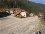
From the Ljubljana - Maribor motorway, take the Šentrupert exit and follow the road towards Logarska dolina. In the village Ljubno ob Savinji, the sign for Smrekovec points to the right. The road then takes you through the centre of the village, where you turn left again after the Smrekovec sign. The road then leads to Ljubenske Rastke, where you park in the parking lot near the church.
Path description:
From the parking lot, continue along the left-hand road in the direction of Travnik and Komno (straight home to Smrekovec). After a few steps of walking, you will see an electricity pole on the right-hand side of the outbuilding and a mountain sign on it, which directs you to the left on a footpath that climbs over a short grassy slope. The path then goes quickly into the wods, where it continues in a cross-climb. After a few minutes' walk, a wide cart track joins us from the left, after which we continue our ascent. Just a little further on, the cart track turns sharp right, and we continue straight on (this part of the path is less well marked). The partly stony cart track which we are climbing up then makes a slight left turn and then leads us out of the wods, where we will see a ruined chapel on the right-hand side of the path.
After the chapel the path disappears and we continue across the meadow to cart track which we follow to the right to a small abandoned hamlet. At the hamlet, cart track turns left and just a few steps further on, signs direct us right onto a footpath which begins to climb steeply through the forest. Higher up, the path leaves the wods onto grassy slopes over which you climb to an asphalted road (road access is also possible).
Continue climbing steeply along the asphalted road, which you follow at the crossroads in the direction of Komno. Higher up, the road leads to a crossroads at which we see signs for Komen, which direct us to a road closed to traffic. This road is then followed for only a short time, as we will soon notice a faded direction sign directing us right into the forest. After a few steps of ascent through the forest, the path leads us to the NOB Memorial.
Continue your ascent in the direction of the hospital along the path, which soon leads to a marked crossroads. Continue slightly right in the direction of Komno (slightly left hospital Celje and Travnik) on the path that leads us higher on the forest road which we follow to the left, but only for a short time, as the markings then direct us right on the footpath. A moderately steep path through the forest then leads us to a small cross where an unmarked path from the valley of the Žep stream joins us from the left. Continue on the path, which climbs crosswise through the forest, but when it emerges from the forest it turns sharp left, where it passes the Bezovec peak where the hunting observation post is located. The hunting observation post at the top of Bezovec can be reached in less than a minute's walk along an unmarked path that branches off to the right.

Pictures:
 1
1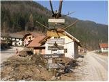 2
2 3
3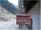 4
4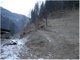 5
5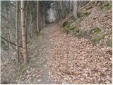 6
6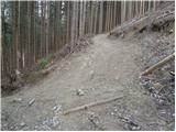 7
7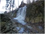 8
8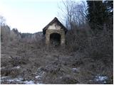 9
9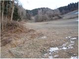 10
10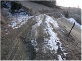 11
11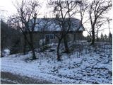 12
12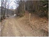 13
13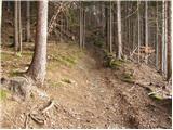 14
14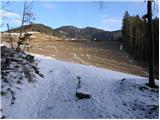 15
15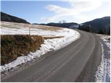 16
16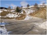 17
17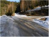 18
18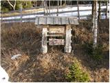 19
19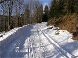 20
20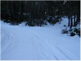 21
21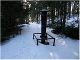 22
22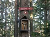 23
23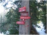 24
24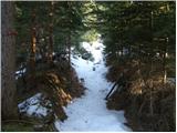 25
25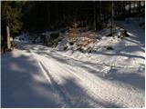 26
26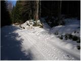 27
27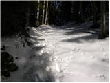 28
28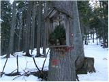 29
29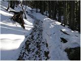 30
30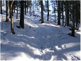 31
31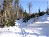 32
32 33
33
Discussion about the trail Ljubenske Rastke - Bezovec
|
| Hribolazec8111. 04. 2024 23:44:36 |
Pozdrav prijatelji planinci, za soboto planiram pohod, kakšna bi bila povezava krožne poti, ter kako je označeno da bi se znašel (Ali pa če priporočate katero drugo izhodišče ter pot za ta dva vrhova in kočo na Travniku - Ne rabi biti nujno krožna, ampak lepše pa je če je);
Ljubenske Rastke - Bezovec - Veliki Travnik - koča na Travniku - Ljubenske Rastke
|
|
|
|
| rokeg12. 04. 2024 10:37:52 |
Se da delat krožno. Samo, če spustite Komen pot ni označena. Z Bezovca je bolj smiselno, da greste čez Komen na Veliki Travnik, nato pa sestopite po opisu poti tu gor v dolino potoka Žep čez Počko planino. Nato imate še dobra 2 kilometra hoje po cesti do Ljubenskih Rastk.
Če izpustite Komen, se morate z Bezovca spustiti po cesti, nato morate po cesti okoli "grape" in nato nazaj na greben Komen - Travnik.
|
|
|
|
| Enka13. 04. 2024 13:34:00 |
Ve kdo, ali so cesta do Ljubenskih Rastk in poti tam okrog po lanskih poplavah zdaj OK? Na PZS je prvi del tele poti še vedno označen kot zaprt. Enako tudi spodnji del poti čez Počko planino.
|
|
|