Starting point: Matizovec (915 m)
| Lat/Lon: | 46,4145°N 14,3°E |
| |
Time of walking: 3 h 5 min
Difficulty: easy pathless terrain
Altitude difference: 1085 m
Altitude difference po putu: 1088 m
Map: Karavanke - osrednji del 1:50.000
Recommended equipment (summer):
Recommended equipment (winter): ice axe, crampons
Views: 13.143
 | 3 people like this post |
Access to the starting point:
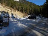
From the Ljubljana - Jesenice motorway, take the Ljubelj exit and follow the road towards the border crossing. Leave the main road at the point where the signs for "Camping and Podljubelj" point to the right. After leaving the main road, after a few metres you will come to a crossroads where you turn left in the direction of "Kofce". Continue through the village on a slightly ascending road and then turn right in the direction of "Matizovec and Kofce". Follow this sometimes slightly narrower road, which is asphalted in the lower part, to a large marked parking area, about 150 metres below the Matizovec farm.
Path description:
From the large free parking lot, continue along the dirt road, which will take you to the Matizovec farm in about 20 minutes.
From Matizovec, continue along the worse road towards Dom na Kofcah , and at several successive crossroads, follow the signs carefully. After a few minutes of walking on the worse road or cart track, the signs direct us to a steep footpath, which first climbs steeply to the left, then crosses over to a woded ridge, where it turns slightly to the right. Continue along the steep mountain path, which crosses the cart track at a higher level and gradually flattens out behind it. Just a little further on, the forest thins out and the waymarked path turns right into the forest and joins cart track a little higher up, which climbs cross-climbing to the right. Cart track turns left higher up, and the marked path from Kala joins us from the right.
From the crossroads onwards, the forest ends, and the increasingly scenic route leads us within 5 minutes of further walking to Doma na Kofcah.
From the mountain home, continue in the direction of Veliki vrh and Kladiva along the initially slightly less visible path, which begins to climb over the meadow. After a 15-minute walk from the Home on Kofcah, you reach a beautiful viewpoint at the cross.
The path then descends gently and in a few minutes leads to the steeper slopes of Košuta. The path then climbs over lane of dwarf pines, where it leads to a crossroads. Continue straight on (right Kladivo and Kofce gora) along the path, which climbs crosswise over steeper and steeper slopes. The path continues along the uncultivated slope and soon leads us to a short steep section where we are helped by a rope ladder (not difficult). After crossing this part, the path turns slightly to the left and continues to climb relatively steeply over the grassy slope. The increasingly scenic route then leads us into a small valley, which we climb almost to the border ridge, where the ridge path joins us from the right. The path then leaves the valley and rejoins the southern slopes, where it passes the summit of "Toplar (2000m)" on the south side. It is at this point that you leave the marked path leading to Veliki vrh and turn right onto a pathless world. After three minutes of steep but easy climbing on the trackless path, you reach Toplar. Starting point - Matizovec 20 minutes, Matizovec - Kofce 1:15, Kofce - Toplar 1:30.

Pictures:
 1
1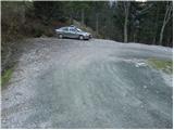 2
2 3
3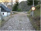 4
4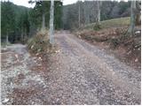 5
5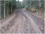 6
6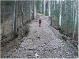 7
7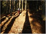 8
8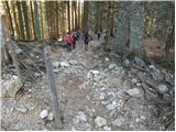 9
9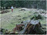 10
10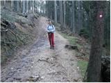 11
11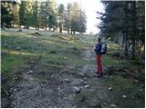 12
12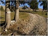 13
13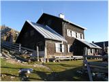 14
14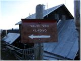 15
15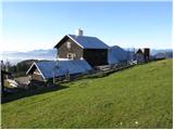 16
16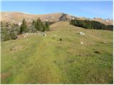 17
17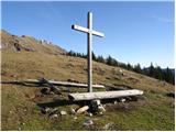 18
18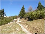 19
19 20
20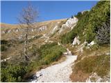 21
21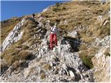 22
22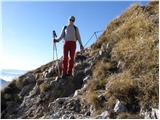 23
23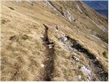 24
24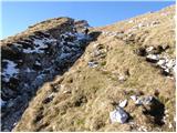 25
25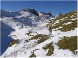 26
26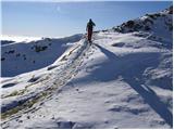 27
27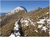 28
28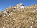 29
29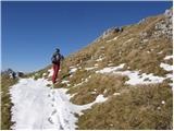 30
30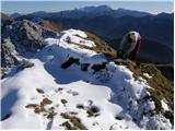 31
31
Discussion about the trail Matizovec - Toplar
|
| efes24. 06. 2010 |
no jutr gremo pa s frendi tle gor,d vidmo kva dugaja u hribih,evo k pridemo jutr nazaj bom pa mav napisu kk je blo 
|
|
|
|
| efes25. 06. 2010 |
no evo,bli gor,nč posebnga  ,šli raj drugam
|
|
|
|
| janate2. 01. 2011 |
Na toplarju sem bil 31.12.10 ko sem se vračal iz Velikega Vrha. Nič posebnega, zanimive pa so bile stene (špice) na avstrijski strani pobočja pod toplarjem.
|
|
|