Medvedova konta - Debela peč (via Kotel and on old path)
Starting point: Medvedova konta (1410 m)
| Lat/Lon: | 46,3748°N 13,9409°E |
| |
Name of path: via Kotel and on old path
Time of walking: 2 h 10 min
Difficulty: easy pathless terrain, easy marked way
Altitude difference: 604 m
Altitude difference po putu: 645 m
Map: TNP 1:50.000
Recommended equipment (summer):
Recommended equipment (winter): ice axe, crampons
Views: 10.957
 | 1 person likes this post |
Access to the starting point:
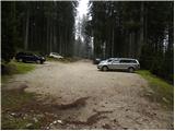
From the motorway Ljubljana - Jesenice take the exit Lesce and follow the road in the direction of Bled, where you will be directed to the right at a semaphore crossing marked for Pokljuka. Follow this road, which takes us through a few villages in the lower part and later starts to climb steeply, to Mrzle Studenec (a mountain located just 50 m after the junction where the road to Bohinj branches off to the left). In the middle of the mountain pasture, a road branches off the main road to the right, leading to Medvedova konte, Pri Rupah and mountain pasture Zajavornik. Turn right here and follow the road to the next crossroads, where you continue to the right in the direction of Medvedova kontra (straight ahead to the Zajavornik mountain). After a short climb, the road descends and leads to the next crossroads, where you continue to the left in the direction of the Blejska hut. Follow this road to the parking lot in front of the ramp, no further driving is allowed.
In winter, the road to this starting point is usually not passable.
Path description:
From the parking lot continue along the wide cart track in the route Blejska koča on Lipanca. Follow the wide cart track, over which there is a ramp, to the first left turn. At this bend, leave cart track and continue straight through the forest, following a faint track which will take you to the end of the nearby forest road in less than 5 minutes. The road is reached at a turning point, which is very similar to a roundabout. The circle is in a clockwise direction, and we follow the road to the nearby cart track, which branches off the road to the left (the track is a few metres before you leave the circle). Take the above-mentioned track, which continues along the left side of the nearby Kotel (the Kotel is a larger, mostly unlined hollow in the middle of the woods, where cold air is trapped). The cart track, which descends only slightly, soon ends, and we continue in roughly the same direction.
We continue walking on a trackless path, only occasionally following the remnants of old dirt tracks and paths.
From the point where the track ends, we first descend slightly to the lower edge of the slope (the slopes on the left, the world is less steep to the right), and then we climb steadily to moderately up a series of undistinguished valleys, which are located at the lower edge of the slopes already mentioned. Higher up, the "path" becomes a little steeper, and then it quickly descends to the meadows of Prevala, where it reaches the marked path mountain pasture Klek - Debela peč, or mountain pasture Klek - Blejska koča on Lipanca.
The marked trail is reached just at the marked crossroads, and we continue to the left in the direction of Blejska koča or Lipanca (straight ahead Debela peč - the usual trail with mountain pasture Klek, to the right mountain pasture Klek). The trail continues transversely to the south-west, without any major changes in elevation. A little further on, emerge from the sparse forest into the lane of the uncultivated slope. Here, on the right-hand side, on a larger rock, you will see the rather faded sign Debela peč, which points you right up the bank.
At this rock, leave the wider and well-marked path leading to Blejska koča and continue right along the route of the former path. There is almost no trace of the route, but the old faded markings are still visible. We continue climbing up the slope straight ahead, with the old markings to help us find our way. Higher up, the path turns right through lane of dwarf pines, and then slightly to the left or straight up again. The steep path continues along steep grassy slopes covered with dwarf pines. A little further on, the path gradually reaches the foot of the short cliffs and becomes steeper still, climbing above the cliffs over a grassy ridge covered with dwarf pines. Here the path turns to the right and joins the above-mentioned normal path with mountain pasture Klek to Debelo crag. When you reach a well-marked mountain trail, the climb is quite steep for a while, and then the trail, which offers increasingly beautiful views, gradually becomes less steep. We continue to climb for some time through the increasingly rare dwarf pines, and the path takes us several times to a ridge from which we have a beautiful view towards Krma and the mountains above the Krma valley (in the background you can also see the peaks above the Vrata valley). This path, which is no longer particularly steep, is followed all the way to the lookout peak, which is reached after a few minutes of further walking.

Pictures:
 1
1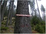 2
2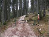 3
3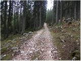 4
4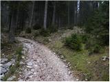 5
5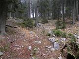 6
6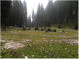 7
7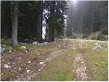 8
8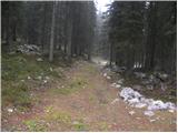 9
9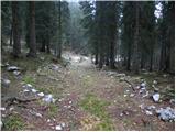 10
10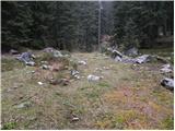 11
11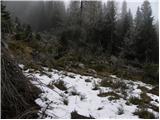 12
12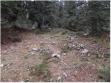 13
13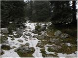 14
14 15
15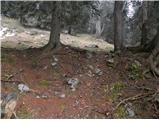 16
16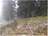 17
17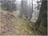 18
18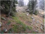 19
19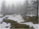 20
20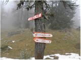 21
21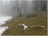 22
22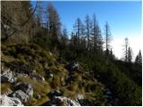 23
23 24
24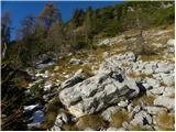 25
25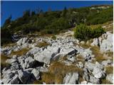 26
26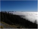 27
27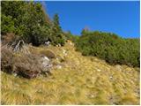 28
28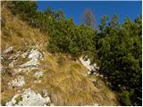 29
29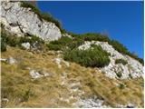 30
30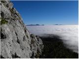 31
31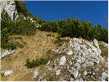 32
32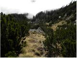 33
33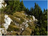 34
34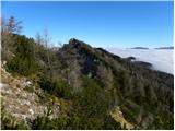 35
35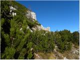 36
36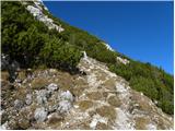 37
37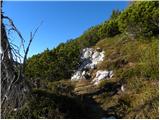 38
38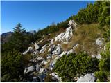 39
39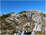 40
40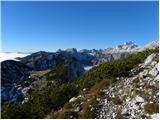 41
41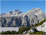 42
42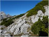 43
43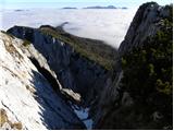 44
44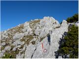 45
45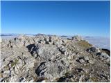 46
46 47
47
Discussion about the trail Medvedova konta - Debela peč (via Kotel and on old path)
|
| matzaj28. 06. 2016 |
Prehodil to pot v soboto 25.6.
Moram reči, da mi je šlo po opisu do slike 11, nato pa sem se 'izgubil' in šel verjetno preveč naravnost navzgor (levo), saj sem na markirano pot prišel nekaj 10m levo od skale na sliki 24 - se pravi bolj proti Lipanci.
Od slike 24 naprej pa sem spet sledil opisu.
Vseeno je bila pot izredno lepa.
|
|
|
|
| Pale30. 10. 2021 19:10:53 |
Podobno kot kolega v zgornjem komentarju sem kmalu po tem, ko se kolovoz konča (slika 11) začel tavati po Pokljuških gozdovih. Po več kot pol ure prečenja pod pobočji na levi sem se po prihodu iz gozda odločil, da zagrizem levo v strm, s skalami prepreden teren. Z idejo, da nekako pridem na markirano pot Klek - Lipanca. Po 20 min me je ustavilo gosto ruševje, kljub temu da se je Debela peč kazala pred menoj. Zmanjkalo mi je motivacije, tako da sem obrnil po podobnih brezpotjih nazaj proti izhodišču.
|
|
|
|
| vrvohodec30. 10. 2022 14:48:15 |
Včeraj sem šel po tej poti z družino. Do 8. slike ni problem najti; kolovoz je tudi precej jasen. Po tem, ko se konča, pa ni več jasna pot.
Po koncu kolovoza sem sledil prbiližno isti izohipsi nekaj 100 metrov. Nato se je kakšnih 10 višinskih metrov nižje pojavil drug star kolovoz / vlaka, ki sem ji sledil. Nato sem prišel do bolj izrazite doline. Delovala je kot nekakšna srnja pot, vmes je bilo tudi nekaj močil. PRi navigaciji sem si pomagal z mapy.cz na telefonu, da sem potem sledil smeri proti križišču markirane poti Klek - Lipanca in stare pot.
Na pot Klek-Lipanca sem prišel kakšnih 50 m pred skalo, kjer je markacija za staro pot (slika 24). Potem sem našel le 2 stari markaciji. Ta del je tudi orientacijsko zahteven. Dva prehoda med ruševjem sta (eden je na sliki 30, drugega nisem prepoznal), ki sta zelo ozka in težko predvidiš, ali se boš zaplezal v ruševje ali pa bod to prehod. Sicer ko si tik pri ruševju, vidiš sledi (živali / zanesenjakov planincev?).
Luštna, samotna in lepo razgledna (tudi za otroke je bila dogodivščina, ker smo vmes našli okostje srne). Ni tehnično zahtevna, orientacijsko pa precej.
|
|
|