Mengeška koča na Gobavici - Rašica (Vrh Staneta Kosca) (lower path)
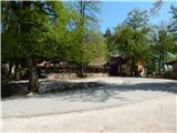
Starting point: Mengeška koča na Gobavici (433 m)
| Lat/Lon: | 46,1656°N 14,5611°E |
| |
Name of path: lower path
Time of walking: 2 h
Difficulty: easy marked way
Altitude difference: 208 m
Altitude difference po putu: 410 m
Map: Ljubljana - okolica 1:50.000
Recommended equipment (summer):
Recommended equipment (winter):
Views: 6.830
 | 1 person likes this post |
Access to the starting point:
Drive into the centre of Mengeš, where, between the two semaphorised crossroads, after the Kranj and Domžale turnoffs, turn west in the direction of the Mengeš hut on the Gobavica River. Continue along Šolski Street, passing first the kindergarten Mengeš and then the Orangery. After Oranžerija, you reach the parking lot and the start of the marked trail to the Mengeška hut, and continue along the steep asphalt road past the Fartek pub to the parking lot in front of the Mengeš hut on Gobavica.
Path description:
From Mengeš huts we continue in the direction of Dobeno and Rašica, the path initially descends along the edge of the pasture, from which we open a beautiful view of the Kamniško Savinjske Alps. A little further on, the path turns left and descends through the lane of a forest to the nearby goat house, where it continues to the right across the meadow. On the other side of the meadow, as you enter the forest, the path splits.
Continue on the left path towards the lower path to Rašica (ridge path on the right). There is a slight descent and then you approach the macadam road, and before you get on it, the markings lead you to the right. Cross Marin hrib and Magarovnik, and between the two hills the path from Topol joins us on the right. When the crossing ends with a few short ascents and descents, we arrive at a marked crossroads where we join the ridge trail, and the trail from Kosez also joins us.
Continue slightly left in the direction of the ridge trail to Rašica, and the way ahead leads along the undistinguished ridge of Srednji hill. Follow the ridge path for a while, then continue left towards Dobené. There is an easy crossing to the left, then a short descent to a dirt road, which you follow to the right. The road then starts to climb and at the edge of the forest, the path from Spodnji Dobene joins from the left.
Continue in the direction of Rašica and follow the road for a while. The road first branches off to the right towards Sel, and a little further on, another of the paths to Rašica, with which we merge at a higher level.
At the part where the path to the left branches off towards Upper Dobeno, we continue to the right in the direction of Rašica. There is some ascent and we are first joined from the right by the aforementioned path to Rašica, and then a little higher up we rejoin the ridge path.
Continue left, again in the direction of Rašica, and follow the marked trail in a slight to moderate ascent to the Vrh Staneta Kosca, a few minutes away, where there is a lookout tower and, a few 10 steps lower, a mountain lodge.
Description and pictures refer to the situation in 2018 (April).

Pictures:
 1
1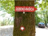 2
2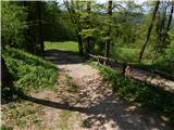 3
3 4
4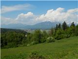 5
5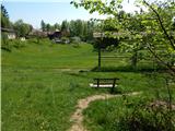 6
6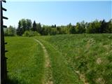 7
7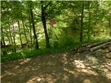 8
8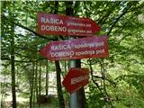 9
9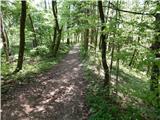 10
10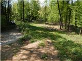 11
11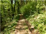 12
12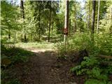 13
13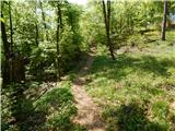 14
14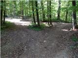 15
15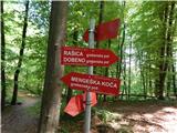 16
16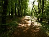 17
17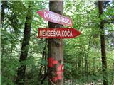 18
18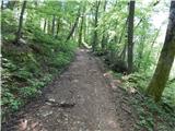 19
19 20
20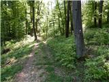 21
21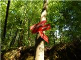 22
22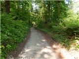 23
23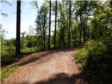 24
24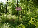 25
25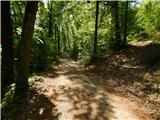 26
26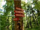 27
27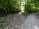 28
28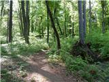 29
29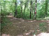 30
30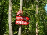 31
31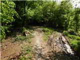 32
32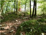 33
33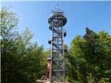 34
34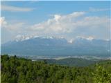 35
35 36
36
Discussion about the trail Mengeška koča na Gobavici - Rašica (Vrh Staneta Kosca) (lower path)
|
| MarinkoR92 4. 02. 2021 |
Pozdravljeni, je pot prevozna za gorska kolesa?
|
|
|
|
| starakapa5. 02. 2021 |
Da šel sem 4.2. po tej trasi.Mokro in ZELO BLATNO PONEKOD
|
|
|
|
| Macesna5. 02. 2021 |
Je stolp na Rašici že odprt?
|
|
|
|
| matic47. 02. 2021 |
Se moram popravit, stolp je zaprt. Verjetno zaradi korone oz. prepovedi zbiranja na javnih krajih.
|
|
|
|
| dezantone8. 08. 2021 09:14:54 |
S kolesom ne ...lovci streljajo
|
|
|