Mlaka - Sveta Ana (Tunjice)
Starting point: Mlaka (340 m)
| Lat/Lon: | 46,2108°N 14,5539°E |
| |
Time of walking: 1 h 30 min
Difficulty: easy unmarked way
Altitude difference: 135 m
Altitude difference po putu: 170 m
Map:
Recommended equipment (summer):
Recommended equipment (winter):
Views: 625
 | 2 people like this post |
Access to the starting point:
a) From the motorway Ljubljana - Jesenice, take the Vodice exit and then continue driving towards Vodice and Kamnik. When you arrive in Mostec, cross the road Mengeš - Kranj at the main semaphore crossroads, then turn left immediately after the crossroads in the direction of Komenda (straight ahead to Kamnik). Continue through Komenda, and we go to the roundabout where the road to Križ and Gmajnica branches off to the right (first exit), and at the following roundabouts and junctions follow the signs for Gmajnica and Mlaka. When the settlement of Mlaka ends, there is a short descent to a crossroads by the Knežje brook, where the route described above starts at the sign. Park in a suitable place nearby.
b) From Trzin or Domžale drive to Mengeš and from there continue to Kranj. At the main semaphore crossroads in Moste, turn right towards Kamnik and then immediately left towards Komenda. Continue through Komenda, and we drive to the roundabout where the road to Križ and Gmajnica branches off to the right (first exit), and at the following roundabouts and junctions follow the signs for Gmajnica and Mlaka. When the settlement of Mlaka ends, there is a short descent to a crossroads by the Knežje brook, where the route described above starts at the sign. Park in a suitable place nearby.
c) First drive to Kamnik, then continue to Kranj. When you arrive in Mostec, just before the main traffic lights, turn right towards Komenda. Continue through Komenda, and we drive to a roundabout where the road to Križ and Gmajnica branches off to the right (first exit), and at the next roundabouts and junctions follow the signs for Gmajnica and Mlaka. When the settlement of Mlaka ends, there is a short descent to the crossroads by Knežje potok, where the described route starts at the sign. Park in a suitable place nearby.
d) Drive to Šenčur, then continue along the road towards Mengeš. A few 100 metres before the semaphorised crossroads in Moste, turn left in the direction of Komenda. Continue through Komenda, and we drive to a roundabout, from which we take the exit towards Križ and Gmajnica, and at the following roundabouts and junctions follow the signs for Gmajnica and Mlaka. When the settlement of Mlaka ends, there is a short descent to a crossroads by Knežje potok, where the described route starts at the sign. Park in a suitable place nearby.
Path description:
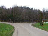
From the sign, continue along the road to the right, crossing the Knežji potok bridge, and immediately after the bridge go left (if you continue to the right, you will arrive in the village of Gora). Walk along the road for a few minutes and then, before the fenced-off area, turn right onto a minor road which gradually turns into cart track. For a short time there is still a barely significant climb, but then the cart track splits, and we take a slightly narrower one on the right, which we climb mostly across to the right. The path quickly becomes a marked trail, which starts near the Hunting lodge Komenda.
Follow the marked path to the left, mostly ascending gently, and at the crossroads follow the markings. The trail continues along and along the undistinguished ridge of Korinovo drč, where it continues with some easy ascents and shorter descents. After a while, when we leave the forest, the path widens into a road, which we begin to climb past the individual houses of the Vinski Vrh settlement, where we follow the markings at the crossroads. Higher up, at the chapel, continue slightly to the left and past the registration box to the hill on which the Church of St Anne stands.
Description and pictures refer to the situation in 2019 (November).

Pictures:
 1
1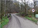 2
2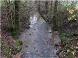 3
3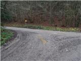 4
4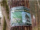 5
5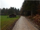 6
6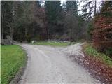 7
7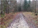 8
8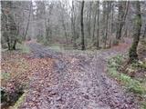 9
9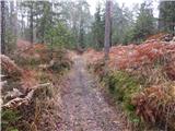 10
10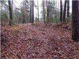 11
11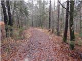 12
12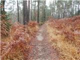 13
13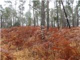 14
14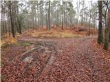 15
15 16
16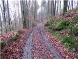 17
17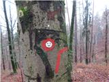 18
18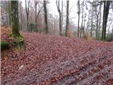 19
19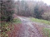 20
20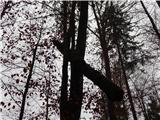 21
21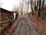 22
22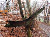 23
23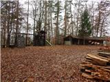 24
24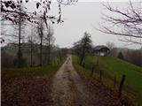 25
25 26
26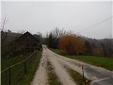 27
27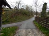 28
28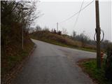 29
29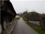 30
30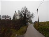 31
31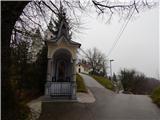 32
32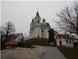 33
33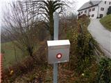 34
34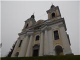 35
35
Discussion about the trail Mlaka - Sveta Ana (Tunjice)