Molnarjev breg - Kamniški vrh (via planina Osredek)
Starting point: Molnarjev breg (1200 m)
| Lat/Lon: | 46,2803°N 14,5359°E |
| |
Name of path: via planina Osredek
Time of walking: 1 h 30 min
Difficulty: easy marked way
Altitude difference: 59 m
Altitude difference po putu: 240 m
Map: Kamniške in Savinjske Alpe 1:50.000
Recommended equipment (summer):
Recommended equipment (winter): ice axe, crampons
Views: 15.470
 | 2 people like this post |
Access to the starting point:
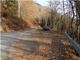
a) From the motorway Ljubljana - Jesenice, take the exit Vodice, then continue to the first semaphore crossing in Vodice, where you turn left towards Cerkelj na Gorenjskem and Brnik. When you reach the main roundabout at Spodnji Brnik, continue driving in the direction of Cerkeliai and the ski resort Krvavec. At the end of Cerklje na Gorenjskem, leave the main road, which continues towards Velesovo and Visoke, and turn slightly right onto the road towards the ski resort Krvavec. Continue to the village of Grad, where signs for Ambrož pod Krvavcem direct you to the right on a steep asphalt road (straight ahead to the lower station of the round-cabin cable car to Krvavec and Štefanja Gora). When the steepness of the steep road eases slightly, you will come to a junction, where you will continue to the left in the direction of Ambrož pod Krvavcem (straight ahead to the settlements of Ravne, Apno and Šenturška Gora). A little further on, the road descends a little and then climbs over slopes that are sometimes quite scenic. Higher up, you reach Ambrož pod Krvavcem, where you pass the church of St Ambrose and the tourist farm Pr Ambružarju on the left. From the tourist farm onwards, the road passes into woods and climbs relatively steeply. When you reach the left-hand serpentine, you are at the starting point, where you can park at a suitable place, at a small crossroads.
b) From the motorway Jesenice - Ljubljana, take the exit Kranj - East, then continue towards Brnik, Komenda and Mengeš. When you reach the main roundabout at Spodnji Brnik, continue driving towards Cerkeliai and the ski resort Krvavec. At the end of Cerklje na Gorenjskem, leave the main road, which continues towards Velesovo and Visoke, and turn slightly right onto the road towards the ski resort of Krvavec. Continue to the village of Grad, where the signs for Ambrož pod Krvavcem direct you to the right on a steep asphalt road (straight ahead to the lower station of the circular cable car to Krvavec and Štefanja Gora). When the steepness of the steep road eases slightly, you will come to a crossroads, where you will continue to the left in the direction of Ambrož pod Krvavcem (straight ahead to the settlements of Ravne, Apno and Šenturška Gora). A little further on, the road descends a little and then climbs over slopes that are sometimes quite scenic. Higher up, you reach Ambrož pod Krvavcem, where you pass the church of St Ambrose and the tourist farm Pr Ambružarju on the left. From the tourist farm onwards, the road passes into woods and climbs relatively steeply. When you reach the left-hand serpentine, you are at the starting point, where you can park at a suitable place, at a small crossroads.
Path description:
From the starting point, follow the forest road that crosses the slopes of Molnar's Bank. Follow the road as it climbs slightly and then reaches a small crossroads where you continue slightly left along the upper road (the lower road or cart track soon ends), along which you can also see markings. There is a few minutes of cross-country climbing, along a road from which we occasionally get some views. A little further on the road splits again, and this time we take the upper left road, from which a steep cart track branches off to the left only a few 10 steps further on. Continue along the road, which you follow to the right-hand bend.
From the bend, continue straight ahead on a marked footpath which continues cross-wise through the woods. In the forest you quickly reach a marked crossroads where you continue downhill to the right in the direction of mountain pasture Osredek and Kamniški vrh (the upper path leads to Kamniški vrh and bypasses mountain pasture Osredek, but it is also possible to continue towards Kriška mountain pasture). A slightly steeper descent follows, then cross the road you have recently left and continue descending. Lower down in the forest, the path turns left and lays down. After a few minutes of crossing, you come out of the forest at mountain pasture Osredek, where there are a few wooden huts.
From the tents at mountain pasture continue eastwards, soon reaching the eastern edge of mountain pasture, where the marked trail from the village of Slevo and the unmarked trail leading by the Korošaški Falls join from the right.
Continue into the forest and start climbing up the initially quite steep slope. Higher up, we reach a ridge where we join a path on the left which bypasses mountain pasture Osredek.
Continue to the right (to the left of our starting point and Kriška planina) along the path that runs along the north side of the ridge. After a short crossing, where the path gets quite close to the ridge, an unmarked path branches off slightly to the right at Planjava, and we continue on the left, north side of the ridge. Cross the steeper northern slope of Planjava, then, once east of Planjava, return to the ridge. On reaching the ridge, descend slightly further to the east, then reach a marked crossroads where you join the visibly more beaten track from Stahovica and Županjih Njiv. Continue straight ahead and start climbing steeply along the scenic western ridge of Kamnik Peak. After about 10 minutes of climbing you will reach Kamniški vrh, and if you continue for a minute further you will reach the bivouac on Kamnice Peak.

Pictures:
 1
1 2
2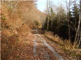 3
3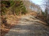 4
4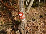 5
5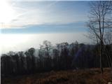 6
6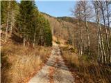 7
7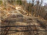 8
8 9
9 10
10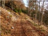 11
11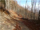 12
12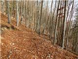 13
13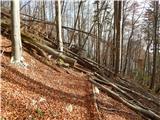 14
14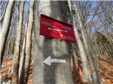 15
15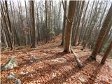 16
16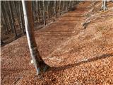 17
17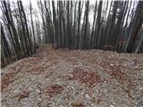 18
18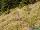 19
19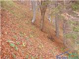 20
20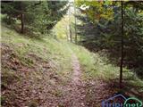 21
21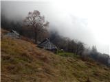 22
22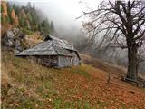 23
23 24
24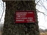 25
25 26
26 27
27 28
28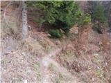 29
29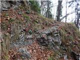 30
30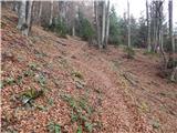 31
31 32
32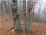 33
33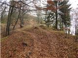 34
34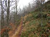 35
35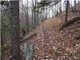 36
36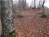 37
37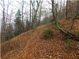 38
38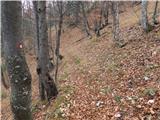 39
39 40
40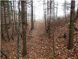 41
41 42
42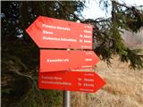 43
43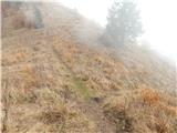 44
44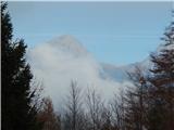 45
45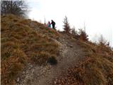 46
46 47
47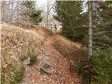 48
48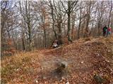 49
49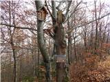 50
50 51
51
Discussion about the trail Molnarjev breg - Kamniški vrh (via planina Osredek)
|
| iUnknown28. 11. 2015 |
Samo pripomba, da je situacija, kako se pride do planine Osredek, sedaj nekoliko bolj zakomplicirana kot pred letom 2014, ker so zaradi pospravljanja padlih dreves iz februarja 2014 naredili zelo veliko novih gozdnih cest, po katerih vozijo s traktorji, tako da se je vcasih nekoliko nesmiselno drzati oznacene poti, saj so ceznjo podrta drevesa, medtem ko te na novo narejene gozdne ceste pripeljejo celo bolj direktno do cilja. Zal nisem uspel precekirati vseh cest, drugace bi jih ze vrisal v zemljevid na OpenStreetMap.
|
|
|
|
| NinaSi13. 07. 2019 |
Na Kamniški vrh čez planino Osredek sem šla pred nekaj dnevi. Na nekaj delih je pot slabo označena (markacij ni ali so slabo vidne), del pod vrhom (preden se pride do epic klopce, ki je tako označena tudi na googlovem zemljevidu), je sploh povsem neoznačen. Sicer pa mi je bil izlet zelo lep in miren (pot je malo obljudena, zato nisem srečala nobenega drugega pohodnika). Vsekakor priporočam  , velja pa seveda biti previden, tudi GPS prav pride.
|
|
|