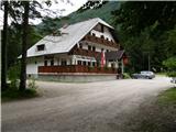
Starting point: Na Razpotju (770 m)
| Lat/Lon: | 46,392°N 14,6273°E |
| |
Time of walking: 5 h
Difficulty: difficult marked way
Altitude difference: 1622 m
Altitude difference po putu: 1645 m
Map: Kamniške in Savinjske Alpe 1:50.000
Recommended equipment (summer): helmet
Recommended equipment (winter): helmet, ice axe, crampons
Views: 13.372
 | 2 people like this post |
Access to the starting point:
We drive to Luce (to get here from Mozirje or via Kranjski rak) and on to the Logar valley. Shortly after the village Solčava you will come to a crossroads where the road to Logarska dolina turns left. Turn left towards the Logar valley (toll) and follow the road to the signs for the hut at Klemenča jama. Park in the parking lot near the Na Razpotju guesthouse. Only guests are allowed to park in front of the guest house.
Path description:
From the parking lot, follow the forest road towards Klemenče jame. After a few minutes' walk, a wide path branches off to the left towards Klemenča Jama. Take this path, which starts to climb. The path, which is quite steep, soon leads to steep slopes, where you cross a slightly exposed ravine with the help of a rope. The path that continues to climb soon leads us to a place where the wall closes the path. Ahead of us we see a cave and above it a marking which directs us into the cave. When we enter the cave, we see that it is not a cave, but a beautifully made tunnel through which we continue. In the tunnel, we have a rope to help us, but we need it more for the descent than for the ascent. On the other side, we cross an exposed ledge on a wide path with a slight incline. The path continues into the forest and climbs steep slopes which are dangerous to slip on when wet. Next, cross another ravine over a small bridge, and then the path leads us to a less steep part of the path, where we join the path from the Planincev home. Continue slightly up the wide path, which soon leads us out of the forest. There is only a short climb up the grassy slope to the hut at Klemenči jama.
From the hut, continue straight in the route Ojstrica along the path, which after a few dozen metres goes into the forest. The path, which climbs moderately to steeply through the forest, leads us higher under rocky cliffs, which are not to crumbly. The path then retreats to the right and leads us to a crossroads where we continue straight towards Škarje, and to the left the very difficult Kopinškova path to Ojstrica branches off. The path continues to cross the slopes to the west, then emerges from the forest and turns slightly to the left. Here it starts to climb a little steeper along the scree, then turns right and climbs towards the saddle below Rjavčki vrh (1898m). From the marked path it is about 10 minutes' climb along a trackless track to Rjavčki vrh. At the saddle, a path also branches off to the right, leading downhill towards the Cottage under the Rinka waterfall. From the saddle, the path then turns left and first climbs past some dwarf pines and then over a scree slope. A slightly steeper climb follows over rocky terrain towards the saddle Škarje (2141m). At the Škarje saddle, the inscription on the scale points to the right. The path climbs steeply and retreats to the ridge slightly to the south. Approach the ridge again and climb up a partly grassy slope. The route then passes the summit of Baba (Lučka Brana 2244m), which is only a few minutes' climb from the waymarked path. The trail then becomes less steep and later descends slightly as it crosses the southern slopes. At the end, the trail turns left and briefly becomes slightly more challenging again. The ascent crosses the steep slopes below the Planjava peak and then reaches a crossroads where you join the other paths to Planjava. At the crossroads, turn right and there is only a short climb up the top slope of the mountain.
At the crossroads - Klemenča jama 1:10, Klemenča jama - Planjava 3:50.

Pictures:
 1
1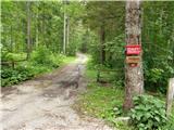 2
2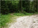 3
3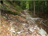 4
4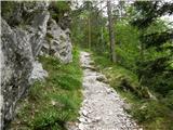 5
5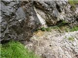 6
6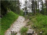 7
7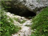 8
8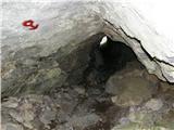 9
9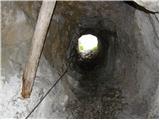 10
10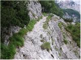 11
11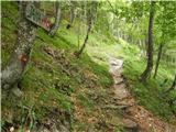 12
12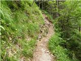 13
13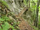 14
14 15
15 16
16 17
17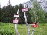 18
18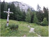 19
19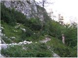 20
20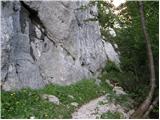 21
21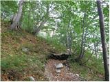 22
22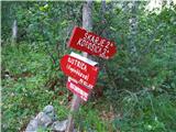 23
23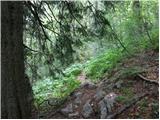 24
24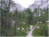 25
25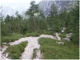 26
26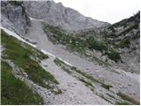 27
27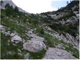 28
28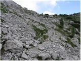 29
29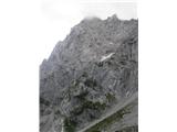 30
30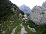 31
31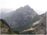 32
32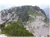 33
33 34
34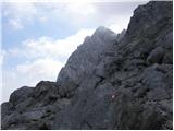 35
35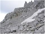 36
36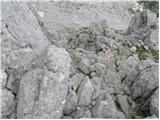 37
37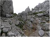 38
38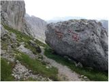 39
39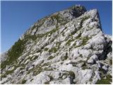 40
40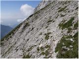 41
41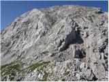 42
42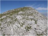 43
43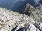 44
44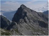 45
45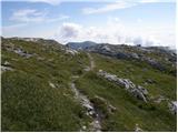 46
46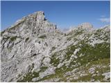 47
47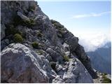 48
48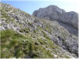 49
49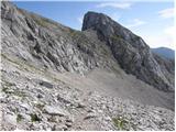 50
50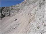 51
51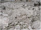 52
52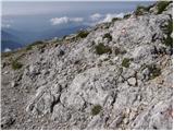 53
53 54
54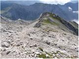 55
55 56
56
Discussion about the trail Na Razpotju - Planjava
|
| seinfeld8. 08. 2016 |
Včeraj sva opravila to pot. Kar zahtevna, večino časa strma, markacije so ponekod slabo vidne. Na poti je(fotografija 27) večje snežišče, zjutraj povsem trd sneg, sva šla pod njim. Ta sneg se letos ne bo stopil. So pa gornje fotografije do poti precej prizanesljive, od škarij naprej je pot na nekaj mestih prepadna.
Gor in dol je dobrih 12km, potrebovala sva 7ur in pol.
|
|
|