Church in Podčertek - Rudnica (above Podčetrtek) (long circular path on Rudnica)
Starting point: Church in Podčertek (215 m)
| Lat/Lon: | 46,15781°N 15,59411°E |
| |
Name of path: long circular path on Rudnica
Time of walking: 4 h 30 min
Difficulty: easy marked way
Altitude difference: 333 m
Altitude difference po putu: 832 m
Map:
Recommended equipment (summer):
Recommended equipment (winter):
Views: 1.510
 | 1 person likes this post |
Access to the starting point:
When you arrive at Podčetrtek, turn right at the roundabout after the centre and immediately at the next roundabout continue straight towards the centre. Pass the municipal building on the left and the school on the right. Then you will see a church on your left, turn left at a sharp bend and you will come to a parking lot on your right.
Path description:
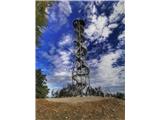
We start our journey at the church parking lot. Continue over the little bridge and turn right along the forest macadam road, after about a kilometre you will see the turn-off for the castle on your right, followed by a slight climb. When you reach the castle, turn left and continue along the forest dirt road, following the mountain signs and walking along the road. After a while, on the left side, through the treetops, you will see the Tower of Health and Joy, which invites you to visit it. When you reach the asphalt road, continue to the left on the asphalt for about 200 m. Then, on the right hand side, you will see a footbridge over a ditch. Cross this footbridge and follow the forest path uphill. When you reach the forest road, turn left. After about 400 metres walk, you will see a turn-off and direction signs to the right uphill. Continue uphill and at the fork in the trail keep to the left where after about 50 metres you will see the Šmarnica shelter, which is open during the weekends and gives you time to rest and enjoy the view. At the shelter Šmarnica the path leads us left again along the forest path, at the crossroads turn right again uphill and then start to descend slightly and on the descent turn right where you can already see the tower, follow the path towards the tower. On the first landing you will find a box with a stamp. Then continue straight on up the steeper hill, where just before the dirt road you will see a roadblock and turn right when you reach the road. Keep walking along this road and follow the signs for Plešivec. At the bend you will see a direction sign and the path straight into the forest. Walk for a while and follow the mountain signs. After a while, our path starts to climb again towards the top of Plešivec, where we will see Albin's resting place with a stamp. The path leads us about 200 metres back along the path we came. Then turn right and follow the signs for the Hunting bivouac and the Cottage at the Witch. Follow the signs all the way, then get to the Hunting bivouac from where you then head towards the Cottage pri čarownici. The trail will follow the macadam until it turns into an asphalt road at some point. Now we are just descending towards the Cottage at the Witch on our right. Continue along the path and you will come to the Minorite Monastery Olimje, and to the right you can visit Deer Ridge. Now it's our turn to walk along the pavement towards Podčetrtek. When you reach Podčetrtek, turn left at the roundabout towards the parking lot where you left your car. The route is 18 km long and 832 metres of total ascent. Video trails can be found at: https://youtu. be/iAY4CljnH-c All other attractions and trails can be found on the VISIT RUDNICA facebook and instagram pages. You can use @visitrudnica in your social media stories or leave the hashtag #visitrudnica under your pictures so everyone can admire your views and highlights from your trip.

Pictures:
 1
1 2
2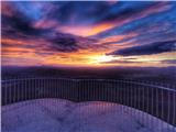 3
3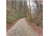 4
4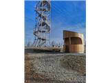 5
5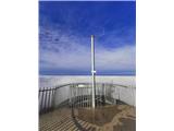 6
6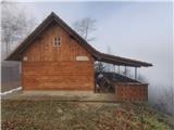 7
7 8
8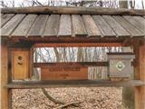 9
9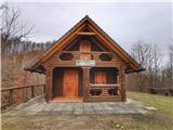 10
10 11
11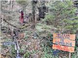 12
12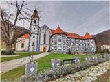 13
13 14
14 15
15
Discussion about the trail Church in Podčertek - Rudnica (above Podčetrtek) (long circular path on Rudnica)
|
| pikica926. 02. 2022 15:47:38 |
Zelo lepo označeno. Pot čudovita in razgibana
|
|
|