Passo Campolongo - Piz Boe (Via Ferrata Vallon)
Starting point: Passo Campolongo (1860 m)
| Lat/Lon: | 46,5193°N 11,87393°E |
| |
Name of path: Via Ferrata Vallon
Time of walking: 4 h 40 min
Difficulty: very difficult marked way
Ferata: C
Altitude difference: 1292 m
Altitude difference po putu: 1380 m
Map: Tabacco 07 1:25.000
Recommended equipment (summer): helmet, self belay set
Recommended equipment (winter): helmet, self belay set, ice axe, crampons
Views: 2.580
 | 2 people like this post |
Access to the starting point:
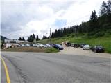
Drive through the Karavanke Tunnel into Austria, then continue to Spittal and on to Lienz (the motorway ends a little after Spittal). We continue along a relatively nice and wide road through the Drava Valley, which leads us into Itali. The road continues past Dobbiaco/Toblach and Brunico/Bruneck. Just after the last-mentioned town, which is passed by a bypass road, we turn left into the Val Badia valley. Continue along the valley past La Vila and Corvara. Then climb up to the Passo Campolongo. A few hundred metres before the pass, you will see a gravel parking area on your left. The parking lot is located behind the Hotel Laguscei, opposite the bus stop. The lower station of the chairlift is also along the road. There is also a smaller parking lot on the right hand side of the road in front of the bus station.
Path description:
From the parking lot, continue along the main road (south) to the Hotel Boe, which is on the right west side of the road. At the hotel, where there are also signs, turn right onto the dirt road after the signs "Rifugio Lago Boe". After the hotel, the road turns right and descends a little, then starts to climb and crosses the ski slope. The road then climbs briefly through the woods and then leads to mountain pasture Malga Plan Fisti.
Continue on the road via mountain pasture and just after mountain pasture you will reach a marked crossroads where a footpath branches off to the left towards the Kaiser Hütte hut. We continue to the right and continue to climb up the road. After a short climb, the 638A trail then branches off to the right towards the summit of Crep de Munt. We continue left along the road, which offers beautiful views towards the Marmolada and the mountains above the Val Badia valley. The road climbs a little steeper here and leads us back to the ski slopes. A little higher up, the road turns to the right and continues to climb along the mostly grassy slopes. The road then becomes flatter and soon leads to the Rifugio Lago Boe hut. The hut is also reached by a circular cable car from Corvara in Val Badia. Near the hut, there is also the lower station of the chairlift leading to the Vallon peak (2530m). Both lifts are also in operation during the summer months.
Near the hut where there is a crossroads, continue left along the ski slope to the signs for Lech de Boe lake and Ütia Franz Kostner hut. The trail follows the right edge of the ski slope and after a short climb leads to the aforementioned lake, which is located to the right of the ski slope under a rocky ridge.
From the lake, continue along route 638, which turns left and crosses the ski resort. The trail then runs slightly to the left of the ski slope on partly grassy terrain. The path soon leads to a marked crossroads where path 636 branches off to the left towards the Kaiser Hütte (Rifugio Bec de Roces). We continue on the path as it climbs the slope parallel to the ski slope and soon path 646A branches off to the right towards the summit of Boeseekofel (Piz da Lech). We continue along the path to the left of the ski slope and slowly beautiful views begin to open up towards hut Ütia Franz Kostner and the precipitous cliffs of the nearby peaks in the Sella mountain group. The slope becomes a little more gentle and the path leads to a marked crossroads.
The path to the right branches off towards the top station of the Vallon cable car and on to the top of Boeseekofel (Piz da Lech), and we continue left along the 638 towards the Ütia Franz Kostner hut. The wide and scenic trail runs westwards and quickly leads to another crossroads.
To the left is just a short climb to the Ütia Franz Kostner hut. If you also visit the hut, then return to the crossroads and continue right on route 638. Just after the crossroads, the path turns left and climbs up towards the scree fields where we are at the crossroads again.
This time leave 638 and turn right onto the path called Roda de Valun. The path then runs north-westwards, following the scree to a valley surrounded by precipitous peaks. The path here first crosses the scree on the left side of the valley in an ascent and then leads to flatter terrain where there is also a crossroads.
To the right is the easy circular route Roda de Valun, and we continue left towards the protected climbing route Via Ferrata Vallon, where we are directed by a large sign on a rock. The path, which is marked here with red and blue markings, then climbs up the scree and leads to the wall where the protected route begins. Before entering the protected part of the route, equip yourself with a helmet and a self-protection kit.
The sheltered path turns right at the start and climbs steeply along the steel cable a few times. The ropes are quite loose in this part and the distance between the rungs to which the ropes are attached is also quite large. The path then briefly turns slightly to the left and leads us under even steeper slopes. Here again we continue to the right and after a few traversing climbs on the exposed slope the path leads us to a suspension bridge. Cross the bridge over a small waterfall and then the climb becomes a little more difficult. The path climbs almost vertically upwards to the left after the bridge and some hand strength is required to progress (difficulty C). The difficult part is relatively short and the sheltered path then soon ends and leads us to lower slopes where there is also a small lake.
The trail turns right here and climbs up an easy slope from which we have a view towards the Piz Boe peak and many other peaks in the vicinity. The path then turns left and climbs gently up a rocky slope on the right side of the valley. On the left, you will also see a slightly larger lake, which is located below the western slopes of Pizes dl Valun. We continue along the relatively gentle path southwards, which slowly curves slightly to the right. As we approach the Piz Lech Dlace peak we come to a crossroads.
The right-hand route goes around the Piz Lech Dlace peak on the west side and then joins route 672. We continue left and cross the slope to the east side of the summit. As we join route 672, the slope becomes slightly steeper and there is a climb up towards the ridge. Here we are helped by the steel cables for a short part of the way. On the ridge, continue to the right and you will soon reach the Piz Lech Dlace peak, where there is a larger cairn.
From the top continue along the ridge and after a short descent you will reach a saddle where there is a crossroads. A second path joins from the protected Via Ferrata Vallon on the right. Also to the right is a cross-route to hut Rifugio Boe, and to the left is an unmarked trail past Lake Eissee.
We continue straight ahead and start climbing up the rocky slope again. A little higher up, the trail turns slowly to the left and leads to a ridge from where the view to the west opens up. Continue south along the ridge and then cross the steeper slopes along the ridge. A short section of the ridge is also helped by a cable car. When we reach the ridge again, we reach the lesser-known peak Cresta Strenta, which at 3124 metres is the second highest peak in the Sella mountain group.
We continue southwards, following the path along the flatter western side of the ridge. Soon the path from hut Rifugio Boe joins us from the right and there is only a short easy climb to the summit.

Pictures:
 1
1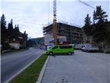 2
2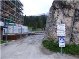 3
3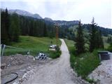 4
4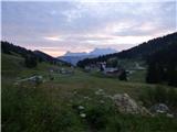 5
5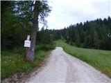 6
6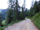 7
7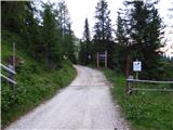 8
8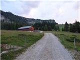 9
9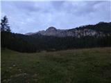 10
10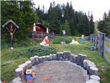 11
11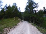 12
12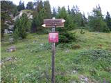 13
13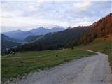 14
14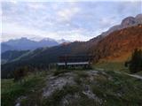 15
15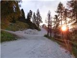 16
16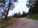 17
17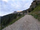 18
18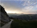 19
19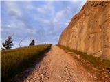 20
20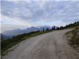 21
21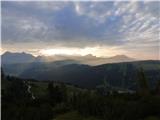 22
22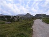 23
23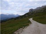 24
24 25
25 26
26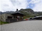 27
27 28
28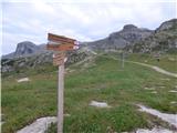 29
29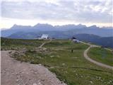 30
30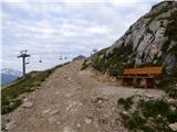 31
31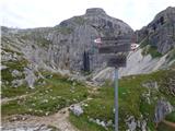 32
32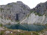 33
33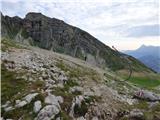 34
34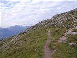 35
35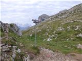 36
36 37
37 38
38 39
39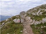 40
40 41
41 42
42 43
43 44
44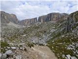 45
45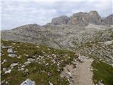 46
46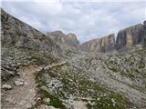 47
47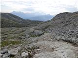 48
48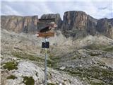 49
49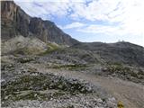 50
50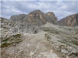 51
51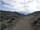 52
52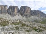 53
53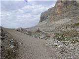 54
54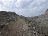 55
55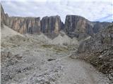 56
56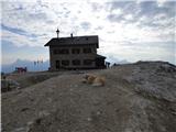 57
57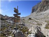 58
58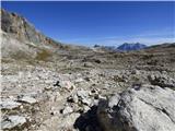 59
59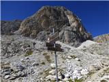 60
60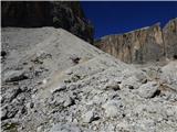 61
61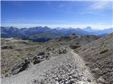 62
62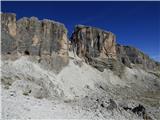 63
63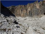 64
64 65
65 66
66 67
67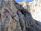 68
68 69
69 70
70 71
71 72
72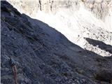 73
73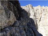 74
74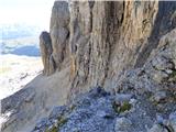 75
75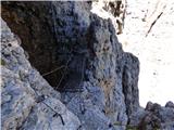 76
76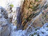 77
77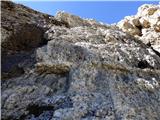 78
78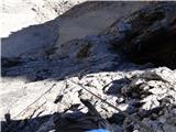 79
79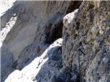 80
80 81
81 82
82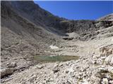 83
83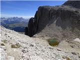 84
84 85
85 86
86 87
87 88
88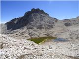 89
89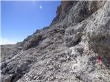 90
90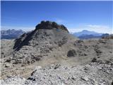 91
91 92
92 93
93 94
94 95
95 96
96 97
97 98
98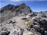 99
99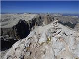 100
100 101
101 102
102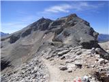 103
103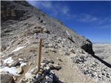 104
104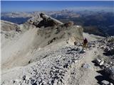 105
105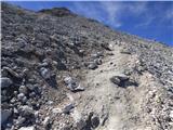 106
106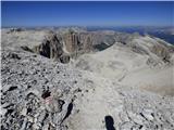 107
107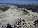 108
108 109
109 110
110 111
111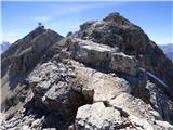 112
112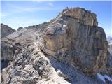 113
113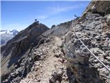 114
114 115
115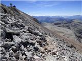 116
116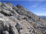 117
117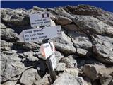 118
118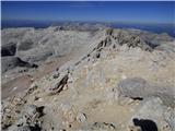 119
119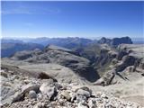 120
120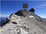 121
121 122
122 123
123 124
124 125
125 126
126
Discussion about the trail Passo Campolongo - Piz Boe (Via Ferrata Vallon)