Petačev graben - Tošč (via Sveta Jedert)
Starting point: Petačev graben (460 m)
| Lat/Lon: | 46,0923°N 14,2887°E |
| |
Name of path: via Sveta Jedert
Time of walking: 1 h 50 min
Difficulty: easy marked way
Altitude difference: 561 m
Altitude difference po putu: 580 m
Map: Ljubljana - okolica 1:50.000
Recommended equipment (summer):
Recommended equipment (winter): ice axe, crampons
Views: 4.650
 | 1 person likes this post |
Access to the starting point:
From Horjul or Dobrova, drive to Polhov Gradec, then continue to Črnji Vrho. A little above Polhovi Gradec, at the junction at the confluence of the Mala and Velika Bozna rivers, continue straight on in the direction of Sela and Škofja Loka (on the left Črni Vrh). Continue along the Mala Božna stream and then you will see the mountain direction signs for Selo, Tošč and Črni Vrh along the road, where you can park.
Path description:
On the opposite side of the parking lot we see a macadam road (direction Selo, Tošč, Črni Vrh and Gabrše), but we follow it for only a few 10 m, and then the footpath signs direct us slightly left to cart track, which climbs along the Selanovo brook. We climb along the stream for some time, and then the signs direct us to the left side (right bank) of the stream. Cart track turns sharply to the left just a little further on and, after a few minutes' further walking, leads us out of the woods and onto the vast hay fields. The path then turns sharply to the right and continues to climb crosswise over increasingly scenic slopes. After about 45 minutes' walk from the starting point, you will come out on a road which you follow to the right (Ogrin, Črni Vrh, Pasja ravan and Sveti Ožbolt on the left). Continue ascending for a short distance and then, after passing a few houses, gradually start descending. After a short descent, you reach a crossroads by a quarry and a chapel. Here, continue right in the route Tošča and follow the gently ascending road for 10 minutes to reach the church of St. Jedert.
From St. Jedert, continue left, initially across a view hayfield, which ends at a strip of sparse woodland. The ascent continues along a well-traced path which climbs for a while along the edge of the increasingly steep hay meadows, then the path passes into a dense forest, where it gradually descends. Higher up, the path turns slightly to the right and gradually passes to the north-west forested ridge Tošča, where we are joined on the left by an even less frequented path from the homestead Vodnik. The path continues on a moderate ascent, crosses some scenic slopes, and then starts to climb steeply. Follow this slightly steeper path in the last part all the way to the top of Tošča, which is reached after a few minutes of further walking.
Petačev graben - St. Jedert 1:00, St. Jedert - Tošč 50 minutes.

Pictures:
 1
1 2
2 3
3 4
4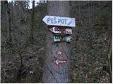 5
5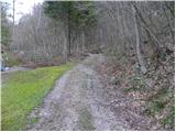 6
6 7
7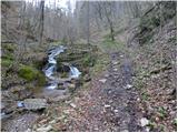 8
8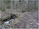 9
9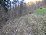 10
10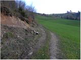 11
11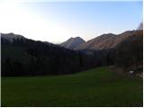 12
12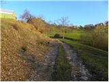 13
13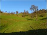 14
14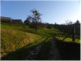 15
15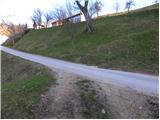 16
16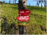 17
17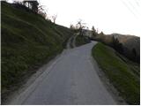 18
18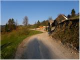 19
19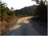 20
20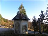 21
21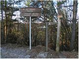 22
22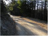 23
23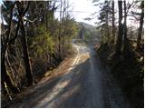 24
24 25
25 26
26 27
27 28
28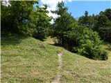 29
29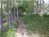 30
30 31
31 32
32 33
33 34
34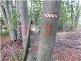 35
35 36
36 37
37 38
38 39
39 40
40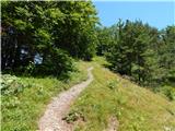 41
41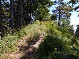 42
42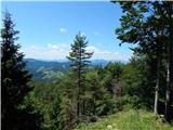 43
43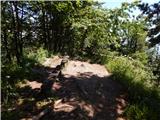 44
44 45
45 46
46
Discussion about the trail Petačev graben - Tošč (via Sveta Jedert)
|
| asluga26. 12. 2015 |
Pot ob Selanovem potoku je poškodovana, na mestih v zgodnjem delu nevarna. Odsvetujem to pot.
|
|
|