Planina Jezerca - Kalški greben (via Dom na Krvavcu and Zvoh)
Starting point: Planina Jezerca (1410 m)
| Lat/Lon: | 46,2855°N 14,5314°E |
| |
Name of path: via Dom na Krvavcu and Zvoh
Time of walking: 4 h 25 min
Difficulty: difficult marked way
Altitude difference: 814 m
Altitude difference po putu: 1075 m
Map: Kamniške in Savinjske Alpe 1:50.000
Recommended equipment (summer):
Recommended equipment (winter): ice axe, crampons
Views: 8.459
 | 1 person likes this post |
Access to the starting point:
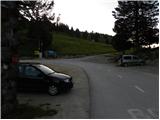
a) From the motorway Ljubljana - Jesenice take the exit Vodice, then continue to the first semaphore crossing in Vodice, where you turn left towards Cerkelj na Gorenjskem and Brnik. When you reach the main roundabout at Spodnji Brnik, continue driving in the direction of Cerkeliai and the ski resort Krvavec. At the end of Cerklje na Gorenjskem, leave the main road, which continues towards Velesovo and Visoke, and turn slightly right onto the road towards the ski resort Krvavec. Continue to the village of Grad, where the signs for Ambrož pod Krvavcem direct you to the right on a steep asphalt road (straight ahead to the lower station of the circular cable car to Krvavec and Štefanja Gora). When the steepness of the steep road eases slightly, you will come to a crossroads, where you will continue to the left in the direction of Ambrož pod Krvavcem (straight ahead to the settlements of Ravne, Apno and Šenturška Gora). A little further on, the road descends a little and then climbs over slopes that are sometimes quite scenic. Higher up, you reach Ambrož pod Krvavcem, where you pass the church of St Ambrose and the tourist farm Pr Ambružarju on the left. From the tourist farm the road passes into the forest and climbs through it to mountain pasture Jezerec, where there is a large parking lot.
b) From the motorway Jesenice - Ljubljana take the exit Kranj - East, then continue to Brnik, Komenda and Mengeš. When you reach the main roundabout at Spodnji Brnik, continue driving towards Cerkeliai and the ski resort Krvavec. At the end of Cerklje na Gorenjskem, leave the main road, which continues towards Velesovo and Visoke, and turn slightly right onto the road towards the ski resort Krvavec. Continue to the village of Grad, where signs for Ambrož pod Krvavcem direct you to the right on a steep asphalt road (straight ahead to the lower station of the circular cable car to Krvavec and Štefanja Gora). When the steepness of the steep road eases slightly, you will come to a crossroads, where you will continue to the left in the direction of Ambrož pod Krvavcem (straight ahead to the settlements of Ravne, Apno and Šenturška Gora). A little further on, the road descends a little and then climbs over slopes that are sometimes quite scenic. Higher up, you reach Ambrož pod Krvavcem, where you pass the church of St Ambrose and the tourist farm Pr Ambružarju on the left. From the tourist farm the road passes into the forest and climbs through it to mountain pasture Jezerec, where there is a large parking lot.
Path description:
At the end of the parking lot, where the road turns left and the road branches off to the right towards the nearby mountain pasture Jezerca, you will notice red mountain direction signs directing you straight onto the marked footpath in the direction of Kriška planina, Vrh Korena, Košutna, Kompotela and Mokrica, which ascends through the pastures of the aforementioned mountain pasture. After a short climb, cart track is reached, and we follow it to the left, crossing the slopes of Kržišče (1658 m). Cart track, which we are following, quickly splits into two parts, and we continue straight on the lower one. Transitionally, we get a nice view towards Kranj, the Škofjeloško hribovje and Storžič, and then the path starts to descend gently. A few more minutes of walking follow, and then we arrive at the parking lot at the lower part of Kriška mountain pasture.
Here the marked path continues slightly to the right towards Planina Koren, and we continue straight on to the other side of the valley, where we start to climb up the grassy slope towards the nearby hamlet. After a short climb we reach the Pr Florjan pasture, which we pass on the right. Above the pasture, gradually ascend a well-trodden, but less well-marked path, which begins to climb steeply up the grassy slope. Higher up, we reach the less well-trodden, partly grassy cart track, which we follow up to where it turns right. From this bend, continue straight ahead along a slightly less distinct path, which will take you up to Dom na Krvavcu in a few minutes.
At Dom na Krvavcu, we get onto a macadam road, and we start climbing up it towards the top of Krvavec and Zvoh. We continue to climb with beautiful views of the Storžič group and Kočna and Grintovec, and the path gradually leads us past the transmitter tower to the slightly steeper slopes of the top of Krvavec. Here the road lays down and crosses the western slopes of the summit, and then soon arrives at the Razor saddle.
At the saddle, an unmarked path with mountain pasture Koren joins us almost imperceptibly from the right (the path branches off from the marked path Kriška planina - mountain pasture Koren, just before mountain pasture Koren), We continue straight on to the nearby red direction signs, which are located just before the crossroads, where the marked trail to mountain pasture Dolga njiva branches off slightly to the left. Continue straight ahead here and start climbing steeply along the transport-rescue road, which is cobbled at the steepest part. The steepness gradually eases and the path leads to a reservoir, which is used for snowmaking on the ski slope. Go around the lake on the left, then continue slightly to the right and in a few minutes you will reach the top of the Zvoha peak. The stamp and the registration book are located slightly below the summit, along the marked path that continues towards Vrhu Korena.
From Veliki Zvoh continue on the marked path along the ridge called Jež-a. After a few minutes of walking, the relatively easy ridge trail starts to descend and leads us to a technically difficult place. With the help of a rope ladder, we climb up a steep and crumbly gully, which is exposed to falling rocks. The gully is short, but still long enough to cause a lot of problems for inexperienced mountaineers. The difficulties then disappear and the pleasant path, which mostly follows the ridge, is followed to two successive switchbacks. At the first one the path branches off to the right down to Mokrica and mountain pasture Koren, and at the second one the path branches off to the right up to Vrh Korena (1 minute). Then descend for about 15 minutes on a slope partly covered with dwarf pines. At the end of the descent, the path leads to the crossroads at Škrbini.
Here we continue straight in the direction of Kalški greben and Cojzova huts along the path which, after a few further steps, leads us to the next crossroads. Continue slightly to the left (Kalška gora and Cojzova koča to the right) along the path, which begins to climb gently up the slopes, which are becoming more and more scenic. The pleasant path, which can be very hot in the middle of the day, leads us first near a small ridge, and then gradually turns slightly more to the left and leads us from dwarf pines to beautiful meadows, where we will find various types of flowers. The wide slope we are walking on then narrows and the meadows are gradually replaced by rocks. Higher up, the path leads to the scenic main ridge, which is then followed to the summit, which is often full of sheep droppings.
During ski slope opening hours, walking on the part of the trail where it crosses the ski slope is forbidden.

Pictures:
 1
1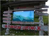 2
2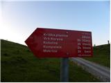 3
3 4
4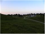 5
5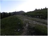 6
6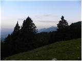 7
7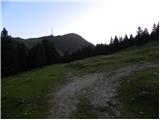 8
8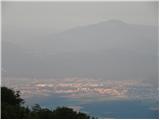 9
9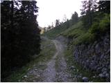 10
10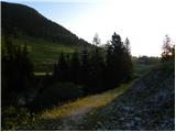 11
11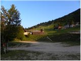 12
12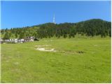 13
13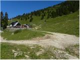 14
14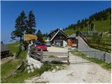 15
15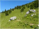 16
16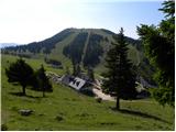 17
17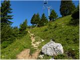 18
18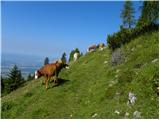 19
19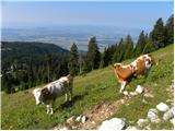 20
20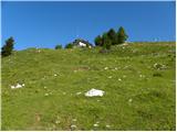 21
21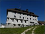 22
22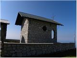 23
23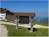 24
24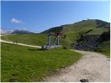 25
25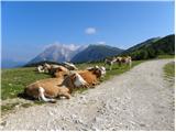 26
26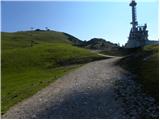 27
27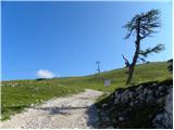 28
28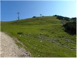 29
29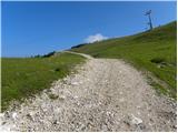 30
30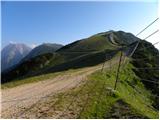 31
31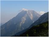 32
32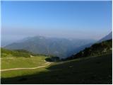 33
33 34
34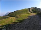 35
35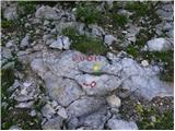 36
36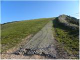 37
37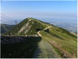 38
38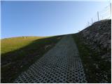 39
39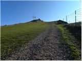 40
40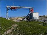 41
41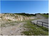 42
42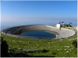 43
43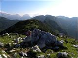 44
44 45
45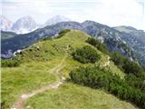 46
46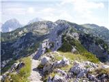 47
47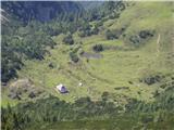 48
48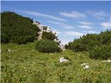 49
49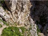 50
50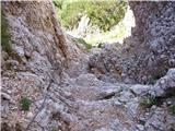 51
51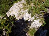 52
52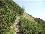 53
53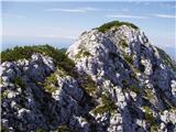 54
54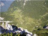 55
55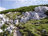 56
56 57
57 58
58 59
59 60
60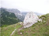 61
61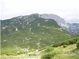 62
62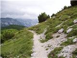 63
63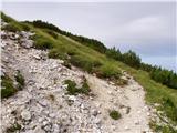 64
64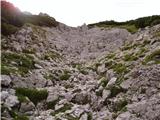 65
65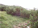 66
66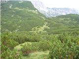 67
67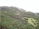 68
68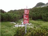 69
69 70
70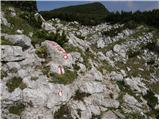 71
71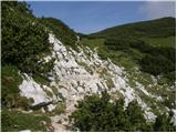 72
72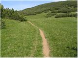 73
73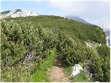 74
74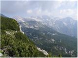 75
75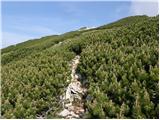 76
76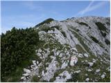 77
77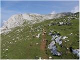 78
78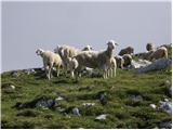 79
79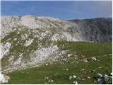 80
80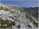 81
81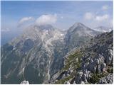 82
82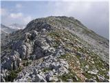 83
83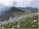 84
84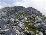 85
85 86
86
Discussion about the trail Planina Jezerca - Kalški greben (via Dom na Krvavcu and Zvoh)