Plaz Črlovec - Vrtaški vrh (upper path)
Starting point: Plaz Črlovec (920 m)
| Lat/Lon: | 46,4311°N 13,8784°E |
| |
Name of path: upper path
Time of walking: 3 h 50 min
Difficulty: partly demanding unmarked way, easy marked way
Altitude difference: 978 m
Altitude difference po putu: 1055 m
Map: TNP 1:50.000
Recommended equipment (summer): helmet
Recommended equipment (winter): helmet, ice axe, crampons
Views: 1.100
 | 1 person likes this post |
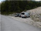
Access to the starting point:
Take the Mojstrana, then follow the signs for the Vrata valley. Follow the road through the Vrata valley to the 8 km marker, or a few 10 metres further on to the Črlovec landslide, where the route described above begins. Parking in the TNP area is only allowed in marked parking spaces.
Path description:
From the Črlovec avalanche, follow the road back a few 10 metres and then continue on a side road that continues north-eastwards. The path ahead leads past a lock, and after the lock an unmarked path branches off to the left, leading to Kukova špica and Njiviceam. Continue along the above-mentioned path (straight ahead mountain pasture Višek and Vrtaška planina on the path below) and start climbing up the right-hand side of the Veliki Črlovec landslide. A little higher up, the path leading over the avalanche joins us from the left (the start is at the Črlovec avalanche, directly from the road leading to Aljažev dom v Vratih, or where the starting point is indicated), and we continue to follow the best-beaten path, as there are quite a few forks, mainly shortcuts or longer bends in the overgrown path. Higher up, the trail passes onto the ridge formed between Veliki and Mali Črlovec, and the trail, which is a scenic route, returns to the forest, through which it climbs in a few more switchbacks. Still in the forest, at a height of about 1500 metres, you reach a crossroads, where you continue to the right (left, where you can see the inscription "KUK", Kukova spica, on a tree).
From the crossroads, we climb through the forest for a few minutes, then the path turns more and more to the right and quickly leads us to the Mali Črlovec avalanche, where we cross a few ravines. More caution is needed on the steeper parts, and the transition from the last, largest gully of Mali Črlovec is a bit awkward. The ascent through lane of dwarf pines is followed, where the path makes a small detour due to a landslide. There is a short crossing ahead and we arrive at a small crossroads where we continue left along the upper path (straight middle path leading to Vrtaška mountain pasture).
The path continues to climb mostly cross-climbing to the right, with the occasional serpentine. Higher up, we cross some more scree, and then the path stops climbing for a while as it continues with some short ascents and descents. After a longer traverse, where the track is relatively easy to follow all the time, the track starts to disappear. Continue slightly to the left and over the pasture fence to reach the lower edge of Njivice, where you will also see the PP marker (trail Planica - Pokljuka), and a few 10 steps further on, you will step onto the marked trail. Follow the marked path slightly left (right Vrtaška planina) and climb up the pleasant valley to the marked crossroads at Njivice.
From the crossroads continue right in the route Vrtaški vrh (straight ahead to Sleme), where the path over the grassy slope is at first not very easy to follow, but once you reach lane of dwarf pines, it is no longer difficult to follow. Climb for a few minutes through dwarf pines, then continue left at an unmarked crossroads and within a few minutes of further walking climb to Vrtaški vrh.
Starting point - crossroads for Kukova špica 1:50, crossroads for Kukova špica - Njivice 1:40, Njivice - Vrtaški vrh 0:20.
The description refers to the situation in 2018 (August), the pictures are from different periods.

Pictures:
 1
1 2
2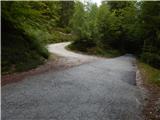 3
3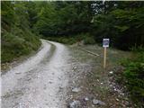 4
4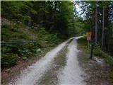 5
5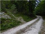 6
6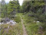 7
7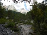 8
8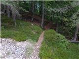 9
9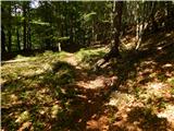 10
10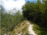 11
11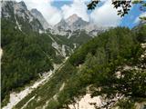 12
12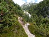 13
13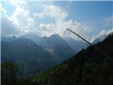 14
14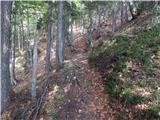 15
15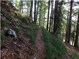 16
16 17
17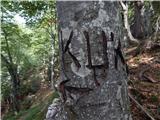 18
18 19
19 20
20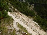 21
21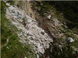 22
22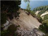 23
23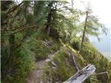 24
24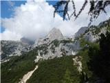 25
25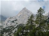 26
26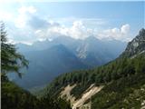 27
27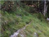 28
28 29
29 30
30 31
31 32
32 33
33 34
34 35
35 36
36 37
37 38
38 39
39 40
40 41
41 42
42 43
43 44
44 45
45 46
46 47
47 48
48 49
49 50
50 51
51 52
52 53
53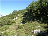 54
54 55
55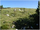 56
56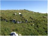 57
57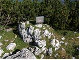 58
58 59
59 60
60
Discussion about the trail Plaz Črlovec - Vrtaški vrh (upper path)
|
| Jusk12. 11. 2019 |
V nedeljo 10.11 sem bil na tej poti,sem pa na okoli 1500m visine obrnil nazaj,ker nisem vec sledil poti,na tej visini je bilo okoli 10cm snega. Je pa lustna serpentinasta pot,se je bom lotil naprej spomladi ko bo brez snega 
|
|
|
|
| Jusk17. 10. 2020 |
pot je po sneženju prejšnjo nedeljo zelo poškodovana,približno od tam naprej ko je slika 16 in 17. Res veliko podrtega drevja po poti  težek sneg je naredil svoje
|
|
|