Podkanja vas / Wildenstein - Hochobir (Ojstrc)
Starting point: Podkanja vas / Wildenstein (511 m)
| Lat/Lon: | 46,5388°N 14,509°E |
| |
Time of walking: 5 h
Difficulty: easy marked way
Altitude difference: 1628 m
Altitude difference po putu: 1645 m
Map: Karavanke - osrednji del 1:50.000
Recommended equipment (summer):
Recommended equipment (winter): ice axe, crampons
Views: 1.800
 | 2 people like this post |
Access to the starting point:
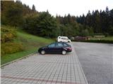
a) Take the Border crossing Ljubelj road into Austria, then turn right at Podljubelj / Unterloibl in the direction of the Hofer store. When you arrive in Borovlje / Ferlach, turn left at the junction a little after the railway line (there is a Eurospar shop to the right of the junction), and at the next junction, after a few 100 metres, turn right in the direction of Železna Kaple / Bad Eisenkappel. Towards Železna Kaple, drive to Podkanja vas / Wildenstein, where signs for Waterfall Podkanjski slap point you to the right. There is a short climb up a slightly narrower road, and then you arrive at a well-maintained parking lot (there is also a guest house and a museum at the starting point).
b) Cross the Border crossing Jezerski vrh into Austria, then after Železna Kapla turn left towards Klagenfurt and Borovlj / Ferlach. Continue along the main road towards Borovlje, and we drive to Podkanja vas / Wildenstein, where the signs for Waterfall Podkanjski slap direct us to the left. There is a bit of a climb up a slightly narrower road, and then we reach a nicely maintained parking lot (there is also a guest house and a museum at the starting point).
c) Drive into Podjuna, then follow the signs for Železna Kaplo / Bad Eisenkappel. After the village of Miklavčevo / Miklauzhof, leave the road towards Železna Kapla and continue right in the direction of Klagenfurt / Klagenfurt and Borovlj / Ferlach. Continue along the main road towards Borovlje, and we drive to Podkanja vas / Wildenstein, where the signs for Waterfall Podkanjski slap direct us to the left. There is a bit of a climb up a slightly narrower road, and then we reach a nicely maintained parking lot (there is also a guest house and a museum at the starting point).
Path description:
From the starting point, continue along the wide tourist trail in the direction of Waterfall Podkanjski slap and Obirje. At first, the path climbs in a few serpentines, then after a short scenic part, the path turns into a forest and narrows a bit. After a few minutes of further walking, the marked path to Obir branches off from the wide path to the right, and we continue straight ahead and after a minute of further walking we reach a well-maintained lookout point at the Podkanjski waterfall.
From the lookout we return to the last crossroads, and then continue along the marked path towards Obir. From the point where we leave the wide tourist path, we start to climb steeply, and in steeper places we are helped by steps and sometimes by ropes (not difficult in dry conditions). After a few minutes, the steepness of the slope eases, and the path turns to the right, where it first crosses the cart track, and a little further on leads us to a forest road, which we follow to the left. Follow the road until it bends to the right, at the beginning of which a marked footpath continues straight ahead. Continue along the forest road, which is also occasionally crossed. There is a slightly longer climb through the forest, where you reach a marked crossroads at a small level.
From the crossroads, follow the path to the left (Jagovčeva mountain pasture to the right, with a possible ascent to Mali Obir, or descent to the Borovnica dam lake), which continues along a small valley, and a little higher up, return to the road, which is followed to the left, and quickly reach the abandoned Hofovška mountain pasture.
Above mountain pasture we finally leave the road, and we continue to climb up the increasingly steep path. Higher up, we reach a wooded ridge where the path from the village of Reberca / Reehberg joins from the left.
We continue to the right along a fairly steep path which crosses a pasture fence a little further on and then starts to disappear in the vast pastures. Cross the pasture and carefully follow the few signs, and when you return to the forest, join the better-beaten path leading from or past Eisenkappler Hutte / Eisenkappler Hütte.
Continue in the direction of Obir and climb up some serpentines above the forest boundary. Some easy walking follows and the trail leads to the unmarked summit of Kraguljše, from where a fine view opens up. The following gently sloping path leads us first past a small swamp, then gradually begins to climb moderately. Higher up, the path becomes a little steeper and, with beautiful views of the surrounding mountains and valleys, leads us to the ruins of the former Rainer Schutz Hütte hut, located at 2040 metres. From the ruins we climb in a few minutes to the main ridge of Obirje, where we continue to the right (Kravji vrh and the Šajda saddle on the left). The ascent follows slightly to the right of the ridge, and we stick to the marked path and do not take shortcuts, as the German-language inscription warns us. The moderately steep path then leads us within a few minutes of further walking to Hochobir, the highest peak of Obir.
Description and pictures refer to the situation in 2017 (August).

Pictures:
 1
1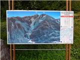 2
2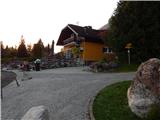 3
3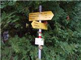 4
4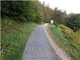 5
5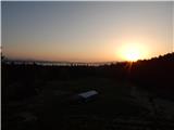 6
6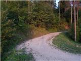 7
7 8
8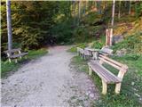 9
9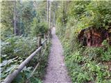 10
10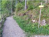 11
11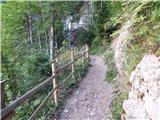 12
12 13
13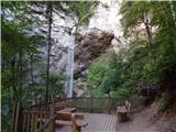 14
14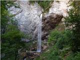 15
15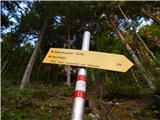 16
16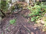 17
17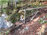 18
18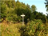 19
19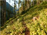 20
20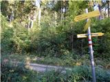 21
21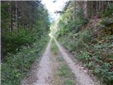 22
22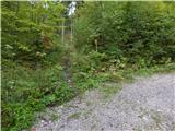 23
23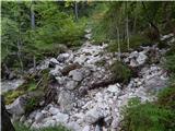 24
24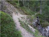 25
25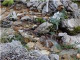 26
26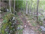 27
27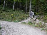 28
28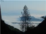 29
29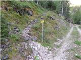 30
30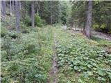 31
31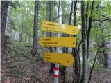 32
32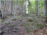 33
33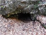 34
34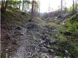 35
35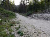 36
36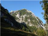 37
37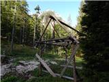 38
38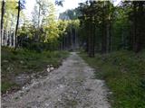 39
39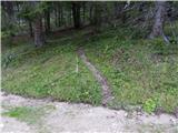 40
40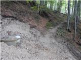 41
41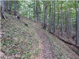 42
42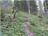 43
43 44
44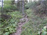 45
45 46
46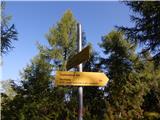 47
47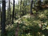 48
48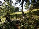 49
49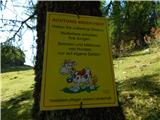 50
50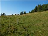 51
51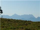 52
52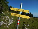 53
53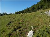 54
54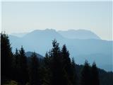 55
55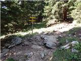 56
56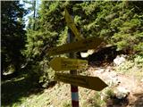 57
57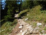 58
58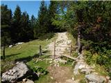 59
59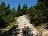 60
60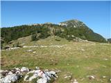 61
61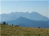 62
62 63
63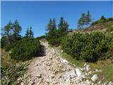 64
64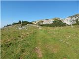 65
65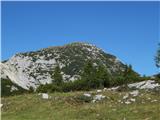 66
66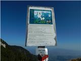 67
67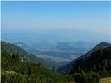 68
68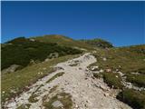 69
69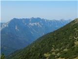 70
70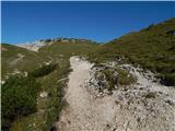 71
71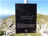 72
72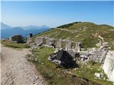 73
73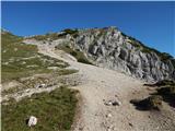 74
74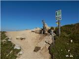 75
75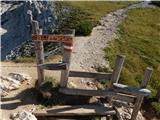 76
76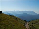 77
77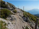 78
78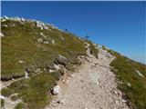 79
79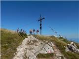 80
80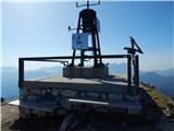 81
81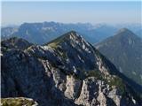 82
82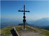 83
83
Discussion about the trail Podkanja vas / Wildenstein - Hochobir (Ojstrc)
|
| jax16. 09. 2017 |
S te strani je v resnici lepši dostop na Obir čez Jagovčevo sedlo in potem po neuradno markirani poti po severnem grebenu. Nekaj poplezavanja, ampak nič posebej težkega. Sestop pa potem tukaj. Lepa krožna tura :-)
|
|
|
|
| Domch10. 10. 2019 |
V torek sem opravil vzpon in sestop po tej poti. Do vrha nekje 3 ure dobre hoje. Nekaj zarašenih delov na poti in na vrhu Krtolovca veliko podrtih dreves na poti, a z malo iznajdljivosti se da. Ob spustu sem se odločil, da poskusim še na Jagovčevo planino in mogoče Mali Obir, pa se je začetno veselje lahkega vzpona po buldožerski cesti hitro končalo, saj se cesta nekaj malega pod sedlom konča. Markacij ni, ker je veliko podrtega gozda. Malo sem poskusil kar direktno čez gozd in trave gor, a potem sem se odločil, da ne tvegam. Pri Hoffmanovi koči sem pregledal vse za markacijami, a zaradi podrtih dreves in nove ceste le teh ni nikjer.
|
|
|
|
| bojank6. 12. 2019 |
Za vzpon sem včeraj porabil točno 5 ur. Nekaj časa sem izgubil na višini cca 1200 m, kjer je vetrolom prevrnil precej dreves in je prehod zoprn. Najbrž se da ta del poti obhoditi desno po gozdni cesti? Hoja po grebenu pa je bila res pravljična - 20-30 cm shojenega snega, sonce, brezvetrje, jasni razgledi na vse strani.
|
|
|