Podkraj - Streliški vrh (Hrušica) (east path)
Starting point: Podkraj (798 m)
| Lat/Lon: | 45,8639°N 14,063°E |
| |
Name of path: east path
Time of walking: 1 h 30 min
Difficulty: easy marked way
Altitude difference: 468 m
Altitude difference po putu: 500 m
Map: Nanos 1:50.000
Recommended equipment (summer):
Recommended equipment (winter): ice axe, crampons
Views: 9.328
 | 1 person likes this post |
Access to the starting point:
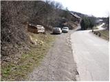
From Logatec, drive towards Idrija. Just after the village Kalce you will see a road heading left towards the villages Podkraj and Col. Take this rather winding road and follow it to the village Podkraj. Park in the small parking lot on the roadside near the signpost for the end of the village Podkraj (there are also mountain direction signs by the parking lot).
From Primorska, take the first road to Col, then continue driving towards Podkraj village. When the road leads to the beginning of the village, do not continue right into the village, but continue along the upper left road, which bypasses the village centre. Near the sign for the start of Podkraj, park in a small parking area by the road.
Path description:
From the starting point, take the ascending cart track in the route Sveti Duh and Javornik. "After a few steps, Cart track turns right and then climbs transversely across a grassy slope. Higher up, we pass into a short lane of forest, after which the path leads us to a marked crossroads, where we continue to the right in the direction of Javornik (left Sv. Duh and Križna gora). The path continues to climb gently along the edge of the forest, and then leads us to Isaac's hut (a small emergency bivouac), which is located slightly to the left of the path.
Slightly above the bivouac, you will reach a crossroads of several kolovozov. Continue straight ahead (direction Javornik) along the partly stony cart track and follow it for a few minutes, then at a small crossroads (marked) continue slightly right along the grassy cart track, which leads us past an old military bunker. Go around the bunker on the left and the path leads to the edge of a pasture fence. Continue along the grazing fence for a while and then the path makes an orientation lop. The path turns right downhill, so to speak in the direction from which you are coming, and then after a short descent left into the forest. Next, we enter a dense forest and climb moderately for a while on the rather overgrown cart track. There is a short descent and the path leads to a dirt road, which you follow to the left. The road soon leads us out of the forest onto a vast grassy slope, in the middle of which we come to a marked crossroads.
Continue right in the direction Javornik, following the footpath, which first climbs gently past a small sign on a tree and then begins to climb steeply over relatively exposed grassy slopes. Higher up, the path flattens out and leads to a larger plain to the south of Streliška vrh. Continue slightly to the left, along a marked footpath, which descends to a small stream, beyond which you will find a pleasant bench. Crossing the eastern slopes of the aforementioned peak, the path then leads to a small pass.
On the right side of the prevala we see a small lookout tower or pulpit, and we continue left (straight down Javornik) along a less well-trodden but well-marked footpath, which begins to climb steeply. The path quickly passes through lane of bushes into forest and climbs even steeper. After a short climb, you reach a beautiful and slightly exposed viewpoint (view of Javornik and Vodice), and then the trail returns to the forest, where it then continues all the way to Streliškega vrh.

Pictures:
 1
1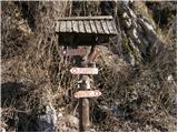 2
2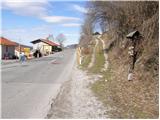 3
3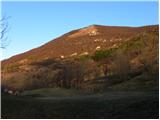 4
4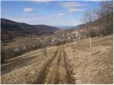 5
5 6
6 7
7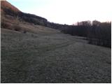 8
8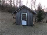 9
9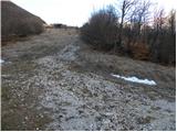 10
10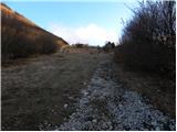 11
11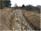 12
12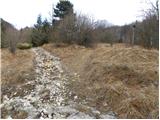 13
13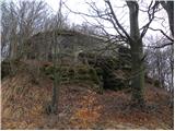 14
14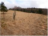 15
15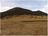 16
16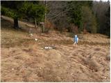 17
17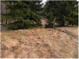 18
18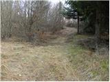 19
19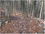 20
20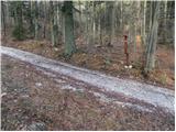 21
21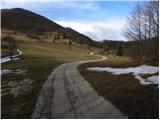 22
22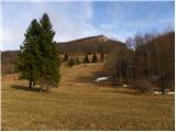 23
23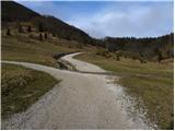 24
24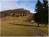 25
25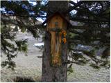 26
26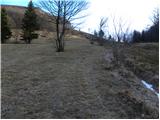 27
27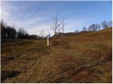 28
28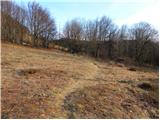 29
29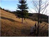 30
30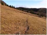 31
31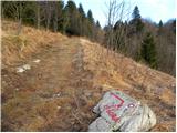 32
32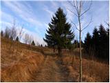 33
33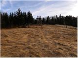 34
34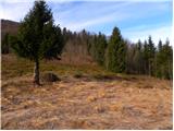 35
35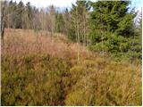 36
36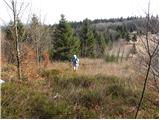 37
37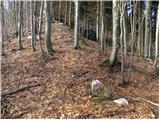 38
38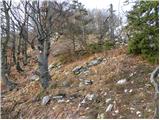 39
39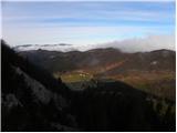 40
40 41
41 42
42 43
43
Discussion about the trail Podkraj - Streliški vrh (Hrušica) (east path)
|
| Am Shagar29. 06. 2015 |
Včeraj na redko obiskanem vrhu. Pot na Javornik je v dobrem stanju. Do odcepa na makadamski cesti brez problemov in tudi naprej do začetka "vzhodne poti". Vzpon na začetku strm. Potrebno se je izgoniti podrtemu drevju (verjetno posledica zadnjega žledoloma; ne tistega velikega lani). Ko se strmina položi pa bujna podrast. Pot je prepoznavna samo na nekaterih mestih. Pomagala sva si z že zbledelimi markacijami za približno smer. Spust nazaj odsvetujem. Na vrhu je sedaj postavljen stolp za namen brežične wi-fi komunikacije. Podrli so tudi nekaj drevja, zato je razgled boljši proti Julijcem s Trgilavom. "Zahodne poti" nisem našel razen dveh markacij na stebru in bližnjemu drevesu. K sreči spust ni predstavljal posebnih orientacijskih izzivov, saj se vidijo nadaljne vzpetine. Spust bolj ali manj naravnost dol do objekta v gozdu. Nato po gozdni cesti, ki pripelja od objekta do križišča. Tam levo na gozdno cesto po kateri pridemo do odcepa, kjer smo šli z nje desno navkreber. Od tam naprej pa po označeni poti na izhodišče. Z vrha vodi tudi trasa, kjer so napeljali kabelj za stolp, vendar kam pripelje nisem niti raziskovala. Torej je sedaj bolj neoznačena steza oz. brezpotje kot označena pot, če se kdo odloči za vzpon. Pa previdno in srečno.
|
|
|