Poldov rovt (Vrata) - Dovški križ (via Brinje)
Starting point: Poldov rovt (Vrata) (941 m)
| Lat/Lon: | 46,4216°N 13,86289°E |
| |
Name of path: via Brinje
Time of walking: 5 h 45 min
Difficulty: very difficult unmarked way
Altitude difference: 1601 m
Altitude difference po putu: 1601 m
Map: Triglav 1 : 25.000
Recommended equipment (summer): helmet
Recommended equipment (winter): helmet, ice axe, crampons
Views: 16.213
 | 2 people like this post |
Access to the starting point:
Take the Mojstrana, then follow the signs for the Vrata valley. Continue through the Vrata valley, and about 100 metres before the 10 km road marker, you will see cart track branching off to the right perpendicular to the main road. This is the start of the route described. The marked parking area where parking is allowed is about 500 metres further along the main road.
Path description:
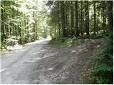
Take the cart track sign, which leads into the wods and then past a small house, where you continue slightly to the left on a footpath. Go through the forest and climb slightly to the left towards the Red Brok. Shortly before the stream, you will reach a crossroads where you turn right onto the path over Brinje. At the crossroads there is a cairn sign, and on a tree there is a carved face and the letter L. The path then begins to climb steeply through the forest and then turns slightly to the right and slowly leads us onto steep grassy slopes. We then spend some time in the keys climbing up the steep slopes towards Juniper's Head. At Brinova Glava (1571m) the path turns slightly to the left and the slopes become less steep again. Here, a path also branches off to the right, leading to the top of Brinova Glava. The path continues through increasingly sparse forest and occasionally climbs up a grassy slope. This path then leads us to the scree slopes below Kopice. Here we first climb on the scree, but when the path turns left onto the wide scree, it is better to continue on the grass along the right-hand side of the scree. Soon the path will also turn left and cross the scree. Then climb up the grassy slopes on the left side of the scree for a while. Towards the end, the path turns slightly towards Šplevta on the left side of the valley and then climbs along the scree all the way to the saddle between Dovški Križ and Šplevto. At the saddle, turn right onto a scree slope from which, after a short climb, turn right and cross a steep rocky slope. When you reach the grassy slopes, turn left uphill. On this part of the path you will notice several less well-trodden paths, all of which are marked with cairns. In dry weather it is best to take the rightmost one, which climbs up a grassy slope. At the end, the path turns left towards the ravine. Climb up a short, not to steep gully and at the end of the gully turn sharp right. If you had continued straight on at the end of the ravine you would have only reached the head of Dovško Križ. When you turn sharp right, the track leads you to the steep eastern slopes of the peak. Cross the slopes to the north and the most challenging part follows. The steep slope descends into a narrow notch. The descent is very short, but caution is needed as there is usually a lot of sand on the rocks. From the notch, climb up the other side and then cairn directs you to the left onto the ridge. The better-maintained path goes straight ahead here, but if you want to avoid the rubble in the last part of the path, it is better to climb up to the ridge from here. The ridge is then no longer difficult to walk along and soon you reach a very scenic summit.
The ascent of Dovški Križ is suitable for mountaineers who have no problems with climbing grade 1.
Despite the fact that there is a path leading to the top (often poorly visible), orientation is still difficult.

Pictures:
 1
1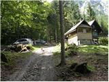 2
2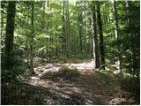 3
3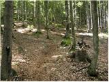 4
4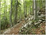 5
5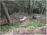 6
6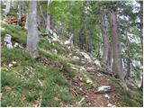 7
7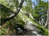 8
8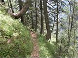 9
9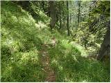 10
10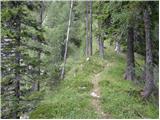 11
11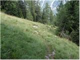 12
12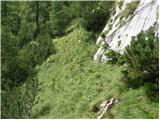 13
13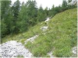 14
14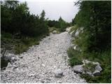 15
15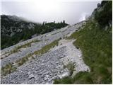 16
16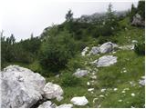 17
17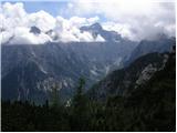 18
18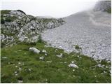 19
19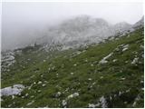 20
20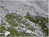 21
21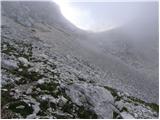 22
22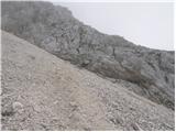 23
23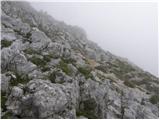 24
24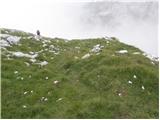 25
25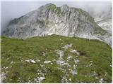 26
26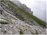 27
27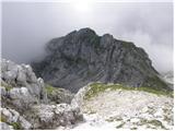 28
28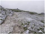 29
29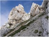 30
30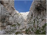 31
31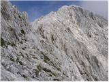 32
32 33
33 34
34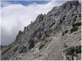 35
35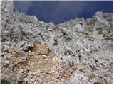 36
36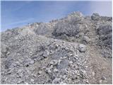 37
37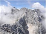 38
38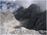 39
39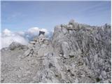 40
40
Discussion about the trail Poldov rovt (Vrata) - Dovški križ (via Brinje)
|
| gordol29. 08. 2013 |
Ta pot je super za gor, dol pa potem mimo bivaka preko dolgih melišč, dobra kombinacija! Pa oči na peclje za možiclje.
|
|
|
|
| katja8717. 11. 2015 |
V ponedeljek (9.11.2015) sva se čez Brinje odpravila na Dovški križ, nato pa skočila še na Šplevto in mimo bivaka II navzdol v dolino. Dan je bil prekrasen, tura pa norooo dobra  Sneg je bil le na škrbini pred vrhom, ampak ni povzročal kaj dosti težav  Slike in opis poti na Planinskem društvu Matica Murska Sobota: http://www.pdmaticams-drustvo.si/ (glej: Album slik!)
|
|
|
|
| Potohodnik9. 06. 2016 |
Ta pot je prijetna za navzgor; tako sem storil jaz. Za navzgor čez melišča more biti zelo težko in naporno. Sam vzpon ni tako tehnično težaven - pravzaprav razen škrbine ni potrebno plezati, pa še tam je enostavno. Glede orientacije pa je treba biti kar pretanjen; počasi.
Kar veselo na pot, ko se stopi sneg!
|
|
|
|
| bo_zl9. 09. 2022 17:55:43 |
je kdo v kratkem bil gor. Sledljivost poti. Namen imam iti v sredo. Če bo vreme seveda. Hvala za odgovore.
|
|
|
|
| rensul11. 09. 2022 20:46:52 |
Sem bil danes čez Brinje in dol mimo bivaka,po meliščih.V zgornjem delu,od Šplevte naprej,oči na peclje,so povsod v pomoč možici,vendar se jih od spodaj slabo vidi.
|
|
|
|
| bo_zl15. 07. 2023 17:35:18 |
Pa je le uspelo. Čez Brinje gor, tu sem na travah malo pred meliščem pod Šplevto malo po svoje hodil, nato le ujamem pot pod meliščem. Od Šplevte naprej na travnatem delu pa zgodbo ponovim, ampak brez težav pridem do grape. Naprej pa ni bilo več težav. Tudi spust v škrbino ni nek bav bav. Mimo bivaka v dolino. Bivak čist, urejen, skratka lep od zunaj in znotraj. Meliščni expres v dolino, le sonce je že močno žgalo. Zato res priporočam gor čez Brinje dol mimo bivaka.
|
|
|