Poljšica pri Gorjah (Zatrata) - Hotunjski vrh (on footpath)
Starting point: Poljšica pri Gorjah (Zatrata) (660 m)
| Lat/Lon: | 46,3711°N 14,0694°E |
| |
Name of path: on footpath
Time of walking: 1 h 30 min
Difficulty: easy unmarked way
Altitude difference: 447 m
Altitude difference po putu: 475 m
Map: TNP 1:50.000
Recommended equipment (summer):
Recommended equipment (winter):
Views: 3.340
 | 1 person likes this post |
Access to the starting point:
a) Take the Bled, then continue driving in the direction of Pokljuka. When you arrive at Zgornje Gorje, turn left at the crossroads by the church in the direction of Poljšice. Continue along the narrow road past the church, then turn right at the nearby crossroads after the chapel. Just a little further on, at the next crossroads, go left in the direction of Poljšice, and when you arrive in the village, go right at the first crossroads, and then left after 10 metres in the direction of the hamlet of Zatrata. Park in a suitable place at the beginning of the hamlet, where you will see signs for the Rikli trail, which branches off the road to the right.
b) Leave the Gorenjska motorway at exit Lipce, then follow the signs for Kočna and later Spodnje Gorje. At Spodnje Gorje join the road from Bled, and we continue in the direction of Pokljuka. When you reach Zgornje Gorje, turn left at the crossroads by the church in the direction of Poljšice. Continue along the narrow road past the church, then turn right at the nearby crossroads after the chapel. Just a little further on, at the next crossroads, go left in the direction of Poljšice, and when you arrive in the village, go right at the first crossroads, and then left after 10 metres in the direction of the hamlet of Zatrata. Park in a suitable place at the beginning of the hamlet, where you will see signs for the Rikli trail, which branches off the road to the right.
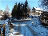
Path description:
From the starting point, where there is also a small crossroads of several roads, continue in the direction of Rikli's path, whose signs direct us slightly right onto a narrow macadam road that climbs gently along the pasture fence. Initially, a fine view opens up towards Karawanks, then the road turns left and, after a short climb, descends gently. In a small valley, leave the minor road and continue climbing left on cart track towards the Rikli trail. Continue on cart track, which continues through the forest, following the signs for the Rikli Trail at the crossroads. Higher up, we get a nice view of Kamnik Savinja Alps, and the path then returns to the forest and gradually leads to a wooded ridge. Follow the ridge, initially climbing, then descending to the forest road, which you follow in the direction mountain pasture Rčitno.
The Knafelč markings also accompany us as we continue along the road. The road, which is quite winding and follows a small valley for a while, turns right higher up and becomes steeper and more and more like a wide cart track. During the ascent on the worse road, we get a passing glimpse of some views in the direction of Galetovec, but when the path returns to the dense forest, it also splits.
Continue slightly right on the ascending cart track (straight mountain pasture Rčitno - 5 minutes), which bypasses mountain pasture Rčitno on the right. During the cross-climb, we get some views towards the above-mentioned mountain pasture, while cart track soon turns into a dense forest, and at the nearby fork we choose the right cart track, which is further on quite exposed from the torrential waters. Follow the cart track until you reach a dirt road, which you follow to the right. Follow the road for a few minutes, then when it starts to descend, leave it (leave the road at the part where it starts to descend, or a minute further on at the ruins of the former Posavc homestead) and continue left into the woods, where after a minute or two you will reach the former ski slope of the Zatrnik ski resort.
Continue up the former ski slope, which turns left, and then, with increasingly beautiful views, you will reach the top station of the abandoned ski lift, from where it is only a short 10-step walk along the ridge to the top of Hotunjski vrh. Description and figures refer to the situation in 2017 (January).

Pictures:
 1
1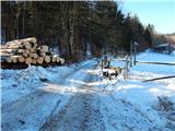 2
2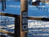 3
3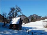 4
4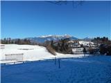 5
5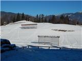 6
6 7
7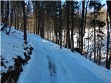 8
8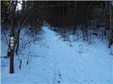 9
9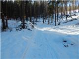 10
10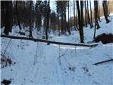 11
11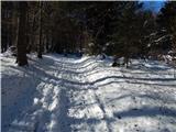 12
12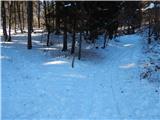 13
13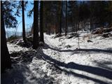 14
14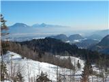 15
15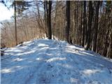 16
16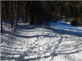 17
17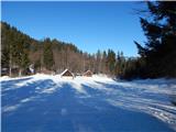 18
18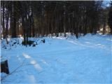 19
19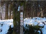 20
20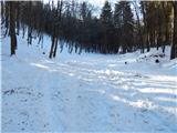 21
21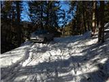 22
22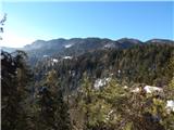 23
23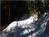 24
24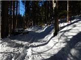 25
25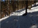 26
26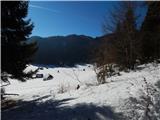 27
27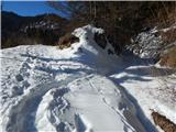 28
28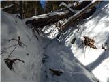 29
29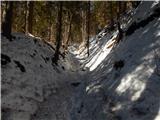 30
30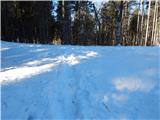 31
31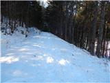 32
32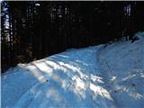 33
33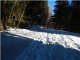 34
34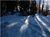 35
35 36
36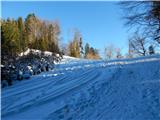 37
37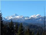 38
38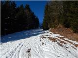 39
39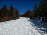 40
40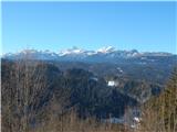 41
41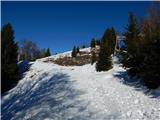 42
42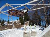 43
43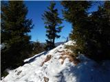 44
44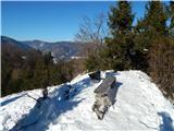 45
45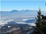 46
46 47
47
Discussion about the trail Poljšica pri Gorjah (Zatrata) - Hotunjski vrh (on footpath)
|
| čomolungma18. 05. 2020 |
Vremenska napoved je obljubljala popoldansko razjasnitev in v pričakovanju lepih razgledov s Hotunjskega vrha, sem se včeraj odločila za to pot. V prvem delu se je potrebno kar dobro ozreti za oznakami Riklijeve poti. Po prihodu na cesto je pot markirana in ni težav; le te pa se pojavijo pri planini Rčitno. Nikakor mi ni uspelo najti odcepa, kolovoz v desno pa je kmalu postal slepa ulica  Po nekaj tavanjih okoli planine in ugotovitvi, da razgledov itak ne bo, sem dokončno obupala. Pa drugič 
|
|
|
|
| bumbi19. 05. 2020 |
Do Himalaje je še veliko razcepov, eni imajo izhod, v nasprotnem primeru se pač vrneš. In spet poskusiš in tudi mali HV lahko postane zahteven hrib. Razgled z vrha je vreden truda.
|
|
|
|
| bumbi19. 05. 2020 |
Do Himalaje je še veliko razcepov, eni imajo izhod, v nasprotnem primeru se pač vrneš. In spet poskusiš in tudi mali HV lahko postane zahteven hrib. Razgled z vrha je vreden truda.
|
|
|
|
| Zemlja19. 05. 2020 |
Ta odcep je na videz na začetku kot malo bolj zapuščen kolovoz, potem pa bolj kot vlaka. Je pa takoj ob desnem robu planine Rčitno.
|
|
|