Starting point: Praproče (559 m)
| Lat/Lon: | 46,0614°N 14,2879°E |
| |
Time of walking: 35 min
Difficulty: easy marked way
Altitude difference: 149 m
Altitude difference po putu: 170 m
Map: Ljubljana - okolica 1:50.000
Recommended equipment (summer):
Recommended equipment (winter):
Views: 7.131
 | 3 people like this post |
Access to the starting point:
From Horjul or Dobrova, drive to Polhov Gradec, then continue to Gorenjska vas. Just after Polhovi Gradec, in Briše, turn right and continue towards the village of Praproče (the exit from the main road is marked and is located by the bus stop). Continue along the narrow and steep road, which quickly leads to the village of Praproče. Follow the road to the upper part of the village, where you will come to a small crossroads at which you will see a cross and mountain direction signs.
There are no suitable parking places at the starting point. You can park a little lower down in a suitable place along the road, or drive a little further and then park in a suitable place along the road.
Path description:
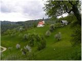
From the starting point, follow the initially still asphalted road in the direction of Mali vrh. The road first gently descends, then leads us to a grassy ridge, from which we have a beautiful view towards Koreno and Črnemu vrh. Continue along the ascending road, which leads us past a hamlet of a few houses to the edge of the forest.
After a few minutes of further walking, the road splits into two parts. The right one leads to Setnik, and we continue on the slightly left one, which after a short climb leads us to a water supply building, after which we join the unmarked path from St Martin's Church.
Continue right and ascend the often rather muddy cart track, which is followed to the top of the grassy slope of Little Peak. Once out of the forest, the summit is only a short walk away along an increasingly scenic path.
Pictures:
 1
1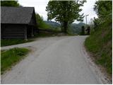 2
2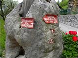 3
3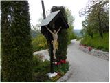 4
4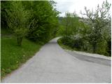 5
5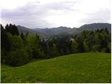 6
6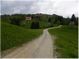 7
7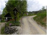 8
8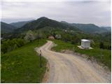 9
9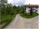 10
10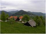 11
11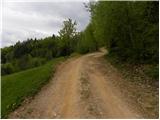 12
12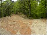 13
13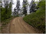 14
14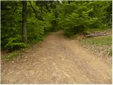 15
15 16
16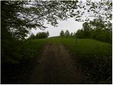 17
17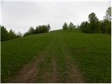 18
18 19
19 20
20
Discussion about the trail Praproče - Mali vrh
|
| Guest3. 12. 2007 |
MT-Pot ni naporna vendar nekoliko blatna.Razgledi čudoviti. Priporočam nadaljevanje poti proti Setniku (pr Žul)in srednjem vrhu (ca. + 2h)po označeni poti.(PPP)
|
|
|
|
| grega_p28. 02. 2010 |
Res je, da blato zaznamuje pot, še posebej zdaj v talilnem času leta, vendar priporočam vsem, ki hočejo videti Polhograjce z drugega zornega kota.
|
|
|
|
| rokeg15. 02. 2023 18:23:46 |
A kdo ve, kje je Veliki vrh (piše na tabli na 3.sliki)? Piše 788 m, kar mi deluje, kot da je eden izmed kot Klešča?
|
|
|
|
| gamsek122. 02. 2023 16:53:43 |
Tega Velikega vrha (788 m) menda sploh ni, ampak se tako imenuje le kmetija zahodno od Malega vrha (708 m), na koti 788 m pa je Klešč.
|
|
|
|
| rokeg22. 02. 2023 21:34:25 |
Zanimivo. Hvala za odgovor gamsek1.
|
|
|
|
| bumbi25. 02. 2023 13:57:05 |
Na karti Polhograjsko hribovje z okolico, ki jo je izdalo Turistično društvo Polhov Gradec, sta dve imeni napisani pri koti 788 metrov: Klešc in Veliki vrh v oklepaju. Severno se nahajati dve kmetiji. Ena je Zgornji Velkovrh in druga Spodnji Velkovrh.
|
|
|
|
| rokeg28. 02. 2023 22:14:28 |
bumbi, hvala za pojasnilo.
|
|
|