Praproče - Polhograjska Gora (Sveti Lovrenc) (steep path)
Starting point: Praproče (549 m)
| Lat/Lon: | 46,0614°N 14,2923°E |
| |
Name of path: steep path
Time of walking: 45 min
Difficulty: partly demanding marked way
Altitude difference: 275 m
Altitude difference po putu: 280 m
Map: Ljubljana - okolica 1:50.000
Recommended equipment (summer):
Recommended equipment (winter): ice axe, crampons
Views: 8.284
 | 3 people like this post |
Access to the starting point:
First, drive to Polhov Gradec (to get here from Horjul or Dobrova), then continue driving to Gorenjska vas. In the village of Briše, turn right in the direction of Praproč and continue along a narrow and relatively steep road. Shortly after the chapel, just visible on the left side of the road, you will come to a large trestle next to which you will see the mountain direction signs for Polhograjska Gora. There are no parking spaces at the starting point.
Path description:
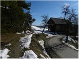
On and next to the trestle we see signs for Goro, which direct us to the right to the wide and at first moderately steep cart track. Cart track, or the worse road, soon becomes completely flat and leads us to a small crossroads where we continue to the right in the direction of Sv. Lovrenec. Cart track then narrows a little further and then leads to grassy slopes where it gradually turns more and more to the right. After a short climb, enter the forest, where you join the path from a slightly lower starting point. Continue straight on the marked path - cart track, which joins the forest road at a slightly higher level.
Continue left in the direction of the difficult path (left down the Praproče road, straight ahead St. Lovrenc easier approach) and continue the ascent on the increasingly steeper path. The path, which mostly passes through a pine forest, climbs steeper and crosses a short exposed slope (especially in wet conditions there is a high risk of slipping). Higher up, the path gently descends and passes onto the ridge of Polhograjska Gora (Polhograjska Gora). Further on, the path passes out of the forest and, after a short further climb, leads to the walls of the Church of St. Lawrence. Here, with the help of a few steps and handholds, we climb over the walls and reach the summit.

Pictures:
 1
1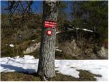 2
2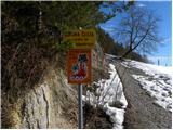 3
3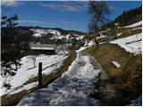 4
4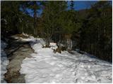 5
5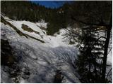 6
6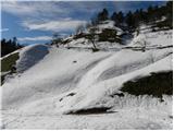 7
7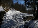 8
8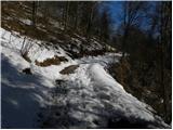 9
9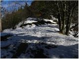 10
10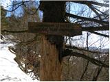 11
11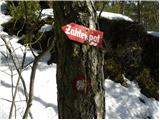 12
12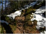 13
13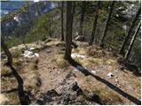 14
14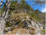 15
15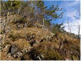 16
16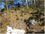 17
17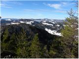 18
18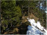 19
19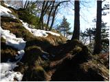 20
20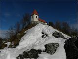 21
21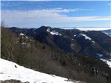 22
22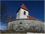 23
23 24
24
Discussion about the trail Praproče - Polhograjska Gora (Sveti Lovrenc) (steep path)
|
| VanSims12. 05. 2012 |
Iz glavne ceste(kake 4 km po Polhovem Gradcu) se zavije LEVO potem pa naprej po strmi in ozki poti ter mimo kapelice.
|
|
|
|
| ljubitelj gora13. 05. 2012 |
Ko se peljete v smeri Praproč boste na enem ovinku pred vasjo vidli smerokaz tam je za parkirat, ker v vasi skoraj ni možno parkirat.
|
|
|
|
| VanSims13. 05. 2012 |
@LG: a potem pridemo na tisto križišče(kjer se odcepi 'zahtevna' pot) po tisti poti, ki je v opisu 'levo navzdol Praproče po cesti'? V tem primeru potem bistveni del poti ni okrnjen.
Sicer pa pot komaj zasluži oznako 'delno-zahtevna'. Malo je treba paziti tam na izpostavljenem mestu oz. parkrat malo pošlatati skalo, to pa je vse. Pot je gotovo lažja kot npr. Westrova na Šmarno goro, ki je na teh straneh tudi označena kot 'delno-zahtevna'
|
|
|
|
| Holcar223. 03. 2013 |
Danes na Lovrencu po "delno zahtevni" poti. Razgleda zaradi vremena danes ni bilo, prav tako ne kaj dosti planincev ali snega. Slednjega je še največ na severnih pobočjih, nekje do 10 cm, vendar bo že jutri zapadel nov. Pot ni za vrtoglave, vendar je priročno razgibavanje in trening za zahtevnejše poti, in to v neposredni bližini glavnega mesta. Na tej poti je bilo danes nekaj otrok, še skoraj malčkov, kar se mi zdi od staršev nespametno. Karkoli, pot je časovno krajša in zanimivejša od tiste po makadamski cesti, in jo priporočam vsem tistim, ki jim trenutne razmere ne pustijo kam višje. V suhem seveda.
|
|
|