Rakov Škocjan - Veliki Javornik (Javorniki)
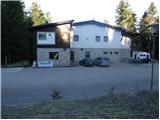
Starting point: Rakov Škocjan (550 m)
| Lat/Lon: | 45,7886°N 14,2979°E |
| |
Time of walking: 2 h
Difficulty: easy marked way
Altitude difference: 718 m
Altitude difference po putu: 718 m
Map: Snežnik 1:50.000
Recommended equipment (summer):
Recommended equipment (winter): ice axe, crampons
Views: 24.360
 | 1 person likes this post |
Access to the starting point:
a) From the Ljubljana - Koper motorway, take the Unec exit and continue to Unco. At Unec, the signs for Postojna and Rakov Škocjan direct you to the right, to the road that continues a little further directly along the motorway. After a few kilometres from Unec, you will reach a crossroads where the signs for Rakov Škocjan direct you to the left onto a dirt road, which will then take you to Hotel Rakov Škocjan.
b) From the Koper - Ljubljana motorway, take the Postojna exit and then continue along the old road towards Logatec. When Postojna ends, turn right at the hamlet of Ravbarkomanda in the direction of Unec, Rakek and Rakove Škocjan. After crossing the railway line over the overpass, continue left on the main road and then cross over the underpass under the motorway to the other side of the motorway. Drive along the motorway for a while and then the signs for Rakov Škocjan will direct you to the left onto a dirt road, which will then lead you to the Hotel Rakov Škocjan.
c) First drive to Cerknica, and from there continue to Unec. At Podskrajnik, turn left towards Rakov Škocjan, Zelš and the industrial zone. At an unmarked crossroads in the industrial zone, continue straight ahead and quickly arrive in Zelše. When the settlement ends, the asphalt soon ends, and the road leads to a crossroads where the road to the Hunting Lodge LD Cerknica branches off to the right, and we continue straight on and continue driving to the Hotel Rakov Škocjan.
Path description:
At the end of the parking lot, you will see signs for the Javornik footpath. The path initially runs along the road between the houses, and then ends. Continue along the poorly marked cart track in the direction of Veliki Javornik. After a few minutes of walking, cart track turns into a barely visible path which, after a few minutes of steep ascent, leads us to a forest road which we follow to the left. After less than 100m of walking along the road, we reach a crossroads where we continue to the right along the road, which climbs steeply. After a further 15 minutes' walk, you reach the next crossroads, where you continue along the road to the left. Follow this road to where a footpath branches off to the right uphill (this is also where the path from Cerknica joins).
The path continues steeply up the slope almost straight up and after 10 minutes leads to a forest road. Follow it to the right for just a minute or so, and then the signs direct you sharply upwards to the left. The path initially climbs straight up the slope, then turns slightly to the right and then climbs steeply for a short time. The steepness then eases and the path leads us in a moderate ascent to the top of Veliki Javornik.
PS: The whole route passes through a forest with a large population of brown bears.

Pictures:
 1
1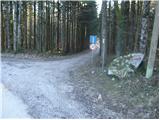 2
2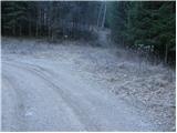 3
3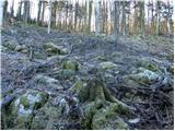 4
4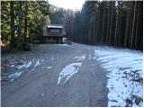 5
5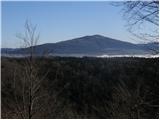 6
6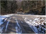 7
7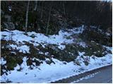 8
8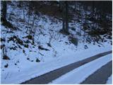 9
9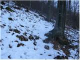 10
10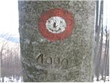 11
11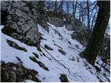 12
12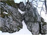 13
13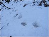 14
14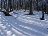 15
15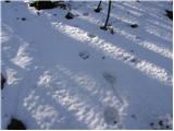 16
16 17
17
Discussion about the trail Rakov Škocjan - Veliki Javornik (Javorniki)
|
| Planinček25. 02. 2008 |
Samotna pot brez večjih razgledov. Pot je zelo strma, palice pridejo zelo prav. Mislim, da je ta pot bolj primerna poleti s kolesom, ko se lahko po gozdni cesti v prijetni senčki pripelješ do vrha.
|
|
|
|
| ulmusglabra21. 12. 2011 |
Včeraj sem šel gor, meni zelo všeč turca, ker je na samem in je veliko gozda. Je pa res dost sledi od medvedov!  Razgleda ni veliko, še najbolje se vidi nekaj metrov pod vrhom (na cca. 1100 m), kjer se zaradi nekaj podrtih bukvic odpre "okno v svet"; vidi se Slivnica in cerkniško jezero,včeraj so se fantastično videle tudi gore in pač vsi hribi na to stran Notranjske. Na vrhu prib. 20 cm snega, ob 13h pa okol -5 stopinj Celzija. To zimo bo to zagotovo večkrat moja ciljna destinacija 
|
|
|
|
| ulmusglabra21. 12. 2011 |
Aja, Planinček, se strinjam s tabo; Javorniki so zelo primerni za kolesarjenje poleti, ko je tu prav spokojna hladovina  Gozdne ceste so v zelo dobrem stanju, le na tistih manj voženih so pogostokrat na vozišču kamni ali celo skale, ki se pač odtrgajo od strmega brega nad cesto... in je pri spustu z biciklom potrebna previdnost. Sam grem gor največkrat iz Kaliča oz. Rakovega Škocjana, potem pa od Vrha po grebenu ali na Cerkniško, Postojnsko ali, največkrat, Pivško stran (Trnje, Palčje) LP
|
|
|
|
| agadir5. 09. 2015 |
Pot iz Rakovega Škocjana je(bila)zaradi posledic žleda delno ali popolnoma neprehodna,izgubijo se tudi markacije in bi bilo potrebno pot ponovno markirati oz. označiti. Obstaja pa tudi pot iz Dolenje vasi(pri Cerknici)in je ne najdem nikjer opisano,je pa tudi markirana
|
|
|
|
| Am Shagar24. 09. 2015 |
Ja pot je tudi iz Dolenje vasi, pa iz Rakeka, vendar je vprašanje v kakšnem stanju so. Še najbolj zanesljivo bi bilo jit po cesti (makadamski odcep takoj po če se prav spomnim). Vsekakor priporočam uporabe zemljevida. Drugače je pa najboljše s kolesom poleti. Cesta pripelje mimo vojaškega objekta pod vrhom do katerega je od tam še 5 minut do vrha.
|
|
|
|
| Am Shagar24. 09. 2015 |
Po odcepu za Kalič sem pozabil dodati.
|
|
|