Ravne - Mittagskogel/Kepa
Starting point: Ravne (1200 m)
| Lat/Lon: | 46,4678°N 13,9917°E |
| |
Time of walking: 4 h 15 min
Difficulty: difficult marked way
Altitude difference: 943 m
Altitude difference po putu: 1100 m
Map: Kranjska Gora 1:30.000
Recommended equipment (summer): helmet
Recommended equipment (winter): helmet, ice axe, crampons
Views: 19.180
 | 1 person likes this post |
Access to the starting point:
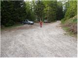
Leave the Gorenjska motorway at the Hrušica exit and follow the road in the route Kranjska Gora, but only as far as the village Dovje near Mojstrana. Turn right here (direction Dovje) and the road will quickly lead you to the mentioned village from where you will continue in the route Frauenkogel. The road will lead you to a crossroads shortly after the village, where you will continue on the right road (sharp left Mittagskogel and Borovje). Continue for some time to the next crossroads, where you turn sharp left in the direction of Frauenkogel (straight ahead Plavški Rovt). Follow this road, which then leads you past the grassy hay meadows called Ravne (a few holiday homes), to a ramp which prohibits further driving. You can park a little further down the road in one of the car parks along the road (from Dovje to the starting point is about 6. 5 km).
Path description:
From the parking lot, continue along the road along which you parked. The road, which climbs moderately and takes us past the ramp, then climbs higher and takes us to a small saddle between Bele peči on the left and Frauenkogel on the right. The road turns right here and after a few further steps leads to a point where a marked footpath branches off up to the left.
Take this path, which climbs steeply and takes you through the forest and past the little well of Starka (1 minute walk from the path) to the bottom of mountain pasture Dovšek Rosenbachsattel. Here the path turns slightly to the left and after a further 10 steps leads us to the hut at mountain pasture Dovška Rožca (you can also go here by road).
From the shepherd's hut continue towards Frauenkogel, then after two minutes on the left side you will see a path which turns into the dwarf pines lane. Take the above-mentioned path (the trailhead is not marked), which crosses the western slopes of Dovška Baba in a gentle descent. The path then turns slightly more to the left and leads quickly past the hunting observatory to the Mlinca saddle. Continue straight along the 'marked' path (Plevelnikov Ridge on the right by the state border), which passes into a belt of compacted forest. A little further on, the forest thins out and the path leads to a marked crossroads at the Koritec well.
At the crossroads, continue straight on (left down Erjavčev rovt) and cross the slopes covered with dwarf pines in a slight ascent. The ascent steepens a few times and the views of the Julian Alps start to get better and better. We continue our ascent, crossing the steep slopes to the west, and soon reach a ridge where a view of the Austrian side opens up. We continue along a relatively narrow ridge for a short distance, then the trail turns left and ascends steep grassy slopes below the Huhnerkogel peak. The path leads to an indistinct ridge on the south side of the peak, where a view opens up towards Kepa. If you wish to visit the summit of Gubno, leave the marked trail at this point and turn right onto the trackless path and reach the summit in a few minutes. The marked path continues to cross steep slopes and leads us to the western side of Gubno. Later on, the route becomes more difficult, crossing an exposed ravine, and the fixed safety gear are also helpful.
The path then leads along a ridge below the slopes of Dovška Mala Kepa. The summit can be reached in 10 minutes on an easy trackless path. The marked trail bypasses the summit on the south side and, after crossing a very steep and crumbly slope, leads us to the saddle between Kepa and Dovško Malo Kepa.
From the saddle, continue westwards and cross the steep slopes on the Austrian side of the ridge to a small saddle where the trail from Austria joins us. The path then climbs steeper and continues along the ridge. Finally, there is an easy climb up the grassy slopes to the top of Kepe.

Pictures:
 1
1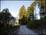 2
2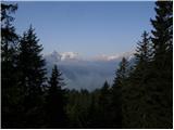 3
3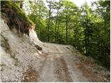 4
4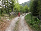 5
5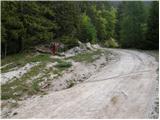 6
6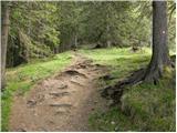 7
7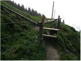 8
8 9
9 10
10 11
11 12
12 13
13 14
14 15
15 16
16 17
17 18
18 19
19 20
20 21
21 22
22 23
23 24
24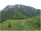 25
25 26
26 27
27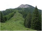 28
28 29
29 30
30 31
31 32
32 33
33 34
34 35
35 36
36 37
37 38
38 39
39 40
40 41
41 42
42 43
43 44
44 45
45 46
46 47
47 48
48 49
49 50
50 51
51 52
52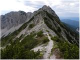 53
53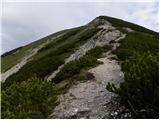 54
54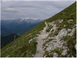 55
55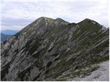 56
56 57
57 58
58 59
59 60
60 61
61 62
62 63
63 64
64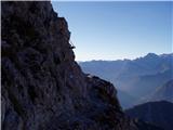 65
65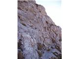 66
66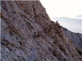 67
67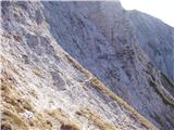 68
68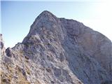 69
69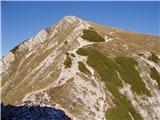 70
70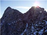 71
71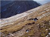 72
72 73
73
Discussion about the trail Ravne - Mittagskogel/Kepa
|
| katja8723. 10. 2012 |
V nedeljo 21.10.2012 smo se po tej poti odpravili na vrh Kepe. Večina poti se kar strmo vzpenja, popestri pa jo tudi kratka varovana plezalna pot. Dan je bil sončen in topel, na vrhu se nas je nabralo kar nekaj ljudi. Slike iz pohoda si lahko ogledate na spletni strani Planinskega društva Matica Murska Sobota: http://www.mojalbum.com/pdmaticams/20121021-kepa/foto/20186307
|
|
|
|
| bbugari110. 08. 2023 13:32:16 |
Po tej poti sem se v torek spustil s Kepe na Dovje. Po divji Dovški Mali Kepi in zelo zahtevni škrbini pred Gubnim, se je izkazalo da je ravna pot pod Gubnim pravzaprav najtežji odsek, saj jo je na več mestih odneslo. Tisti del je zdaj zelo nevaren, zato pri vzponu na Kepo priporočam grebenski vzpon na vrh Gubnega in grebenski sestop direkt na škrbino. Odsek od studenca do Mlince in Mlinca sta popolnoma blatna. Na Mlinci se držim pašne ograje, torej državne meje. Počivam na Dovški Rožci, lokacija bi bila sicer odlična za planinsko postojanko na področju Dovške Babe in predvsem Kepe. Pot pod Belo pečjo je čudovita in ponuja čudovit razgled proti Triglavu. Vrbanove špice so od tu videti še posebej impresivne. Pot nato za kratek čas preide na gozdno pot, a po spustu z nje se kmalu povsem izgubi v veliki poseki. Morda je v smeri navzgor orientacija nekoliko lažja, navzdol pa se je treba držati levega (spodnjega) roba poseke, dokler ne najdemo poti nižje ob studencu. Glede na to, da gre za odsek SPP-ja, menim, da je takšno stanje poti nedopustno. Potem (okrog tri in pol popoldne) naletim na judovsko družino v srajcah in sandalih s šestimi otroki (dva dojenčka). Pravijo, da plezajo na Dovško Babo...  Na Dovjem se odžejam v mrzli vodi pri koritu.
|
|
|