Razglednik - Črni vrh (above Soriška planina) (by road)
Starting point: Razglednik (1205 m)
| Lat/Lon: | 46,2523°N 14,0046°E |
| |
Name of path: by road
Time of walking: 1 h 10 min
Difficulty: easy unmarked way, easy pathless terrain
Altitude difference: 281 m
Altitude difference po putu: 285 m
Map: Škofjeloško in Cerkljansko hribovje 1:50.000
Recommended equipment (summer):
Recommended equipment (winter): ice axe, crampons
Views: 1.290
 | 1 person likes this post |
Access to the starting point:
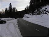
a) From the motorway Ljubljana - Jesenica take the exit Lesce and follow the road towards Bled and on to Bohinjska Bistrica. From Bohinjska Bistrica turn left towards Tolmin and Soriška planina. Above the village Nemški Rovt you will reach a marked crossroads, where you continue right in the route Soriška planina (slightly left Škofja Loka and Železniki). On the road to Soriška planina, pass the trail (road) turnoff to Orožnovo hut (the turnoff for Orožnovo hut is marked, but it branches off the main road to the right), and then follow the main road for about 1 km, where you will see a small parking area on the right, and on the left you will see a road that branches off sharply to the left and continues towards mountain pasture Pečana. At the crossroads, you can also see the first markings and a mountain direction sign for Ratitovec.
b) From Železniki or Podbrdo, take the first exit to Soriška planina and then continue towards Bohinjska Bistrica. From the parking lot at Soriška planina drive for about 1 km and then you will see a forest road turning off to the right, leading to mountain pasture Pečana. Park at the crossroads on the left side of the road in a small parking lot.
Path description:
From the starting point, first cross the road carefully, then turn onto the macadam road towards Ratitovec. The road quickly enters the forest, through which it starts to climb moderately. Higher up, the road lays down and leads to a small marked crossroads.
Continue slightly right on the unmarked road (slightly left Ratitovec), which continues to climb gently through the forest, leading us along an unmarked valley. A little further on, at a small fork, continue straight on (the left-hand road ends in the forest), and then there is a fairly gentle climb. When the road turns sharp right, we are joined on the left by cart track, which leads down to a marked path leading from Soriška planina towards Ratitovec, and we continue on the road, which starts to climb more visibly. There is a cross-climb to the right, and we follow the road from which cart track soon branches off to the left, which can be climbed to Črni vrh, and we continue along the road to its end.
From the end of the road, continue left and climb the easy trackless path to an undistinguished ridge, and continue along it to the undistinguished and partly vegetated Črni vrh, with increasingly beautiful views.
The description refers to the situation in 2019 (January) and the pictures are from different periods.

Pictures:
 1
1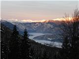 2
2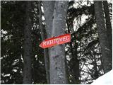 3
3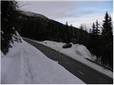 4
4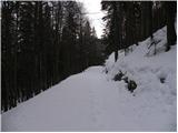 5
5 6
6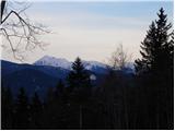 7
7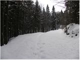 8
8 9
9 10
10 11
11 12
12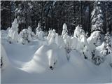 13
13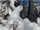 14
14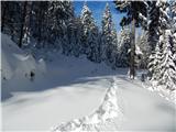 15
15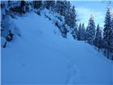 16
16 17
17 18
18 19
19 20
20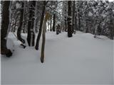 21
21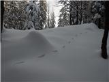 22
22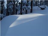 23
23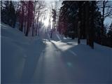 24
24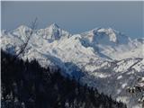 25
25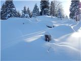 26
26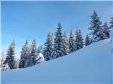 27
27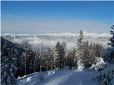 28
28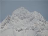 29
29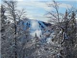 30
30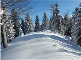 31
31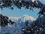 32
32
Discussion about the trail Razglednik - Črni vrh (above Soriška planina) (by road)