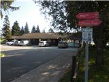
Ribiška koča Šoštanj - Šoštanj (path Trška pot around Šoštanj)
Starting point: Ribiška koča Šoštanj (358 m)
| Lat/Lon: | 46,3772°N 15,0529°E |
| |
Name of path: path Trška pot around Šoštanj
Time of walking: 3 h 30 min
Difficulty: easy marked way
Altitude difference: 0 m
Altitude difference po putu: 315 m
Map: Šaleška dolina z okolico 1:50.000
Recommended equipment (summer):
Recommended equipment (winter): crampons
Views: 2.841
 | 2 people like this post |
Access to the starting point:
DeepL logo
DeepL logo Translator
DeepL Pro
Why DeepL?
API
Plans and pricing
Apps
Start free trial
Login
Menu
Millions translate with DeepL every day. Popular: Spanish to English, French to English, and Japanese to English.
Translation modes
Translate text
29 languages
Translate files
. pdf, . docx, . pptx
Translate text
Source text
Select source language. Currently selected:
Slovenian
a) Iz smeri Maribor se peljemo po avtocesti do izvoza Arja vas, kjer nadaljujemo desno v smeri Velenje oz. Slovenj Gradca. Peljemo se skozi Velika Pirešica, Črnova in Vinsko Goro do Velenje, kjer nadaljujemo naravnost mimo tovarne Gorenje v smeri Šoštanj. Malo za Velenje v rondoju zavijemo v smeri Šoštanj, pri Termoelektrarni zavijemo na most in peljemo skozi center Šoštanj. Pri Kajuhovem domu zavijemo desno čez železniško progo in nato takoj za železniško progo zopet desno, ter sledimo cesti. Pri Tresimirjevem parku zavijemo zopet desno in cesti sledimo do konca, ko se pripeljemo na veliko parkirišče pred ribiško kočo.
b) Iz smeri Ljubljane se peljemo po avtocesti do izvoza Šentrupert, kjer že vidimo oznake za Topolšico. Nato se peljemo skozi Preserje, Male Braslovče in Letuš proti Šmartnemu ob Paki. Od tu nadaljujemo do vasi Gorenje, kjer zavijemo desno na magistralno cesto proti Velenju. Malo pred Velenje v rondoju zavijemo v smeri Šoštanj, pri Termoelektrarni zavijemo na most in peljemo skozi center Šoštanja. Pri Kajuhovem domu zavijemo desno čez železniško progo in nato takoj za železniško progo zopet desno, ter sledimo cesti. Pri Tresimirjevem parku zavijemo zopet desno in cesti sledimo do konca, ko se pripeljemo na veliko parkirišče pred ribiško kočo.
Translation results
Select target language. Currently selected:
English
a) From Maribor take the motorway to the Arja vas exit, where you turn right in the direction of Velenje or Slovenj Gradec. Go through Velika Pirešica, Črnova and Vinsko Gora to Velenje, where you continue straight past the Gorenje factory in the direction of Šoštanj. Just after Velenje at the roundabout turn in the direction of Šoštanj, at the Thermoelectric power station turn onto the bridge and drive through the centre of Šoštanj. At Kajuh's home turn right over the railway line and then right again just after the railway line and follow the road. At Tresimir Park, turn right again and follow the road until it ends at a large parking lot in front of a fisherman's hut.
b) From the direction of Ljubljana, follow the motorway to exit Šentrupert, where you can see the signs for Topolšica. Then drive through Preserje, Male Braslovče and Letuš towards Šmartné ob Paki. From here, continue to the village of Gorenje, where you turn right onto the main road to Velenje. Shortly before Velenje at the roundabout turn towards Šoštanj, at the Thermoelectric power station turn onto the bridge and drive through the centre of Šoštanj. At the Kajuh's home, turn right over the railway line and then right again just after the railway line and follow the road. At Tresimir Park, turn right again and follow the road to the end, when you come to a large parking lot in front of a fisherman's cottage.
In 1994, the Maribor PD marked a trail along the boundaries of the medieval town of Maribor and named it the Trail of the Market Town around Maribora. The trail is an easy circular route of just over 13 kilometres, suitable for families, as you can also end the trail at certain sections and return to Maribor. It takes 3 to 4 hours to complete the entire route. The trail has 5 checkpoints and is marked with Knafelč markings along the entire route. A trail diary with a short description and a trail map is available free of charge at the fisherman's hut.
The route starts at the fisherman's hut in Maribor, where the first checkpoint is also located. From the hut, continue in the direction Črnova (at the direction sign Trška pot - Vrhovnik). From the trail, you will have a view of the ruins of Pustega grad, which you will visit later. First, walk along the embankment of the lake for some time, and soon descend to the Velenje - Maribor walking and cycling path, which ran parallel to it earlier. We continue eastwards towards Velenje. To the right we pass the imposing buildings of the Maribor Thermal Power Plant, the Šentrupert - Velenje railway line and the Paka River. After less than a kilometre, we reach a fence near the ash dump, where we leave the walking and cycling path and continue to the right under the coal and ash transport system of the CHP. Here you cross an industrial area and a railway line, so a little caution is in order. Continue through a small industrial zone to the main road Velenje - Maribor, before crossing the Pako River. Cross the road and continue to the right, walking along it for about 100 m. On the way you can stop at Tresimir's Well, but the water in the well is not drinkable! Soon, a path branches off the main road into the forest, which you follow. When the steepness of the track eases, we come to a crossroads where we could continue straight on to Letuš, and we head right back up the slope. Soon we come to an asphalted steep road, which we climb up to the last house. From the path we have a nice view of the Šaleška Lakes (Družmirsko, Šmartno ob Paki, Škalsko), Velenje and to a lesser extent the degraded area of the subsidence, the coal deposit and the mine facilities of the Velenje Coal Mine. In the distance we can admire the peaks of Šoštanj, a little closer XX21XX and Radojč. The trail continues into the forest past a newer cottage to the first house on the opposite side of the forest. Through the forest you can observe the mighty cooling towers of the Maribor Thermal Power Plant. The path then continues along the asphalted road along the ridge, where on the left we can observe the individual farms of the neighbouring village XX26XX and the top of XX27XX with the Church of the Holy Cross. Soon the asphalt road starts to descend and we reach the "Maribor" side of the hill again, where we are again greeted by the view of the TPP and the power lines. For a better view in the distance, there are the peaks of Smrekovec and XX28XX, and a little closer, St. Križ above XX29XX, Lomek (Lom) above XX30XX, the farms in the villages XX31XX, XX32XX, XX33XX, Ravne and Razbor, and the town centre Arja vasa. Still follow the descending asphalt road to the crossroads above which stands the Oražnov Cross. If you want to finish the walk at this point, you can follow the road down to the centre of Arja vasa (20 min) or
Dictionary
The dictionary is unavailable for this language pair.
Unlock DeepL’s full potential – Try DeepL Pro for free
Try Pro for 30 days free
You are using the free version of DeepL
Translate up to 5,000 characters
Translate 3 locked documents/month
10 glossary entries
Unlock DeepL Pro features
Maximum data security
Unlimited text translation
Translate and edit more documents
See more features
Translate even faster with DeepL apps
Desktop app image
DeepL for WindowsDownload for free
DeepL for
iOS
and
Android
Download for free
DeepL in the Press
Tech giants Google, Microsoft and Facebook are all applying the lessons of machine learning to translation, but a small company called DeepL has outdone them all and raised the bar for the field.
Its translation tool is just as quick as the outsized competition, but more accurate and nuanced than any we’ve tried.
TechCrunchUSA
DeepL has also outperformed other services, thanks to more "French-sounding" expressions.
Le MondeFrance
Even though the translations from English by Google and Microsoft are quite good, DeepL still surpasses them. We have translated a report from a French daily newspaper - the DeepL result was perfect.
Golem. deGermany
A quick test carried out for the combination English-Italian and vice versa, even without any statistical pretensions, allowed us to confirm that the quality of the translation is really good. Especially from Italian into English.
La StampaItaly
The system recognizes the language quickly and automatically, converting the words into the language you want and trying to add the particular linguistic nuances and expressions.
ABCSpain
Indeed, a few tests show that DeepL Translator offers better translations than Google Translate when it comes to Dutch to English and vice versa.
RTL ZNetherlands
In the first test - from English into Italian - it proved to be very accurate, especially good at grasping the meaning of the sentence, rather than being derailed by a literal translation.
la RepubblicaItaly
Personally, I'm very impressed by what DeepL is able to do and yes, I think it's really great that this new stage in the evolution of machine translation was not achieved with software from Facebook, Microsoft, Apple or Google, but by a German company. We like to make ourselves a little bit small and pretend that there is no one in this country who can stand up to the big players. DeepL is a good example that it is possible.
Mobile GeeksGermany
DeepL from Germany could surpass Google Translate
WIRED's quick test shows that DeepL's results are indeed in no way inferior to those of the high-ranking competitors and, in many cases, even surpass them. The translated texts often read much more fluently; where Google Translate forms completely meaningless word chains, DeepL can at least guess a connection.
WIRED. deGermany
DeepL, an online translator that outperforms Google, Microsoft and Facebook
wwwhat's newLatin America
Language
English
DeepL
Resources
Help Center
Blog
API documentation
Data security
Privacy policy
Terms & Conditions
Product
Free translator
Features
DeepL Pro
Translation API
Desktop app
Mobile app
Chrome extension
Company
Contact Sales
Press
Careers
Publisher
twitter
facebook
linkedin
github
instagram
Path description:
In 1994, the Šoštanj PD marked a trail along the boundaries of the medieval town of Šoštanj and named it the Trail of the Market Town around Šoštanja. The trail is an easy circular route of just over 13 kilometres, suitable for families, as you can also end the trail at certain sections and return to Šoštanj. It takes 3 to 4 hours to complete the entire route. The trail has 5 checkpoints and is marked with Knafelč markings along the entire route. A trail diary with a short description and a trail map is available free of charge at the fisherman's hut.
The route starts at the fisherman's hut in Šoštanj, where the first checkpoint is also located. From the hut, continue in the route Družmirsko jezero (at the route sign Trška pot - Vrhovnik). From the trail, you will have a view of the ruins of Pustega grad, which you will visit later. First, walk along the embankment of the lake for some time, and soon descend to the Velenje - Šoštanj walking and cycling path, which ran parallel to it earlier. We continue eastwards towards Velenje. To the right we pass the imposing buildings of the Šoštanj Thermal Power Plant, the Celje - Velenje railway line and the Paka River. After less than a kilometre, we reach a fence near the ash dump, where we leave the walking and cycling path and continue to the right under the coal and ash transport system of the CHP. Here you cross an industrial area and a railway line, so a little caution is in order. Continue through a small industrial zone to the main road Velenje - Šoštanj, before crossing the Pako River. Cross the road and continue to the right, walking along it for about 100 m. On the way you can stop at Tresimir's Well, but the water in the well is not drinkable! Soon, a path branches off the main road into the forest, which you follow. When the steepness of the track eases, we come to a crossroads where we could continue straight on to Gora Oljka, and we head right back up the slope. Soon we come to an asphalted steep road, which we climb up to the last house. From the path we have a nice view of the Šaleška Lakes (Družmirsko, Velenje, Škalsko), Velenje and to a lesser extent the degraded area of the subsidence, the coal deposit and the mine facilities of the Velenje Coal Mine. In the distance we can admire the peaks of Pohorje, a little closer Paški Kozjak and Radojč. The trail continues into the forest past a newer cottage to the first house on the opposite side of the forest. Through the forest you can observe the mighty cooling towers of the Šoštanj Thermal Power Plant. The path then continues along the asphalted road along the ridge, where on the left we can observe the individual farms of the neighbouring village Lokovica and the top of Gora Oljka with the Church of the Holy Cross. Soon the asphalt road starts to descend and we reach the "Šoštanj" side of the hill again, where we are again greeted by the view of the TPP and the power lines. For a better view in the distance, there are the peaks of Smrekovec and Uršlja gora, and a little closer, St. Križ above Bele Vode, Lomek (Lom) above Topolšica, the farms in the villages Bele Vode, Topolšica, Zavodnje, Ravne and Razbor, and the town centre Šoštanja. Still follow the descending asphalt road to the crossroads above which stands the Oražnov Cross. If you want to finish the walk at this point, you can follow the road down to the centre of Šoštanja (20 min) or

Pictures:
 1
1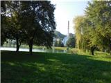 2
2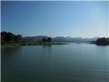 3
3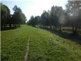 4
4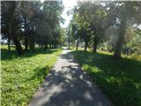 5
5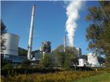 6
6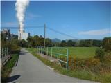 7
7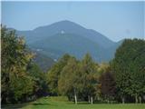 8
8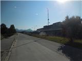 9
9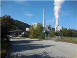 10
10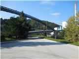 11
11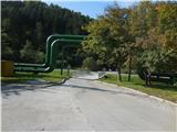 12
12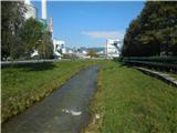 13
13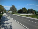 14
14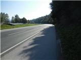 15
15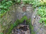 16
16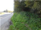 17
17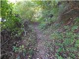 18
18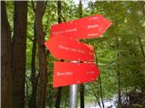 19
19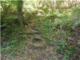 20
20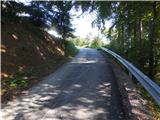 21
21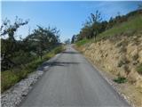 22
22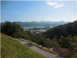 23
23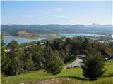 24
24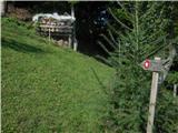 25
25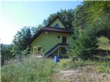 26
26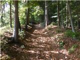 27
27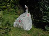 28
28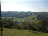 29
29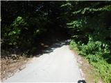 30
30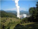 31
31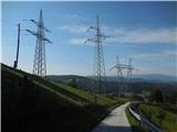 32
32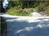 33
33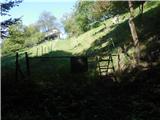 34
34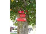 35
35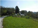 36
36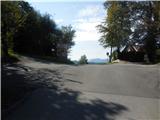 37
37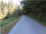 38
38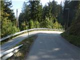 39
39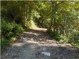 40
40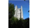 41
41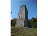 42
42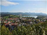 43
43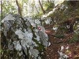 44
44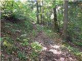 45
45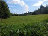 46
46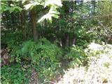 47
47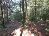 48
48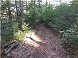 49
49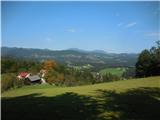 50
50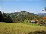 51
51 52
52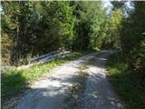 53
53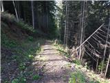 54
54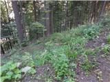 55
55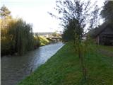 56
56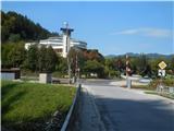 57
57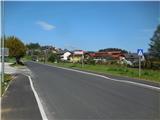 58
58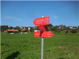 59
59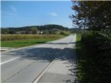 60
60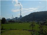 61
61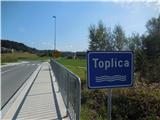 62
62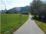 63
63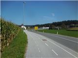 64
64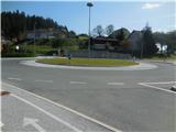 65
65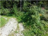 66
66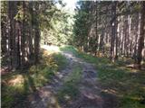 67
67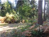 68
68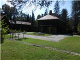 69
69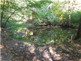 70
70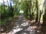 71
71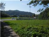 72
72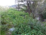 73
73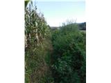 74
74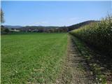 75
75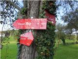 76
76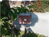 77
77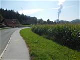 78
78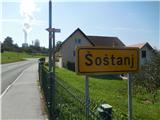 79
79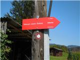 80
80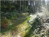 81
81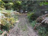 82
82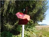 83
83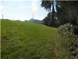 84
84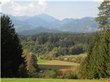 85
85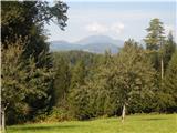 86
86 87
87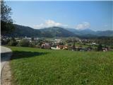 88
88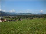 89
89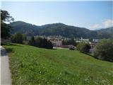 90
90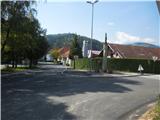 91
91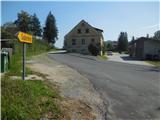 92
92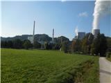 93
93
Discussion about the trail Ribiška koča Šoštanj - Šoštanj (path Trška pot around Šoštanj)
|
| ločanka2. 05. 2021 17:44:00 |
Če si že tu, se je dobro podat tudi na oglede Šaleških jezer. In sicer so tri: Družmirsko jezero (Šoštanjsko), ki je menda najgloblje v Slovenij, potem Velenjsko, ki je največje slovensko jezero in pa Škalsko. Vsako je nekaj posebnega, a vsa zanimiva. Ob Velenjskem jezeru je tudi uradno kopališče. Šoštanjsko pa ni primerno za kopanje.
Jezera so nastala po udoru tal zaradi izkopavanj lignita. Midva sva za hojo okrog vseh treh jezer namerila okoli 15 km.
Primerno tudi za opazovanje raznih ptic.
|
|
|