Rifugio Nordio - Osternig (Ojstrnik) (direct way)
Starting point: Rifugio Nordio (1210 m)
| Lat/Lon: | 46,5506°N 13,4824°E |
| |
Name of path: direct way
Time of walking: 2 h 10 min
Difficulty: easy marked way
Altitude difference: 842 m
Altitude difference po putu: 842 m
Map: Julijske Alpe - zahodni del 1:50.000
Recommended equipment (summer):
Recommended equipment (winter): ice axe, crampons
Views: 17.627
 | 1 person likes this post |
Access to the starting point:
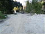
We drive to Trbiz / Tarvisio, which is just a few kilometres after the national border on the Italian side of the Rateče border crossing. You can also get to Trbiz/Tarvisio from Austria, where you must first drive to Bialystok/Villach and then cross the Thori-Coccau border crossing to Trbiz/Tarvisio. In Trbiz / Tarvisio, follow the signs for Udine along the old road (not the motorway). Shortly after Trbiz / Tarvisio, you will arrive in the village of Ukve / Ugovizza, where you turn right into the centre of the village. In the middle of the village you come to a stream, where a paved mountain road turns up alongside the stream. Follow this road to a crossroads where you go straight ahead (right), and just after this crossroads you will come to the next crossroads, where you go left. Follow this road, which is mostly asphalted, to the rifugio Nordio hut, where you park in the parking area next to the hut.
Path description:
From the parking lot, take the road to the left, past the dilapidated Nordio hut. The road starts to climb moderately and leads in curves to a place where it is exposed to falling rocks. Caution is needed, despite the net protection placed slightly above the road. It is best to leave this part as quickly as possible.
After this, cross the stream and continue climbing northwards to the crossroads. Straight ahead is the road to the Lom saddle, and to the right is the direct route to Osternig. We turn right onto the path marked 407, which leads to Osternig. After a short descent, the path crosses a stream and then climbs steeply through the forest. Soon the path from the Lom saddle joins us from the left.
The path continues to climb through a rather dark forest. The steepness then eases and the path leads us out of the forest to the pastures at mountain pasture Bistrica. Then it is a ten-minute walk across a gently sloping meadow to the houses at mountain pasture, which we can already see in front of us.
At mountain pasture you reach a road where you turn left. Follow the road for a few dozen metres to the signposts for Osternig. Turn left onto the footpath, which begins to climb crosswise over the steep grassy slopes of the mountain. After about 15 minutes' walk from the road, the path climbs steeply and then joins an old military causeway, where you continue to the right. The steepness of the path and the slope subsides and the path leads to a crossroads of two paths. The right one goes to the top past the cross, the left one directly to the top. I recommend the right path, which is longer by about five minutes but is more scenic. The path that climbs only slightly leads past the meteorological station to the cross, which stands on the eastern headland.
At the cross, turn left and follow the path along the summit ridge. The summit is reached in five minutes from the cross.
Rifugio Nordio - mountain pasture Bistrica 1:25, mountain pasture Bistrica - Osternig 45 minutes.

Pictures:
 1
1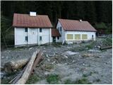 2
2 3
3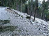 4
4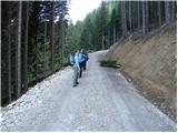 5
5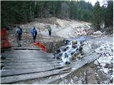 6
6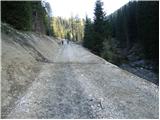 7
7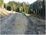 8
8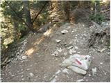 9
9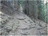 10
10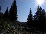 11
11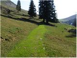 12
12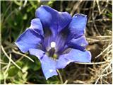 13
13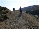 14
14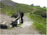 15
15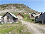 16
16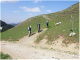 17
17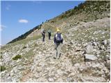 18
18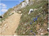 19
19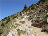 20
20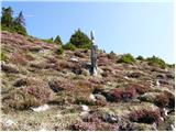 21
21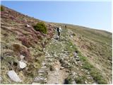 22
22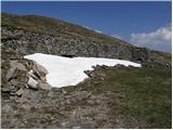 23
23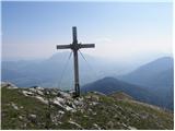 24
24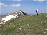 25
25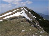 26
26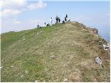 27
27
Discussion about the trail Rifugio Nordio - Osternig (Ojstrnik) (direct way)
|
| grega_p6. 06. 2010 |
Trenutno je pot 407 zaprta, tako, da je potrebno narediti ovinek čez sedlo Lom - mislim, da približno 10min daljša varianta..
|
|
|
|
| slavkovoda12. 07. 2014 |
Izhodišče je še vedno tam na parkirišču pri 1210 metrih, nova, lepa koča pa se nahaja precej višje na 1406 metrih, dobrih 10 minut pred planino Lom. Pri koči lahko zaviješ na Lom in potem na meji z Avstrijo desno, ali pa pri koči desno malo navzdol in potem v breg, poti se kmalu združita in potem veselo po gozdu do planine Bistrice. Na vrhu Ojstrnika pa božanski razgled na vse strani.
|
|
|
|
| J.P.29. 01. 2024 20:09:48 |
Cestnino(parkirnino) v višini 5€ poravnano na začetku gorske ceste, ki je do zgornjega parkirišča lepo splužena. Kako je s cestnino skozi poletje ne vem...vsekakor pa vrh vreden obiska saj je izjemno razgleden! Navidezna gneča se razblini pri koči. 
|
|
|