Robanov kot (Belšek) - Križevnik (via Belšekova planina)
Starting point: Robanov kot (Belšek) (587 m)
Name of path: via Belšekova planina
Time of walking: 4 h
Difficulty: difficult pathless terrain
Altitude difference: 1322 m
Altitude difference po putu: 1322 m
Map:
Recommended equipment (summer):
Recommended equipment (winter): ice axe, crampons
Views: 2.030
 | 4 people like this post |
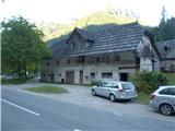
Access to the starting point:
We drive to Luce (to get here from Mozirje or via the Volovljek Pass) and onwards to the Logar Valley. About 100 m after the wooden sign "Robanov kot" there is the farm Belšek on the left side of the road. Park at the bridge, there is space for one car.
Path description:
After the farm Belšek, follow the road left uphill. Walk along the road for about 25 minutes. The road turns right and turns into cart track, go right at the fork in the track. Cart track / logging trail becomes steeper and steeper. From the main cart track the side logging trail split off, keeping to the main cart track. In the keys you go up, after a good hour's walk first a track branches off to the right, then to the left, going straight ahead all the way. Cart track is laid down, then descends slightly. A spring or well can be heard to the right below the track. A few metres further on, under the track, is the remains of a tent, we are on the remains of Belšek's mountain pasture. 1h 20'.
Above the spring at the big rock (above the track) a ravine is visible to the right of the rock. Head up. Walk along the gully on the right side without a path steeply upwards. At first the gully is not distinct, but as you go higher it becomes more and more distinct. When you are almost at the top of the cliffs, you will see a path to the left into the ravine (from the road, just over 200 metres). Follow this path down into the ravine and walk up it. From the road you can also go left along the gully, up to the rock barrier and follow the track right into the gully (you enter the gully a little lower than if you go right along the gully). There are several small jumps in the gully which can be climbed (I) or bypassed by following the dwarf pines route (dwarf pines). Walk along the gully for about 200 vertical metres, keeping more to the right. At the top of the gully, step onto the edge of the plateau. 2h 40'.
You will see a burnt dwarf pines. At first there is no path, walk roughly in a south/south-west direction. After approx. 50 m the path becomes more visible. Follow the well-trodden path on the rolling terrain through the cut dwarf pines between the larch trees until you reach Polšak's mountain pasture. (When you go back, the route is exactly towards Raduha. ) Follow the well-trodden path through the cut dwarf pines between the larch trees until you reach Polšak's mountain pasture. At mountain pasture turn sharp right , at its edge you will see a path. Follow the well-trodden path. At a large grassy hollow, turn right, towards the edge and then right up along the ridge. The path is cut through dwarf pines and passes slightly below the ridge, keeping more to the right. There used to be a miniature Aljaž tower at the top, now there is a wooden cross.

Pictures:
 1
1 2
2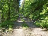 3
3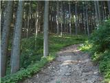 4
4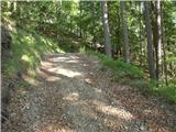 5
5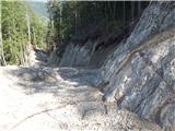 6
6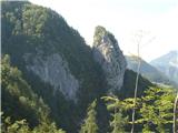 7
7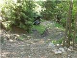 8
8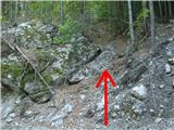 9
9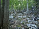 10
10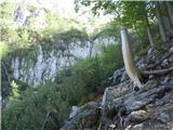 11
11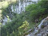 12
12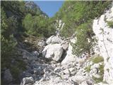 13
13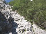 14
14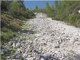 15
15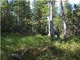 16
16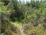 17
17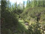 18
18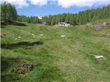 19
19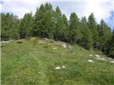 20
20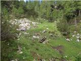 21
21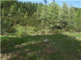 22
22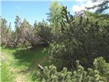 23
23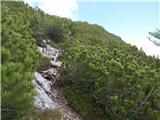 24
24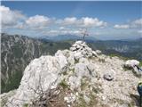 25
25
Discussion about the trail Robanov kot (Belšek) - Križevnik (via Belšekova planina)
|
| geppo16. 06. 2020 |
S to gozdno vlako so uničili eno najlepših pristopnih poti do planine.
Še ena varianta pristopa je ostala, ki je pa na enem delu malce težja ( zelo neugodna prečnica v gozdu ). Bom moral enkrat pogledat, kaj je še od te ostalo? Odkar je narejena ta vlaka, me nič več ne mika v ta konec.
|
|
|
|
| panoramik16. 06. 2020 |
Kje pa je mini stolp na vrhu?
|
|
|
|
| Ninđa7. 06. 2021 13:49:34 |
@geppo, si kdaj šel od kmetije Vrsnik-Govc v smeri Belšekove planine? Včeraj sem videl eno vlako tja gor. Sem šel po njej ampak me je dež pregnal nazaj v dolino.
Lp, Nino
|
|
|
|
| geppo7. 06. 2021 14:23:24 |
Kar nekajkrat prehodil to pot. Bila je stara vlaka, ne ta nova, kot je sedaj. Do Belškovega stana so bile dve poti. Ena se je z vlake odcepila desno - možic. Ta je bila na enem mestu precej zahtevna - strma. Gor je šlo, navzdol zelo pazljivo. Ta pot naj bi deloma še obstajala. Druga pot se je od vlake odcepila po grebenu navzgor in ni bila zahtevna. Bila je povezana tudi s potjo čez Kačjek. Po tej poti naj bi sedaj potekala nova vlaka. Videl sem samo označena drevesa, ki so jih potem posekali in naredili vlako. Po tem nisem šel več v ta konec. Kolegi so mi povedali, da te sedej ta vlaka pripelje direkt do nekdanjega stanu. Kaj je z izvirom na planini, tudi ne vem? https://www.hribi.net/trenutne_razmere/slo/belsekova_planina/3/7454 lp
|
|
|