Ruski križ - Škrlatica (via Kriška stena)
Starting point: Ruski križ (1000 m)
| Lat/Lon: | 46,4444°N 13,7746°E |
| |
Name of path: via Kriška stena
Time of walking: 7 h 30 min
Difficulty: very difficult marked way
Altitude difference: 1740 m
Altitude difference po putu: 2250 m
Map: Triglav 1.25.000
Recommended equipment (summer): helmet, self belay set, ice axe, crampons
Recommended equipment (winter): helmet, self belay set, ice axe, crampons
Views: 41.989
 | 3 people like this post |
Access to the starting point:
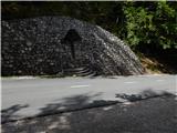
First drive to Kranjska Gora, then continue driving towards the Vrh Leh pass just before the 3rd serpentine of the Ruska or vršiška road, you will see the Russian Cross on the right and a small parking lot on the left, where you park. As the parking lot is relatively small and quickly full, you can also park a little higher up in the larger parking lot just above the 4th serpentine (in this case we have to descend a little to our starting point at the Russian Cross).
The starting point can also be reached from the coastal side via the Vršič Pass.
Path description:
Just before the 3rd serpentine of the Ruska cesta, we will notice the mountain signs for Koča v Krnici along the road, which direct us slightly to the left to the wide cart track, which immediately starts to descend moderately. After a few minutes of descending through the forest, the path is laid and leads us to the dry Pišnica riverbed. Just after crossing the stream, the path turns slightly to the left and leads us out of the forest onto the vast grassy slopes of the mountain pasture in Klin, where we see a secluded hut on the right and the small memorial park of Mali Tamar on the left. The path ahead is completely laid out and then joins the forest road coming from the former Hotel Erika or the bridge over the Velika Pišnica. Continue right here and follow the relatively steep forest road all the way to Koča v Krnici, which is reached after about 20 minutes of further walking.
From the hut, where there is a pleasant shade, continue straight ahead towards the Kriška Stena, following the valley Cirque, gently at first and then steeply upwards. The path soon emerges from the forest, where a fine view of the nearby cliffs opens up. Next, cross the rubble brought by storms from the surrounding ravines. The path ahead becomes steeper and still leads us in the same direction. The last trees are already behind us and we are slowly crossing the scree below the walls of the Kriška Stena. In the upper part of the scree, the path turns slightly to the left to the entrance to the Kriška wall. Here the climbing part of the route begins, where you put on your helmet. The path turns left at the start of the wall and climbs steeply. In the wall, the route is mostly along natural passages, and in some places we are also helped by fixed safety gear. Also, be careful not to break any rocks on this part! After a bad hour of climbing on the wall, which is quite difficult in places, we get off. After a few more steps, we walk to a crossroads, where we continue left downhill in the route Škrlatica (right Križ). After a few minutes of descent, the path leads us to the next crossroads, where we continue left again (straight ahead, the bivouac at Dwarf pines and the valley of Vrata). Next, walk under the walls of Gubno and Dovško Gamsovec almost horizontally for about 30 minutes. The way forward starts to climb up the steep Rdeča škrbina, which is located between Dolkova Špica and the less known Rogljica. From the stump, continue straight down towards Škrlatica (right Dolkova špica for 15 minutes). The trail crosses a short sheltered gully, then descends a steep and very dangerous gully (possible snowfields in early summer). The descent ends 200 vertical metres lower, in the smaller cirque Last Dolek, where you also reach a crossroads. Continue left up towards Škrlatica (straight Vrata valley) and climb up a steep scree slope. Climb the scree until you reach the climbing part of the route to Škrlatica. Here, the markings direct us to the right and the path changes from the scree to the rocky part of the route. The route continues along the west face and is well protected by rungs and ropes. Soon we reach a difficult but well protected crossing. The view of the almost vertical wall escapes us, and over it passes a path protected by crampons and a rope. If you have a camera, this is the place to take pictures. Be careful, sometimes one of the staples turns. S Starting point - Koča v Krnici 45 minutes, Koča v Krnici - top of Kriška stene 3:30, top of Kriška stene - Rdeča škrbina 1:15, Rdeča škrbina - Škrlatica 2:00.

We can extend the trip to the following destinations: Škrlatica
Pictures:
 1
1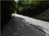 2
2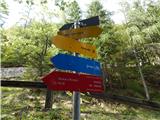 3
3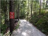 4
4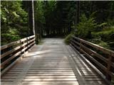 5
5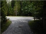 6
6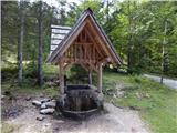 7
7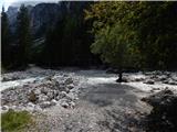 8
8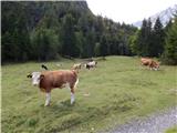 9
9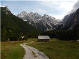 10
10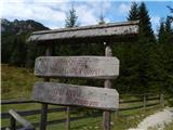 11
11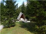 12
12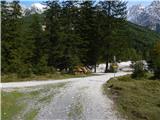 13
13 14
14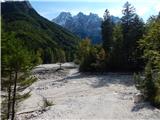 15
15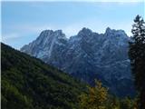 16
16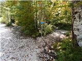 17
17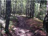 18
18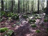 19
19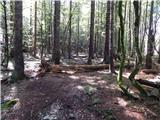 20
20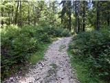 21
21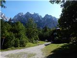 22
22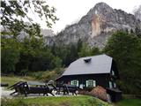 23
23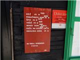 24
24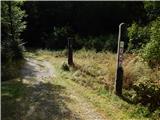 25
25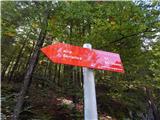 26
26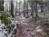 27
27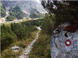 28
28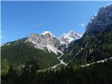 29
29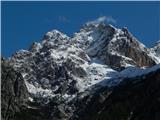 30
30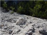 31
31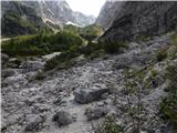 32
32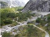 33
33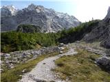 34
34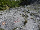 35
35 36
36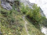 37
37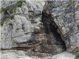 38
38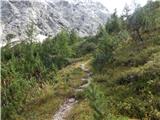 39
39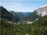 40
40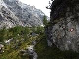 41
41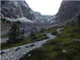 42
42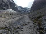 43
43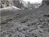 44
44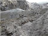 45
45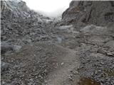 46
46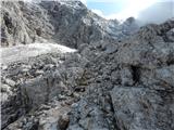 47
47 48
48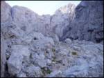 49
49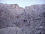 50
50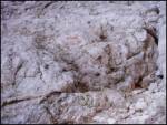 51
51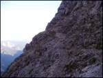 52
52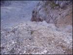 53
53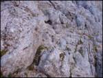 54
54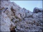 55
55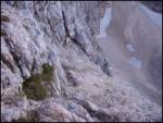 56
56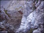 57
57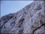 58
58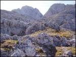 59
59 60
60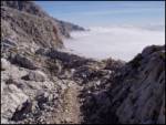 61
61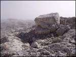 62
62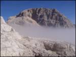 63
63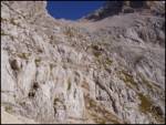 64
64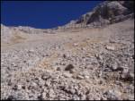 65
65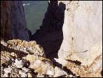 66
66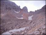 67
67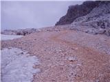 68
68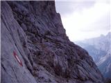 69
69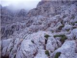 70
70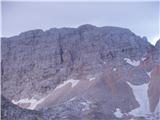 71
71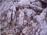 72
72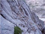 73
73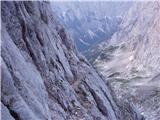 74
74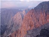 75
75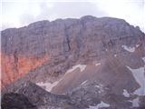 76
76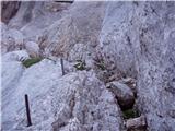 77
77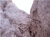 78
78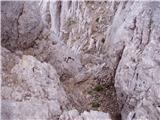 79
79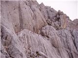 80
80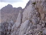 81
81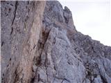 82
82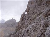 83
83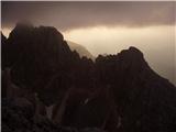 84
84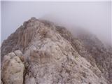 85
85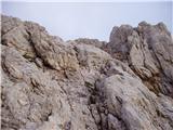 86
86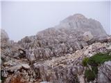 87
87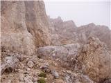 88
88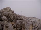 89
89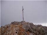 90
90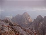 91
91
Discussion about the trail Ruski križ - Škrlatica (via Kriška stena)
|
| meta.nacy20. 06. 2011 |
Pozdravljeni usi skp!A je kdo že mogoče kej hodil proti Škrlatici,kakšne so snežne razmere na Kriški steni in potem naprej....????Najlepša hvala za inf.,1.7. mam plan it gor! 
|
|
|
|
| JusAvgustin21. 06. 2011 |
na kriški steni kopne, pod kriško steno sneg... 
|
|
|
|
| tej2524. 07. 2012 |
Prosim za informacijo v kakšnem stanju je pot.  Zanima me predvsem stanje varoval in markacij. Hvala!
|
|
|
|
| 5r20. 08. 2012 |
S prijateljema smo včeraj opravili s potjo. Pot je dobro označena, predvsem v steni, varoval več kot dovolj. Sama stena je po zahtevnosti približno enaka kot kasnejši končni vzpon na Škrlatico.
Malce smo se le lovili z oznakami na vrhu, ko smo prišli iz stene na plato, ker ni takoj jasna smer nadaljevanja. Tam greš 10 minut nekako proti Stenarju, nato zavije pot v levo.
Sestop smo opravili v Vrata, saj je sestop po steni verjetno zoprn, poleg tega pa bi zaradi same dolžine izleta prišli do nje precej utrujeni.
|
|
|
|
| marepn95515. 09. 2021 09:59:58 |
Včeraj sem prehodil to pot v obe smeri in dodal še obisk Doklove špice (bilo bi škoda se odreči prekrasnim razgledom) in pot je lepa na spustu iz Rdeče škrbine zaradi drobirja pod nogami kar zahtevna. Podobno zahteven je na povratku tudi spust po Kriški steni, ko je treba biti kar pazljiv, da ne pride do zdrsa zaradi drobirja pod nogami. Sicer pa enkraten izlet za dušo z zadostno količino vode in zgodnjim štartom. Za celo pot s krajšimi postanki sem porabi cca. 14 ur.
|
|
|
|
| di3. 09. 2023 08:37:25 |
Na fotografijah ni razvidno: ali sta jeklenici (pravokotno druga na prvo) le na vrhu (nad grapo) ali tudi nižje spodaj?
Ni nikjer fotografij vseh posameznih delov Rdeče škrbine?
|
|
|