Ruski križ - Stenar (via Križ)
Starting point: Ruski križ (1000 m)
| Lat/Lon: | 46,4444°N 13,7746°E |
| |
Name of path: via Križ
Time of walking: 6 h 15 min
Difficulty: very difficult marked way
Altitude difference: 1501 m
Altitude difference po putu: 1750 m
Map: TNP 1:50.000
Recommended equipment (summer): helmet, self belay set
Recommended equipment (winter): helmet, self belay set, ice axe, crampons
Views: 21.321
 | 3 people like this post |
Access to the starting point:
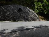
First drive to Kranjska Gora, then continue driving towards the Vrh Leh pass just before the 3rd serpentine of the Ruska or vršiška road, you will see the Russian Cross on the right and a small parking lot on the left, where you park. As the parking lot is relatively small and quickly full, you can also park a little higher up in the larger parking lot just above the 4th serpentine (in this case we have to descend a little to our starting point at the Russian Cross).
The starting point can also be reached from the coastal side via the Vršič Pass.
Path description:
Just before the 3rd serpentine of the Ruska cesta, we will notice the mountain signs for Koča v Krnici along the road, which direct us slightly to the left to the wide cart track, which immediately starts to descend moderately. After a few minutes of descending through the forest, the path is laid and leads us to the dry Pišnica riverbed. Just after crossing the stream, the path turns slightly to the left and leads us out of the forest onto the vast grassy slopes of the mountain pasture in Klin, where we see a secluded hut on the right and the small memorial park of Mali Tamar on the left. The path ahead is completely laid out and then joins the forest road coming from the former Hotel Erika or the bridge over the Velika Pišnica. Continue right here and follow the relatively steep forest road all the way to Koča v Krnici, which is reached after about 20 minutes of further walking.
From the hut, where there is a pleasant shade, continue straight ahead towards the Kriška Stena, following the valley Cirque, gently at first and then steeply upwards. The path soon emerges from the forest, where a fine view of the nearby cliffs opens up. Next, cross the rubble brought by storms from the surrounding ravines. The path ahead becomes steeper and still leads us in the same direction. The last trees are already behind us and we are slowly crossing the scree below the walls of the Kriška Stena. In the upper part of the scree, the path turns slightly to the left to the entrance to the Kriška wall. Here the climbing part of the route begins, where you put on your helmet. The path turns left at the start of the wall and climbs steeply. In the wall, the route is mostly along natural passages, and in some places we are also helped by fixed safety gear. Be careful not to break any rocks on this part! After a bad hour of climbing on the wall, which is quite difficult in places, we get off. A few steps of walking follow to the crossroads, where we continue right up in the direction of Križa and the path which passes on a wide ridge, quickly leads us to Bovška vratica, from which we have a view of the Kriška Pods, where we can see the highest Slovenian lake. Continue left towards the top of Križa (directly Pogačnikov dom), which is only a 10-minute walk away. The way forward first climbs steeply along an increasingly narrow ridge, then climbs steeply with the help of a rope over a slightly exposed rock slab, behind which you reach an interesting passage through a natural chute. With some skill, the narrow chute leads to the Križ lookout. From Križa, continue along the path, which starts to descend steeply on the other side. Next, with the help of a rope and one scramble, descend the exposed path to a slightly wider ridge. Here, the less well-marked path turns right and descends steeply on a crumbly surface. After a few minutes of descending, you reach a small crossroads where you continue left down towards the Vrata valley (right path, bypassing the summit of Križa). The path then crosses some slightly exposed slopes in a moderate descent, and after that leads to the base of Stenarska vratca, where there is a crossroads. Continue slightly left in the direction of Stenar (right Vrata and Zadnjica) along the path which gradually starts to climb towards the Stenar gate. The marked path leaves the gate slightly to the right and ascends in a switchback to the top of the slope. Here the path turns slightly to the left and quickly leads to the top of a relatively steep summit slope.
Starting point - Koča v Krnici 45 minutes, Koča v Krnici - Križ 4:00, Križ - Stenar 1:30.

Pictures:
 1
1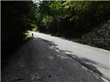 2
2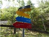 3
3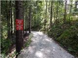 4
4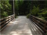 5
5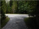 6
6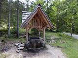 7
7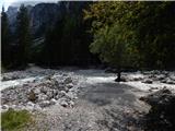 8
8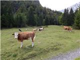 9
9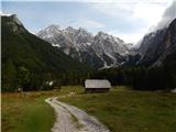 10
10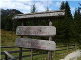 11
11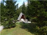 12
12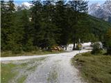 13
13 14
14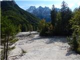 15
15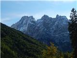 16
16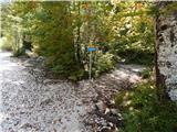 17
17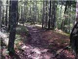 18
18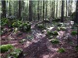 19
19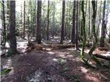 20
20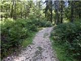 21
21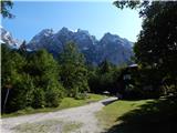 22
22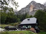 23
23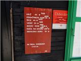 24
24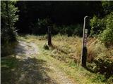 25
25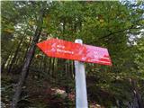 26
26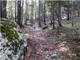 27
27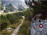 28
28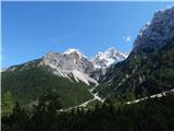 29
29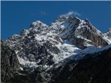 30
30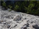 31
31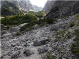 32
32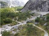 33
33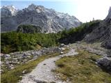 34
34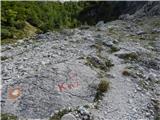 35
35 36
36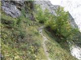 37
37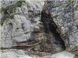 38
38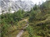 39
39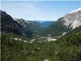 40
40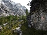 41
41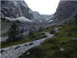 42
42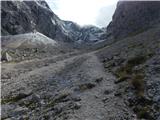 43
43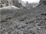 44
44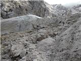 45
45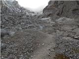 46
46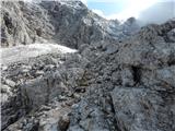 47
47 48
48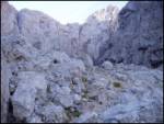 49
49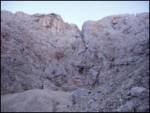 50
50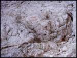 51
51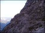 52
52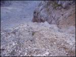 53
53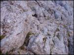 54
54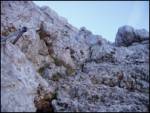 55
55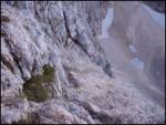 56
56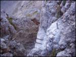 57
57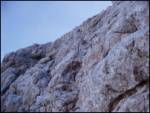 58
58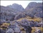 59
59 60
60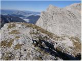 61
61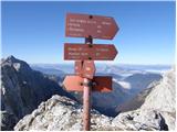 62
62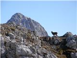 63
63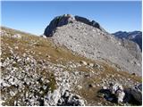 64
64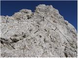 65
65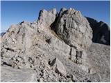 66
66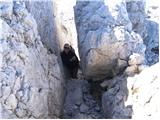 67
67 68
68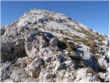 69
69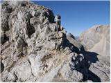 70
70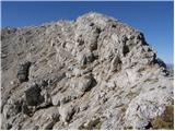 71
71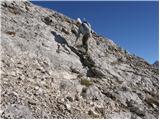 72
72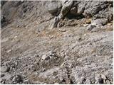 73
73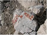 74
74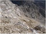 75
75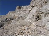 76
76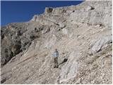 77
77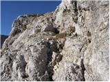 78
78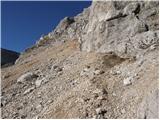 79
79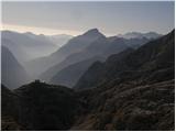 80
80 81
81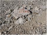 82
82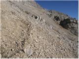 83
83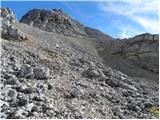 84
84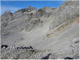 85
85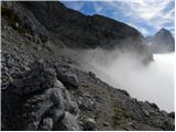 86
86 87
87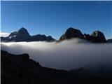 88
88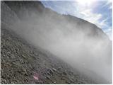 89
89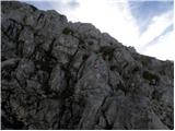 90
90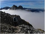 91
91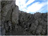 92
92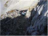 93
93 94
94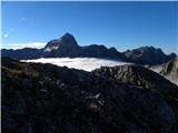 95
95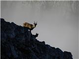 96
96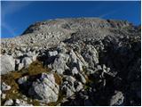 97
97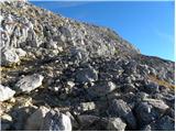 98
98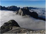 99
99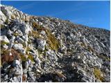 100
100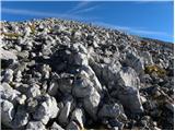 101
101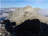 102
102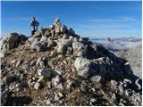 103
103 104
104
Discussion about the trail Ruski križ - Stenar (via Križ)
|
| kantavtor13. 08. 2007 |
huda tura...potrebna dobra kondicija...
|
|
|
|
| VanSims9. 07. 2018 |
Opis bi bilo smiselno popraviti. Pot z vrha naprej je očitno opuščena, na kar opozarja napis STOP na skali. Treba se je vrniti nazaj do malo pred vrhom, kjer se odcepi tista v opisu omenjena pot, ki obide vrh Križa ter se usmeriti na njo proti Stenarju. Vse skupaj ne podaljša poti več kot za dobrih pet minut.
|
|
|